AdBlock Detected

It looks like you're using an ad-blocker!

Our team work realy hard to produce quality content on this website and we noticed you have ad-blocking enabled.

Echo Point Blue Mountains

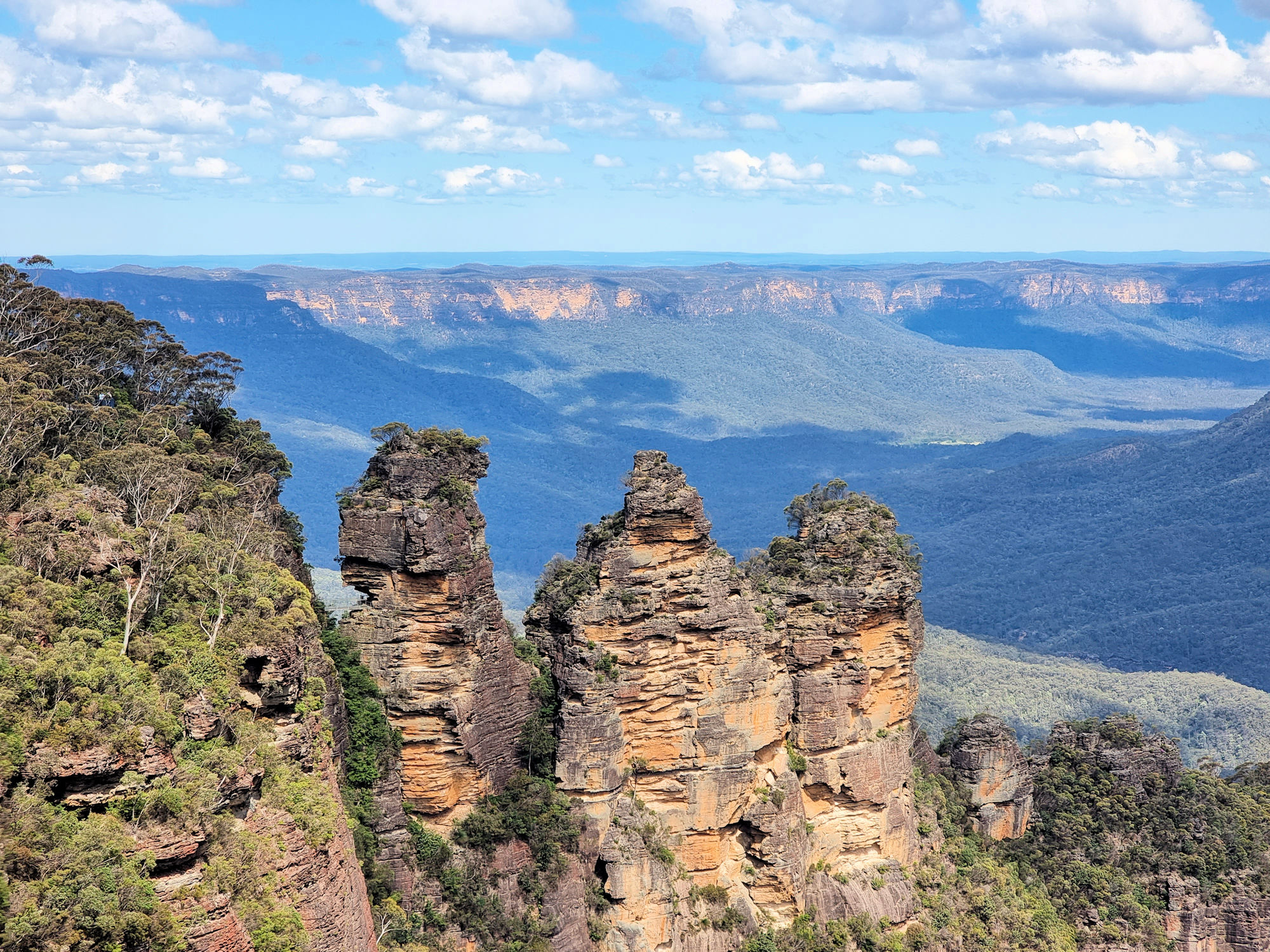
The Three Sisters From Echo Point

Echo Point Blue Mountains

Probably the best place to start your trip to the Blue Mountains, Echo Point in Katoomba has amazing views, access to several walks and an information centre. Parking is available in the surrounding streets, where parking meters ensure no-one visits for free.

Our first stop was the Visitor Information Centre because recent rain had closed many tracks and we needed to find out which ones were still open. After speaking to the helpful staff, we walked around the viewing area which has fantastic views of the Three Sisters and the Megalong Valley. The Three Sisters are probably the most famous rock formation in the Blue Mountains with this being the best pace to see them.

A small track behind the Visitor Information Centre leads to Spooners Lookout with more great views over the valley and an end-on view of the Three Sisters. This is a paved track, people even took prams along one section of it. From here stairs lead down to the Sisters and the Giant Stairway (800 steps), but were closed for repair work). This small track also forms a section of the Prince Henry Cliff Walk which runs from Scenic World to Leura.

Unfortunately the Prince Henry Cliff Walk was cut in several places while storm damage was repaired. However, we walked a small section, seeing some amazing views.

Something to look out for on the way to Spooners Lookout is a series of metal sculptures of Australian wildlife. Placed onto rocks defining the track they make an interesting addition to the walk. These walks are relatively easy, and there are usually lots of people doing them., so can become busy!

Our photos are available for purchase on

To see what else there is to do in New South Wales, please see some of our other stories.

Knapsack Gully Viaduct Lapstone Zig Zag Railway
Knapsack Gully Viaduct

The Viaduct’s History

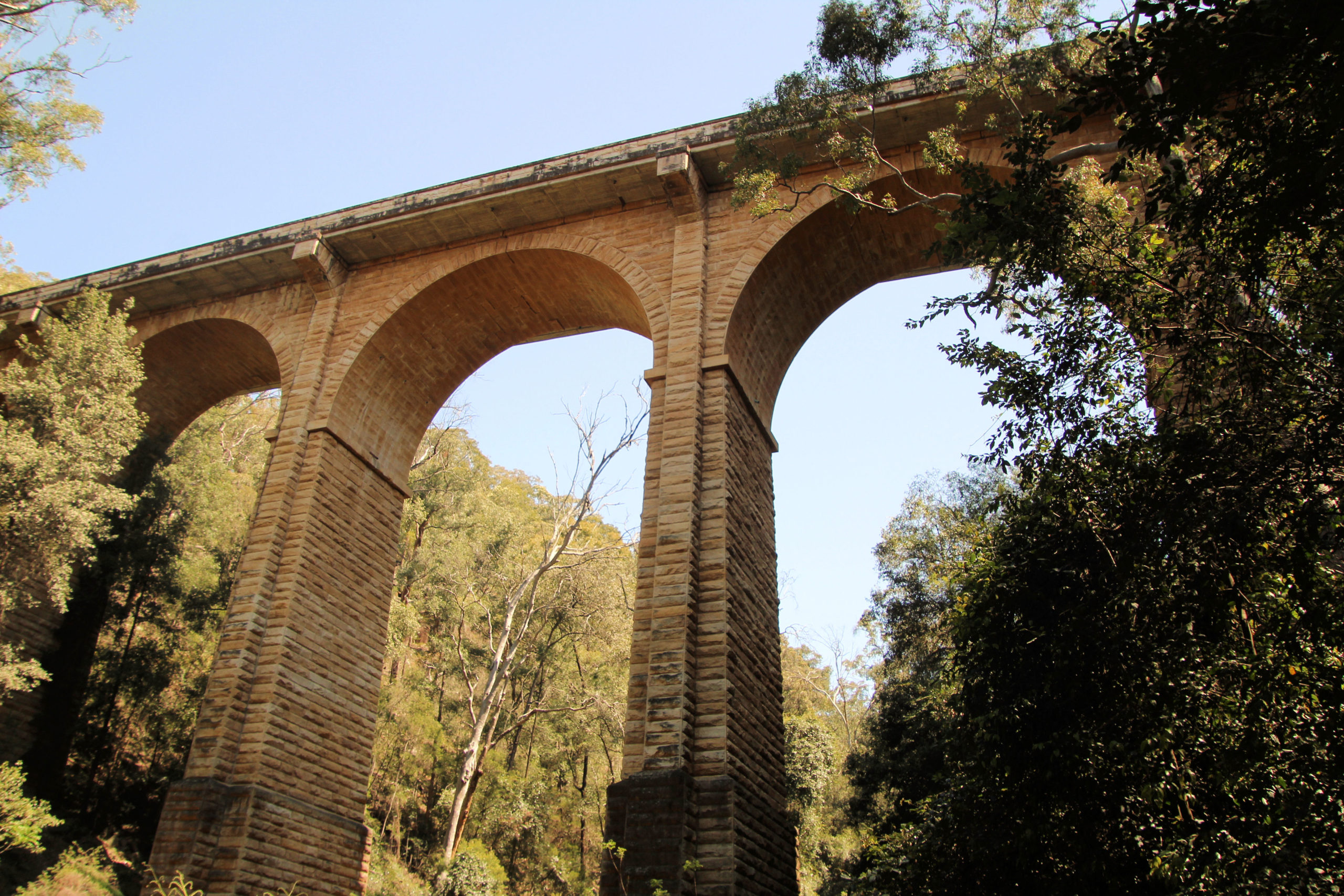
Designed by John Whitton, The Knapsack Gully Viaduct once formed part of the the Lapstone Zig Zag , which climbed the eastern side of the Blue Mountains to Glenbrook. The construction stands 40 metres high. and 118 metres long, making it an impressive structure when viewed from below. Originally used for rail transport, the bridge was modified in 1926 becoming a section of the Great Western Highway for normal vehicle use. The upgrade of the M4 however, has bypassed this section of road. This is great as it can be used for bikes, and hiking, as there are some great walking tracks nearby. This beautiful piece of construction is heritage listed.

Access to the Knapsack Gully Viaduct

Setting off from the car park at the trailhead, we found the walk to the viaduct very easy because it is flat and well maintained. From here, a steep track made of roughly formed steps descends to the base of the bridge. These are difficult to negotiate in places, but we had no issues with this because we wore sturdy footwear.

The reward for climbing down is a magnificent view of the viaduct from the valley floor, where the scale of the arches can really be appreciated. There is a canopy of vegetation, and large rocks, on which we were lucky enough to see a bearded dragon lizard sunbaking. We managed to take some great photos.

Climbing back to the roadway on the opposite side of the gully, we found the track blocked by fallen trees, so did a little bit of climbing to get over it. We really appreciated the walk and seeing this massive bridge in all its glory.

John Whitton Memorial

Sitting next to the trailhead carpark is the John Whitton Memorial. This obelisk has (or had – some are missing) plaques commemorating the viaduct’s construction. Specifically, they commemorate the designer, John Whitton and the builders who lost their lives during its construction. A short walk from the carpark, it’s worth looking at, along with th ruins of the gate-keeper’s cottage nearby.

To see what else there is to do in New South Wales, please see some of our other stories.

Our photos are available for purchase on

Lennox Bridge – Blue Mountains

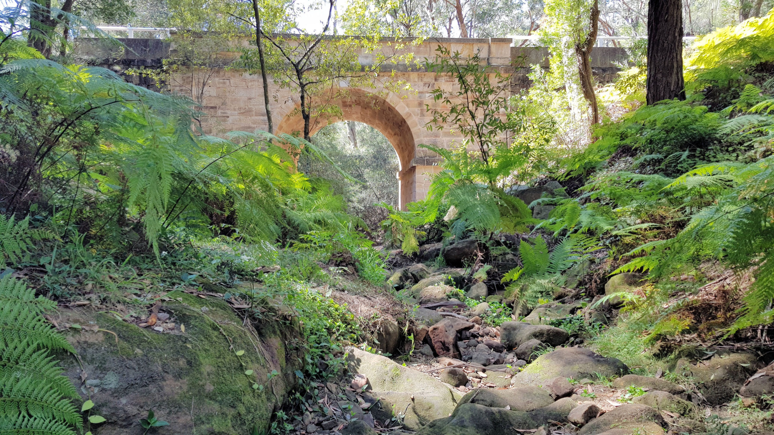
Lennox Bridge From Along the Steam

Lennox Bridge in the Blue Mountains

Located in the foothills of the Blue Mountains, Lennox Bridge (or the Horseshoe Bridge) is the oldest surviving stone arch bridge in Australia, If you are in the area it is worth a quick stop off the Great Western Highway. A parking bay allows you to park away from the road, making access to the bridge safer than parking on the main roadway. Steps lead down to Lapstone Creek which flows under the bridge, but they are rough and irregular, so take care. Before you go down the steps there is an information board with a brief history of the bridge.

During our visit, the creek wasn’t flowing, so with care we were able to walk under the bridge to see the stone work and archway. We also went a little further, as we had our boots on, which made it easy to see a little more of the natural setting, also great for taking pictures.

This was a quick stop, but great stonework in the construction of the bridge, was great to look at and well worth the time.

To see what else there is to do in New South Wales, please see some of our other stories.

Our photos are available for purchase on