AdBlock Detected

It looks like you're using an ad-blocker!

Our team work realy hard to produce quality content on this website and we noticed you have ad-blocking enabled.

Ironbark Falls Mangrove Mountain

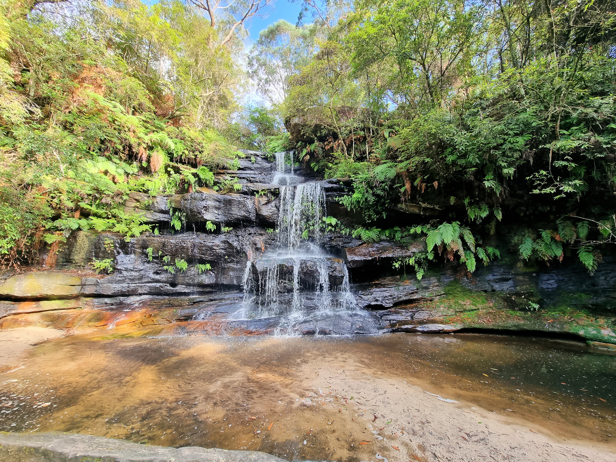
Pool at the Base of Ironbark Falls

Ironbark Falls Mangrove Mountain

An overgrown sign marks the start of the walking track to Ironbark Falls at Mangrove Mountain (New South Wales Australia). Very easy to miss, the small parking area is 1.2km along Ironbark Road from the Wisemans Ferry Road intersection.

Not far from the parking area, a small track leads off to the left, where you will find an information board. If you miss the track turn off, you will come across a small creek. This means you have gone too far, so turn around and go back.

The Track Down to the Waterfall

From the information board the track narrows and becomes more overgrown. This provides a really nice atmosphere because you are surrounded by vegetation. Along the way, different plants have name plates, but many are badly weathered and illegible.

Lower Section of the Track

As you descend through the valley, the track has areas constructed of uneven rocks, so be careful here. In several areas, where the path is steep, or has uneven surfaces, signs warn you to be careful.

The moss-covered rocks and ferny understory create a quiet, shady environment that is very peaceful to walk through.

Things to See Along The Way

Toward the bottom of the valley, near the falls, a fallen tree, now overgrown with moss lies next to the track. Nearby a raised platform with a chair on it sits over another fallen tree. Although too faded to read, there is a plaque on the platform.

Ironbark Falls

At the end of the track, you reach the five-tiered Ironbark Falls. During our visit, no one else was around, so we had the whole area to ourselves. Recent rainfall meant that there was plenty of water flowing and the falls put on a great display for us.

The fern covered banks of the creek surrounding the falls were beautiful giving the whole area a wonderful feeling of tranquillity.

What Did We Think?

The entire walk from the car park to the falls only took around 15 minutes, making it a quick but fun hike. The narrow and overgrown trail adds a great feeling to the area, giving it a lovely atmosphere. The falls themselves are really nice, because the look great being surrounded by ferns and shrubs.

To see what else there is to do in New South Wales, please see some of our other stories.

Our photos are available for purchase on

Broken Bay Pearl Farm

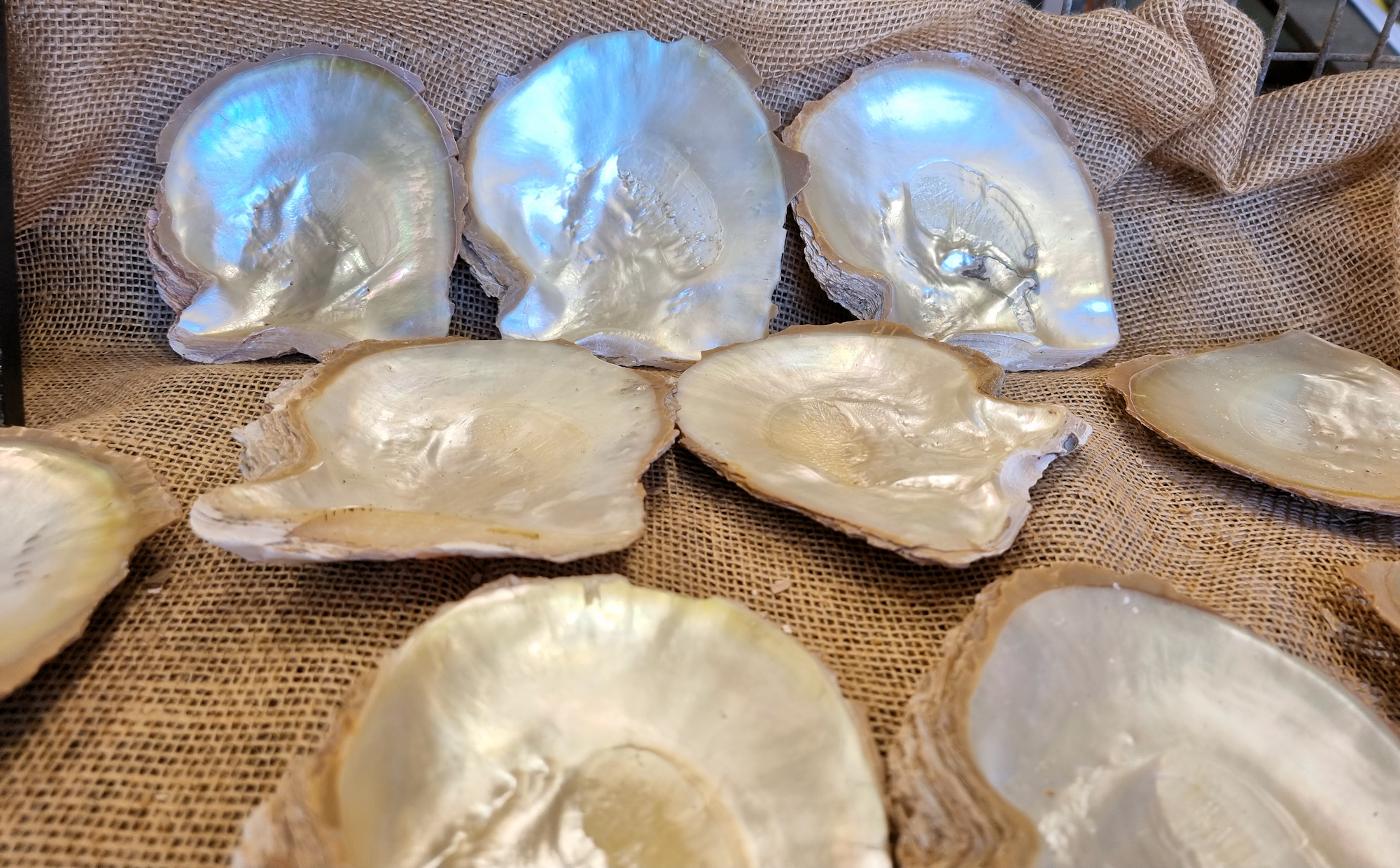
Mother of Pearl Oyster Shells Broken Bay Pearl Farm

Broken Bay Pearl Farm

Established in 2003, Broken Bay Pearl Farm is New South Wales’s only pearl farm. Although Sydney Rock oysters used for eating are farmed here, this is the first business to farm pearls.

Located at Mooney Mooney on the Hawkesbury River, parking was at a premium, with some people on our tour parking at the Mooney Mooney Club and walking (only a 5-minute walk away). Starting at an old oyster shed, now used as a sales room and “Shellar Door”, we checked in and waited for the tour to start.

The two-hour tour starts with a history of oyster harvesting in Australia. Archaeological evidence indicates that Aboriginal people (the Darkinjung and Ku-ring-Gai) fished for oysters at least 20,000 years ago. With colonialization, oysters were used for food and later for use in concrete, where their shells were used for lime. Pearl farming first commenced in Broome, Western Australia in 1946.

Local pearl farming started when Agoya oysters were noticed growing on Sydney Rock oysters. This species of oyster produce beautiful mother of pearl, a prerequisite to make pearls. After trials, it was found they could be successfully farmed, leading to Broken Bay Oyster Farms.

The Tour

After learning all about pearls, we boarded the catamaran for a one-hour cruise to see the oysters. On the way the guide stopped to show us Aboriginal rock carvings.

Located next to a beautiful little beach, the oyster lease currently contained eight-month-old oysters, because others had been moved out to sea. This was because recent rain had flushed too much fresh water into the area, which was not good for their development.

Our guide retrieved some from their baskets, so we had a chance for a close-up look at them. He then showed how pearls are seeded before they are returned to the water.

Tour Boat Broken Bay Pearl Farm
Tour Boat
Train Bridge over the Hawkesbury River
Aboriginal Fish Rock Carvings
Beach Near the Oyster Lease
8 Month Old Oysters
8 Month Old Oysters
8 Month Old Oysters
8 Month Old Oysters
Oyster Growth Stages Broken Bay Pearl Farm
Oyster Growth Stages
Pearl Seed and Damaged Pearls

What Did We Think?

This was a great tour and something we hadn’t heard about before. Until discovering them, we had no idea about farming pearl oysters on the east coast, let alone being able to go on a tour. We really enjoyed the two hours we were there, because it was interesting and educational.

Stoney Creek Track Strickland State Forest
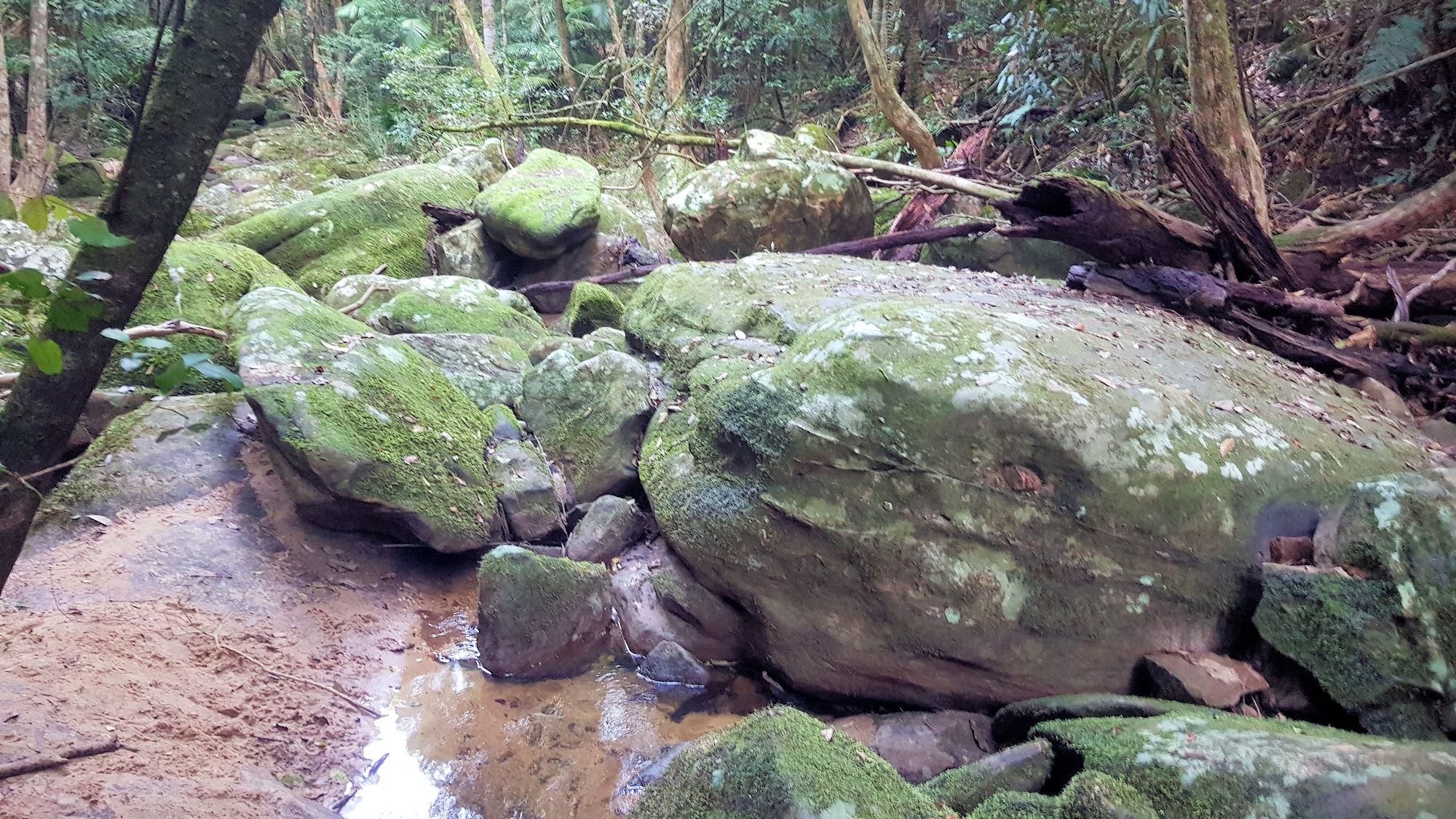
Boulders in a Creek

Stoney Creek Track Strickland State Forest

Getting There

Located in the Strickland State Forest, Stoney Creek Track is a great walk winding its way along Stoney Creek from the upper Banksia picnic area to the lower carpark.

Banksia Picnic Area

The track starts near the entrance to the Banksia Picnic Area, where a large car park and toilet facilities sit next to covered picnic areas. Several information boards show the various tracks in the area, along with some of the wildlife you might see along the way.

The lower carpark provides an alternate starting point, where you can walk the track uphill, before returning.

Stoney Creek Track

With a one way distance of 1.1km, or 2.2km return, this walk can be combined with other tracks to form a loop. We combined it with the Ridge to Rainforest Track, giving us a constantly changing landscape for the whole walk.

After completing the Ridge to Rainforest Track, which finishes at the lower carpark, we used the Stoney Creek Track to return to our car at the Banksia Picnic Area. The gully rainforest at the start is dark and cool, where you are surrounded by dense trees and moss covered boulders. Toward the top, the vegetation changes to cabbage tree ferns, which adds great variety to the walk.

This is an uphill track, but we didn’t find it too steep and at only 1.1km long it’s quite short. To help in the steeper spots, steps cut into rocks make the track easier. The many boulders in the creek that give it its name look amazing covered in moss.

What did We Think?

This was a great uphill walk, with changing vegetation along the way. Following the creek from rainforest to cabbage tree palms was fun. Although an uphill walk, it is only 1.1 km long, with opportunities to stop and admire your surroundings on the way. When combined with the Ridge to Rainforest it creates a good length walk through different forest types.

To see what else there is to do in New South Wales, please see some of our other stories.

Our photos are available for purchase on