AdBlock Detected

It looks like you're using an ad-blocker!

Our team work realy hard to produce quality content on this website and we noticed you have ad-blocking enabled.

Arboretum and Bellbird Tracks in Strickland Forest
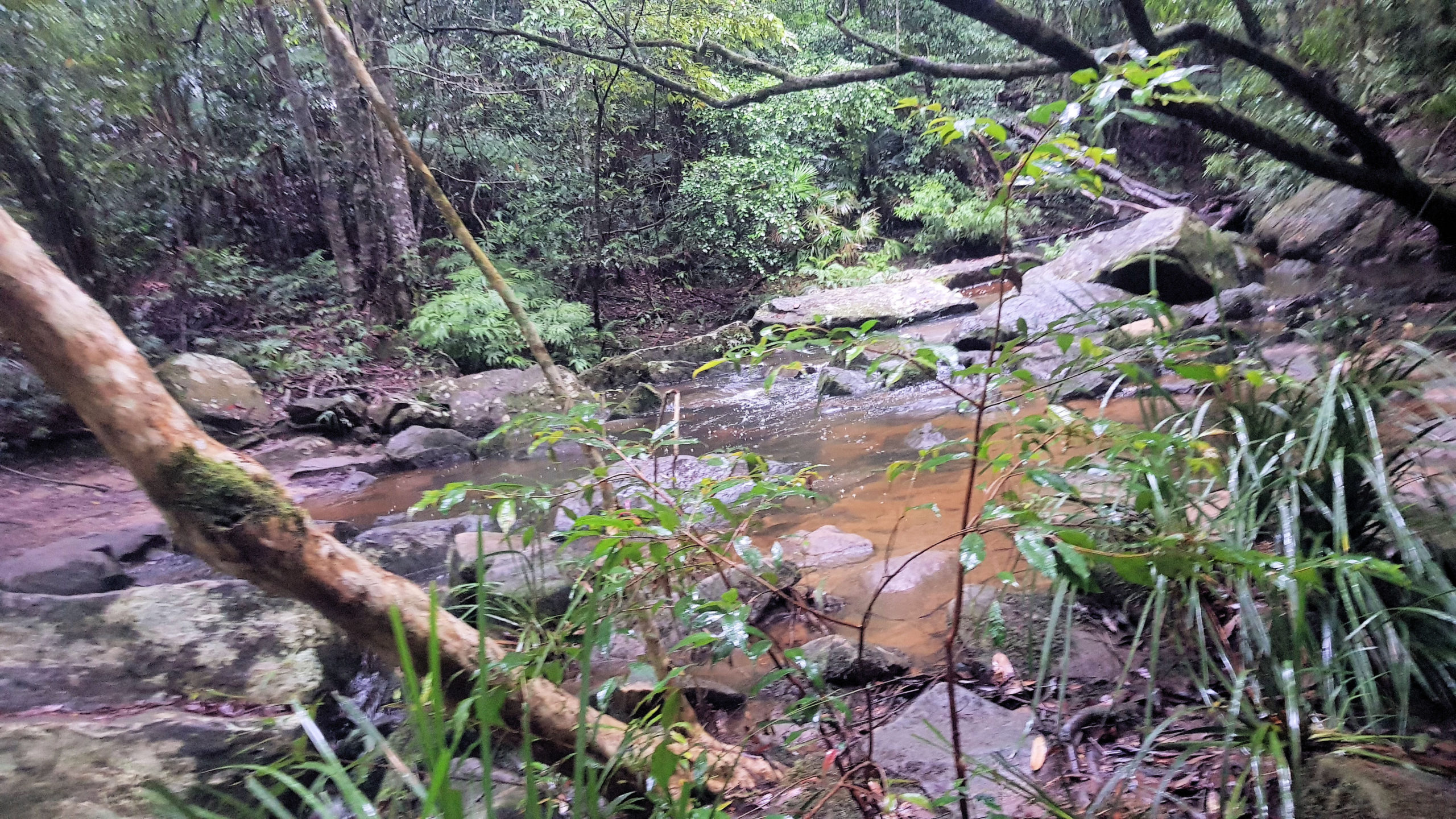
Stoney Creek Crossing

Strickland State Forest

Two great walks located in the Strickland State Forest are the Arboretum and Bellbird Tracks. Located on the Central Coast of NSW, less than an hour’s drive north of Sydney, south of Newcastle, or a 10-minute drive west of Gosford, Strickland State Forest is a great place to visit.

The forest is only five square kilometres but contains an impressive variety of flora and fauna species, along with extensive walking tracks. These wander through varying forest types, past waterfalls, under cabbage tree palms and along creeks.

The forest has excellent picnic facilities including an all-weather shelter, picnic tables and toilets located at the Banksia Picnic Area

Arboretum Loop Track

Located at the end of the Strickland Forest Road, the car park for the Arboretum Loop Track is well maintained but has no facilities. You will find these at the Banksia Picnic Area, which you pass on your way in.

From the car park, walk down the trail to Stoney Creek, which has rocks laid out as steppingstones. On our visit, the creek was running high, because of rain and many rocks were under water and slippery. We took our time crossing to make sure we didn’t slip.

The trail then winds through forest, while staying close to the creek. On reaching Narara Creek, you will find a suspension bridge, which make the creek crossing easy, safe and, fun.

Continuing along the trail you will come across a sign to the Arboretum Loop. This area is great to walk through as much of it was planted over 100 years ago making the trees large and mature. Many of the tree are have signs to show their species, which adds to the interest of the walk. At two points large trees have fallen over the creek, forming natural bridges, although they are covered in moss and slippery.

Bellbird Track

Located not far from the Arboretum Track, the Bellbird Track starts at a well-made signpost, making it easy to find. From here it winds through fern filled forest, before reaching a creek crossing. The creek was running high because of recent rain, which made the crossing difficult. Usually, the concrete steps are easy to use, but these were under water.

We found leaches on our legs after the crossing, which we quickly removed. Leaches are common in the area, particularly after rain, so be prepared for them.

Things to be Aware Of

Falling Pinecones

Signs at the car park warn of falling pinecones in some seasons, so be aware of this.

Creek Crossings

Depending on the tracks you take, several creek crossings may be required. After heavy rain the water will be higher and the rocks in the water may be slippery when standing on them to cross the river, so be careful.

Leaches

Leaches live around the creeks and in the wet undergrowth, especially after rain when they are very active. Assume that you will be bitten by them and come prepared with salt and anti-leech sprays as well as decent boots.

What Did We Think?

Apart from the leaches and the slippery creek crossings, we had a great time. It was wet and raining, but this added to the atmosphere in the forest, with everything being wet and damp.

Moonee Beach and the Pink Cave

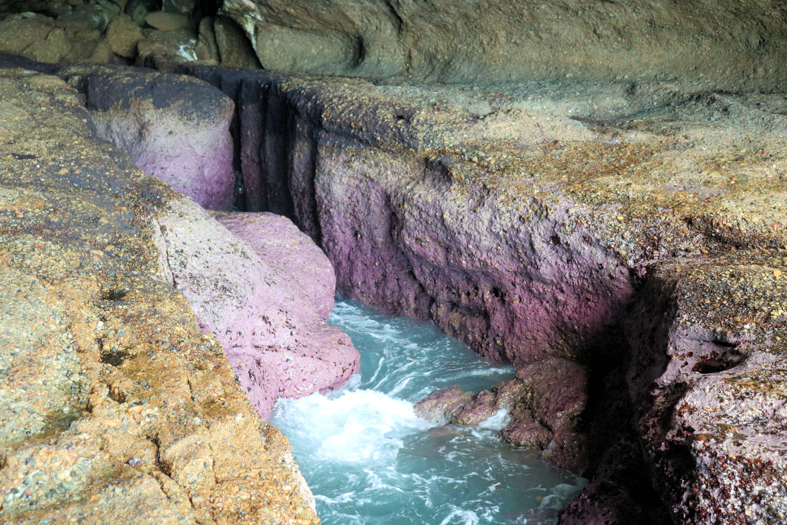
The Pink Cave

Moonee Beach and the Pink Cave

Getting There and Parking

Located in Catherine Hill Bay South of Newcastle, Moonee Beach and the Pink Cave (also called Deep Cave Bay) are an amazing place to visit, because of their beautiful colours and setting. Parking is limited near the beach access trail, as the road is narrow. However, a small area of the one-way road is wider to allow cars to park. A sign indicates the way to the beach.

The Track Down to the Beach

A sandy trail leads down to the beach, winding through bush until it reaches the beach. The beach is beautiful and quiet, making it a great place to relax and enjoy the sand and waves.

Moonee Beach

At the end of the track, you come out at Moonee Beach, an 800m long sandy beach with rock platforms at each end. At 800m long, there is plenty of room for everyone, so it’s unlikely to get crowded. Swimming is not advised, because the beach is not patrolled. While there we saw a lot of marine stingers washed up on the sand, which we were careful not to step on. Be careful, as the sting can still work even if they are dead. This is another reason to be careful swimming here.

Rock Platform

The rock platform on the north end of the beach is where you will find the pink cave. Access to the cave is only safe at low tide, so make sure you check tide times before you go. Walking across the rock platform can be slippery, so have good footwear and take care.

On your 700m walk to the cave, take time to look at some of the wonderful rock pools, as some are very colourful. Also look at the algae and seaweed growing on the exposed rocks, many of them are also brightly coloured.

The Pink Cave

Remember to only go here at low tide, because this is the safest period, as well as ensuring you see the pink rocks. The rocks are wet and slippery, because the cave is tidal, so take care.

Inside the cave, where the waves wash in, you will see the amazing pink rocks. Fully exposed at low tide, they make a great sight.

What Did We Think?

This was a great place to visit, because of the amazing colours of the cave. The beach is a great place to relax and enjoy you surrounding, either before or after the walk along the rock platform.

A great addition to this visit is the Ghosties Beach Cave, which is only 1600m away along the beach.

To see what else there is to do in New South Wales, please see some of our other stories.

Our photos are available for purchase on

Wisemans Ferry and the Great North Road
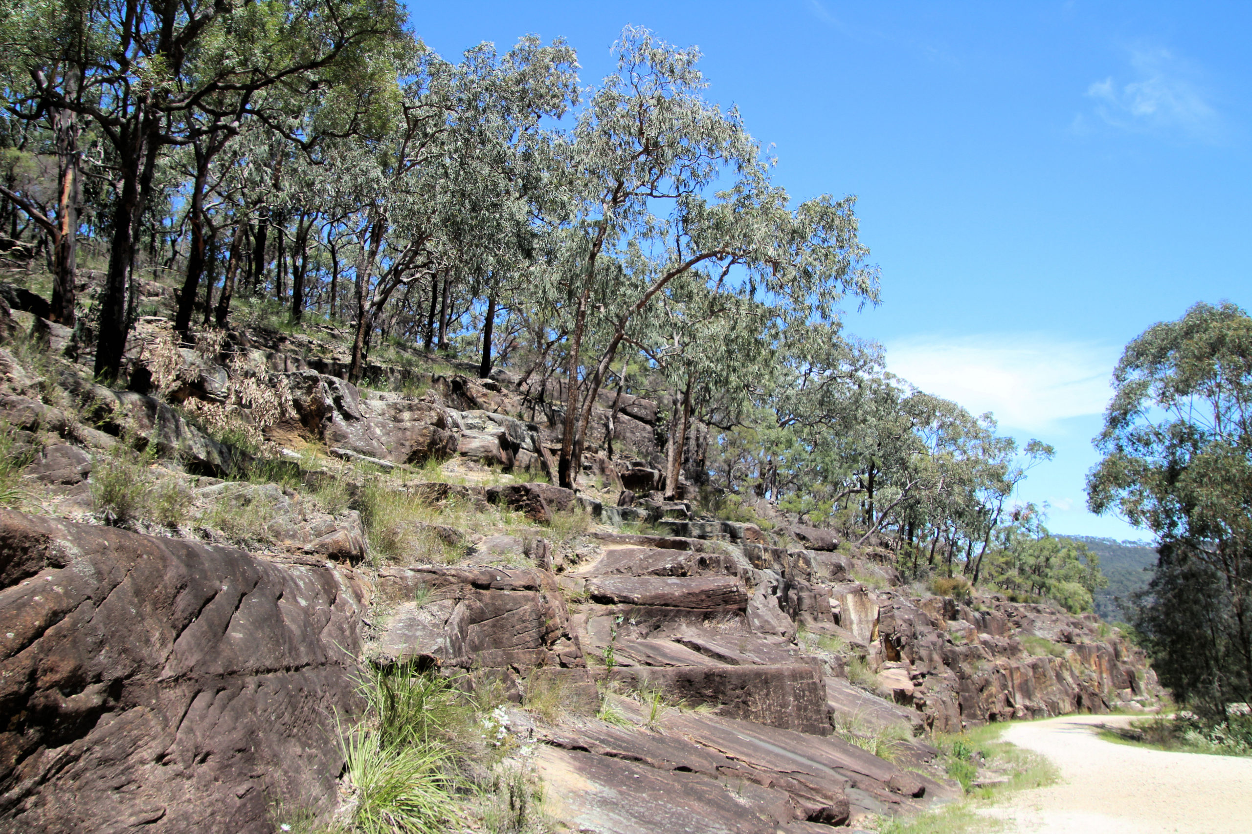
The Quarry Site on the Great North Road

Wisemans Ferry

Located on the New South Wales Central Coast and North of Sydney, Wisemans Ferry is a historic town connected to the Great North Road.

Hawkins Lookout Wisemans Ferry

Travelling north from Sydney, the road passes through some wonderful scenery with very tight windy roads in places. Just outside Wisemans Ferry is Hawkins Lookout which provides great views over the mountains and the Hawkesbury River. We made a quick stop here to admire the views before continuing on to the town.

Convict Trail Memorial

Near the ferry landing is a carpark with a cafe and memorial site. The memorial commemorates the building of the Great North Road and the ferry crossing. We relaxed here for a while with a snack and coffee after the drive, before boarding the ferry.

The Ferry

The ferry master will direct you when it is safe to drive on board and park in the marked spaces. Once parked, turn off your engine and enjoy the short ride to the other side. Use of the ferry is free, so no payment is necessary.

The Great North Road

The entrance to the Great North road is to the left of the ferry crossing. There is only limited parking available, with no dedicated car park. In busy times this will be a problem and you may need to walk some distance to get there.

The Great North Road was built by convict labour between 1825 and 1836 to link Sydney to Newcastle and the Hunter Valley.

Information Boards

Information boards, convict silhouettes and examples of tools, provide context for what you are looking at. This enables a greater understanding of what the convicts endured because you can visualise them working on the road or in the stone quarry.

The Road

The road surface is well maintained and although it goes uphill is not a difficult walk if you take it slowly. Remember to take water, use sunscreen, and wear a hat, because there is not much shade.

The dry stonewall buttresses on the downhill side of the road are of excellent workmanship, especially when you consider the conditions the convicts were working in.

Sites Along the Way

Along the walk, there are several sites of interest. The first is the remains of a large quarry, where stone was quarried for use in the road. Tools on display here show how primitive the work was and how difficult it would have been.

The second spot is called Hangman’s Rock, although is doubtful if this is what it was used for. Steps are cut into the rock, enabling you to climb up for a better look.

What Did We Think?

We stopped at Hangman’s Rock and returned to our car, although you can continue to Finches Line Walking Track which will bring you out south of the Ferry crossing. This is a part of Australia’s colonial history and it is great that the site has been preserved and presented so well for visitors. This part of the Great North Road is only a short walk, but lets you see some important historical sites. We enjoyed the walk and the history on display.

If you are interested in the Great North Road, read our post on the northern section.

Our photos are available for purchase on

To see what else there is to do in New South Wales, please see some of our other stories.