AdBlock Detected

It looks like you're using an ad-blocker!

Our team work realy hard to produce quality content on this website and we noticed you have ad-blocking enabled.

Barrington Tops National Park

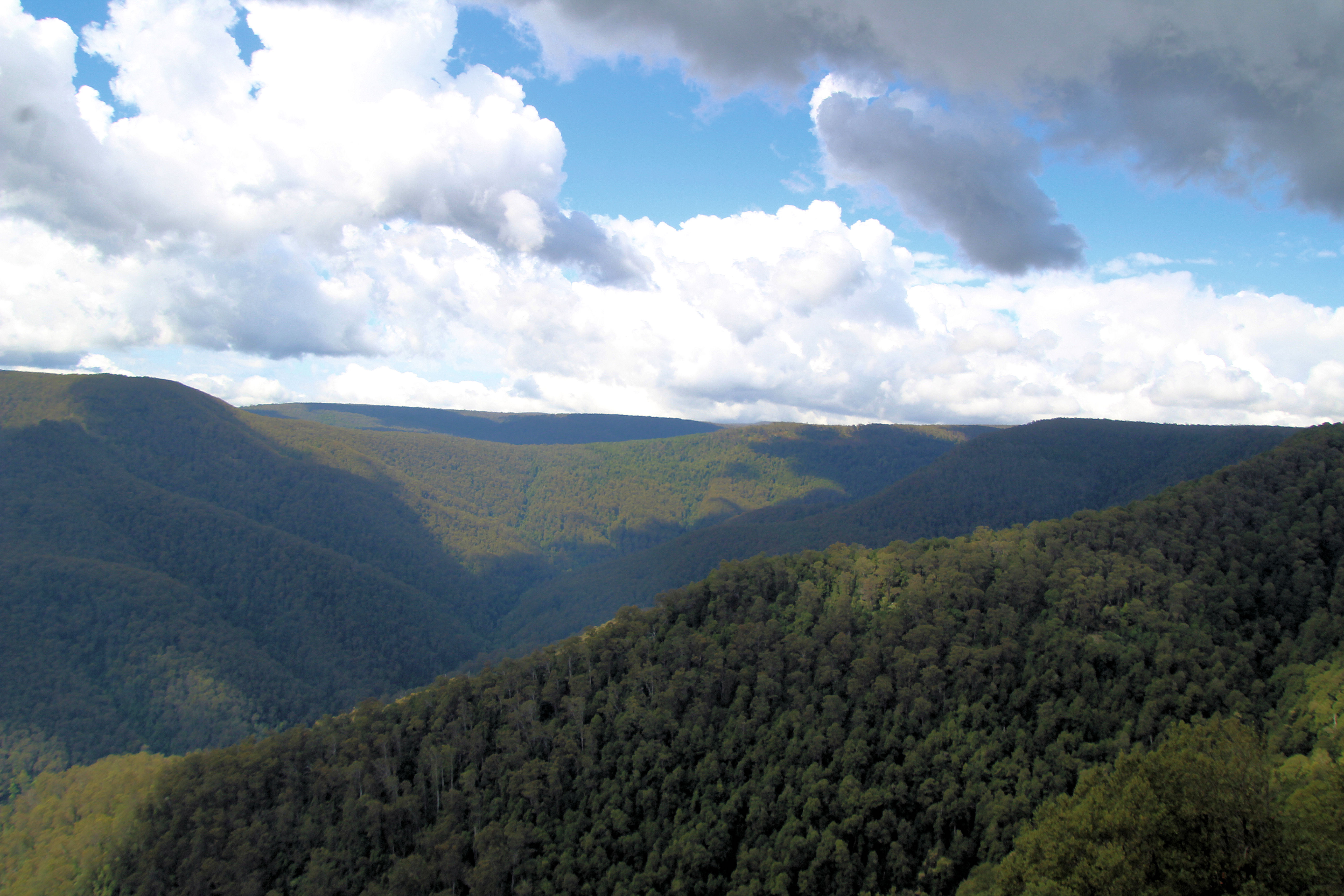
Devil's Hole Lookout Barrington Tops National Park NSW Australia

Barrington Tops National Park

Aberdeen

Our drive to the Barrington Tops started at Aberdeen in the NSW Hunter Valley.  This is a small town, famous for its Scottish heritage and its annual Highland Games.  Also of interest as you pass through the town is St Mark’s Church.

Polblue Swamp Walk

Polblue Swamp Walk can be started in either the camping ground, or the nearby day parking area.  The walk forms a loop that passes through both areas. This was a nice walk that took us 30 minutes to complete.  The loop, skirts the swamp area and passes through wooded area, over several creeks (with bridges) and finishes with a board walk over part of the swamp.

We found the board walk to be the most interesting, as it had a variety of bird life and plants.

Devil’s Hole Lookout

The track to Devils hole Lookout is very short (about 5 minutes) and paved. The view is amazing over the Barrington Tops, because the viewing platform is placed well. 

Thunderbolt’s Lookout

Thunderbolt’s Lookout gives views similar to Devils hole, but also has a more interesting walk to the viewing area. You pass ferns, huge trees, and part of the path is enclosed overhead with tree branches forming a passageway.

Honeysuckle Walk

Honeysuckle Walk was our favourite in the Barrington Tops, because of its wonderful trees and undergrowth. The walk starts at the Honeysuckle Picnic Ground and then loops around through the forest before returning to the picnic area.

The walk passes through Antarctic beech forest with an undergrowth of tree ferns. Many of the trees have moss covered trunks are a spectacular sight. This walk took us 30 minutes, but could be quicker if you don’t stop to admire the surroundings.

Mountain Maid Gold Mine

Hidden Treasure track is an easy walk through dry rain forest following Copeland Creek beneath the rain forest canopy. This hike also takes you past remnants of the area’s mining history. Along the track you will pass mine adits that have been barred shut. Some are now home to micro bats and you can smell the guano from the entrance.

We took 90 minutes to complete this track. Be careful of the signage and take a map (or photograph the map at the start of the walk), because some signs are not obvious.

The Basin Loops track takes 3 1/2 to 4 1/2 hours and is an extension of the Hidden Treasure track.  We didn’t have time to complete this one, so left it for another day.

What Did We Think?

Our trip finished in Gloucester, where we had a late lunch at a cafe on the main street before the drive home. The Barrington Tops was a great day out with some lovely walks and scenery. There are many places to stop and admire the scenery as well as walks for beginners to the more adventurous.

To see what else there is to do in New South Wales, please see some of our other stories.

Merriwa Sheep Beautiful Golden Canola

Festival of the Fleeces Merriwa NSW

Merriwa

Merriwa is know throughout the Hunter Region for its annual Festival of the Fleeces. Once a year the town celebrates its association with the wool industry by parading sheep wearing red socks down the Main Street. This is a unique event and sheep in socks are worth seeing.

Welcome Sign
Merriwa Welcome Sign

Festival of the Fleeces

The festival has grown so that the Main Street is lined with stalls selling local produce and crafts. There are displays of sheep shearing and sheep dogs. One of the side streets held a car show.

Things to See in Merriwa

Merriwa Historical Society Museum and Visitor Centre located on the main street houses some interesting artifacts from Merriwa’s sheep shearing past as well as selling local arts and crafts.  Outside is a small slab hut and a three dimensional mural.

Being an old town Merriwa has several great old buildings to look at. The main street has some nice buildings, most of which have been re-purposed in recent years.  The local churches are nice examples of heritage building and make good photos.

The war memorial is on the main street through town and includes a 40mm Bofors anti aircraft gun nearby.

When travelling through we always stop at the  Merriwa Bakery for pies and coffee. This little shop is always busy, so you know the food must be good.  There is seating inside, out front or in the back courtyard.

Opposite the swimming pool is a bottle museum. It was not open when we were there, but would be interesting to look through.

Also outside the pool is a Brittania Steam Engine,  used to power shearing equipment at Charles Blaxland’s Cullingral station.

Merriwa Silo

Merriwa has painted their grain silo with beautiful mural reflecting the area’s character. It shows sheep in red socks as well as the canola crop in flower. As you drive through town you can’t miss it.

Merriwa Silo
Merriwa Silo

Other Attractions in the Area

Canola Crops in Flower

In September, the canola crops planted west of Merriwa provide a beautiful golden landscape as you drive towards Dubbo. The vast fields of yellow flowers look surreal as you drive by.

Battery Rock

Not far outside town is a Battery Rock rest area. There is an excellent example of columnar basalt here that is very easy to access and walk over.
Geological Sites of NSW describe the formation as “an amazing example of polygonal basalt columns also known as columnar jointing. The columns are nearly horizontal (not like those at Bald Hill Falls which are vertical). Around 35 million years old the basalt lava erupted at a temperature estimated to be about 1,200 degrees. The jointing is caused by shrinkage as the lava slowly cools; normally columns like these are vertical as the lava cools from top to bottom when the flow of lava is horizontal. In this case the flow must have been nearly vertical and the flow has cooled from the outside face causing the jointing to form inwards from the outer face in a near horizontal plane.”

The Drip

Our visit to The Drip in the Goulburn River National Park was a pleasant walk along the well maintained tracks. The bush and river views as you walk in are great with many opportunities for photographs.

The end of the track is at The Drip, where water drips (hence the name) off the cliff making an environment for ferns and mosses.

Gungal

Driving from Newcastle, you will pass through the locality of Gungal and its cute little Catholic Church, dedicated to St. Anthony of Padua. The church is obvious from the highway and parking outside is easy.

To see what else there is to do in New South Wales, please see some of our other stories.

Tomaree Head Summit Walk

Xenith Beach Tomaree Head Summit Walk

Tomaree Head Summit Walk

The Tomaree Head Summit Walk is part of the Tomaree National Park near Nelson Bay New South Wales, Australia. This is a great bush walk to the summit of Mount Tomaree, which can be very steep in places, so take your time. Rest and enjoy the fantastic scenery and stunning views from the top as well as along the way. From the summit you can see out to the surrounding islands and waterways.

The walkways are very well constructed and maintained by the 
NSW National Parks and Wildlife Service.  At the base of the mountain they are paved changing to metal gratings, railings and natural rock paths as you get higher. There are several stairways and narrow walkways, so be patient and let others pass.

Parking

The car park at the start of the track is quite small and on weekends and during school holidays it can become full quickly. Some people park on the road or on one of the side-tracks, but even these can become full.

Xenith Beach

The entrance for Xenith Beach is a near the start of the Tomaree Head Summit Walk. If you don’t want to go onto the beach you get fantastic views from the top of the walk.

World War 2 Gun Emplacements

The track to the World War II gun emplacements leads off from the Tomaree Head Summit track. We took this track after coming back down from the top of the mountain. The walk around to the gun and placements is flat and consists of an old bitumen road, so is very easy after the climb to the summit. The emplacements themselves date from World War II and are of concrete construction. Although dismantled, leaving only the outer shells, they are still interesting to visit.

If you’re interested in World War II and the fortifications built in Australia at that time this is a great place for you to visit. As an additional bonus you get some great views over the surrounding ocean and out to the islands.

To see what else there is to do in New South Wales, please see some of our other stories.