AdBlock Detected

It looks like you're using an ad-blocker!

Our team work realy hard to produce quality content on this website and we noticed you have ad-blocking enabled.

Bradfield Park North Sydney

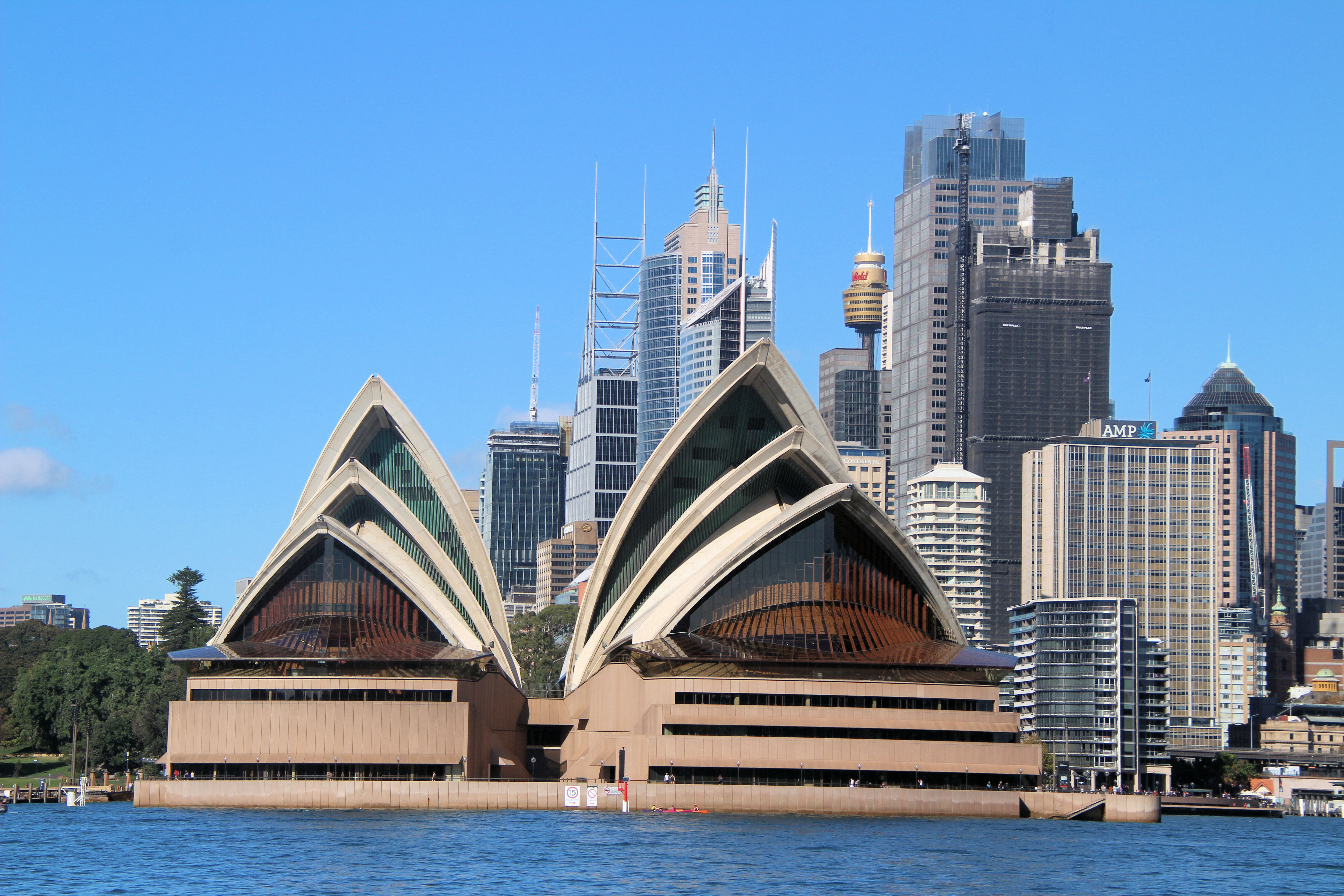
Sydney Opera House From Milsons Point

Bradfield Park North Sydney

Located partially beneath the Sydney Harbour Bridge, Bradfield Park is a publicly accessible park in North Sydney which provides magnificent vistas of the harbor, Circular Quay, and the Sydney Opera House. The park, named in honor of John Bradfield, the renowned engineer responsible for the bridge’s design, encompasses a playground, picnic facilities, a paved area under the bridge, and a direct pathway leading to the Olympic Pool and Luna Park complex.

Bradfield Park History

Originally conceived as a garden suburb in 1924, the plans for the area took a different turn in 1940 when it was designated as a Royal Australian Air Force station. Throughout World War II, this station served as a training ground for over 200,000 members of the RAAF and the WAAAF. Today, the once military station has transformed into the breathtaking Bradfield Park. This picturesque public space is conveniently accessible by public transportation, located just a short stroll away from Milsons Point railway station and Kirribilli shops.

What to See

Walking to the park from the train station, we noticed this amazing looking door on a house along the way.

Ornamental door on a house near Bradfield Park

Eastern Side

Entering the park, one of the initial sights that strikes you is a peculiar steel sculpture. Presented by the Swiss Government and the Swiss Australian Community in commemoration of the 2000 Sydney Olympics, this remarkable work of art is crafted using components salvaged from an antiquated train, along with rivets sourced from a Swiss bridge and discarded industrial steel.

The Australian Angel

The foreshore of Bradfield Park is a fantastic spot for taking photos. You can capture many great landmarks and even use the weather shelters to get a unique perspective of the Sydney Opera House across the shore.

Sydney Opera House From Milsons Point

Of course, the dominant feature in the area is the Sydney Harbour Bridge. Walking through the park will take you past the buttress towers and under the train roadway. From here you get a completely different view of the bridge than when driving over it. You can see the structure and engineering that has gone into its design and the huge amount of steel needed to build it.

Under Sydney Harbour Bridge

Underside of the Sydney Harbour Bridge Bradfield Park
Underside of the Sydney Harbour Bridge

Located under the bridge and forming part of the foreshore is the bow of the first HMAS Sydney which served in World War One.

The Bow of HMAS Sydney (I)

Western Side

Originally situated at the intersection of Berry and Miller Street in North Sydney, ‘Harbour Cycles’ by Richard Byrnes has now found its new home in the western section of Bradfield Park. Made from aluminium, this impressive creation showcases various elements such as the iconic struts of the Harbour Bridge, maritime machinery, and local architectural designs.

Harbour Cycles by Richard Byrnes Bradfield Park
Harbour Cycles by Richard Byrnes
Entrance to Milsons Point Station under the Sydney Harbour Bridge

The history of the area is explained with a series of information boards. These are great because most people would be unaware of the area’s history.

Information Board
Information Board

Sitting atop the Broomfield Memorial Drinking Fountain in Bradfield Park, this bronze fox terrier was crafted in honor of the 75th anniversary of the Harbour Bridge. The fountain serves as a tribute to Jessie Broomfield, a generous benefactor who left funds for the well-being of Sydney’s dogs and specifically requested the installation of trough-equipped fountains in public parks for our furry companions to quench their thirst. Positioned at the northernmost section of the park, adjacent to Lavender Street, the fountain stands as a testament to Broomfield’s philanthropic legacy.

Statue of a fox terrier atop a drinking fountain, with drinking troughs for dogs Bradfield Park
Statue of a fox terrier atop a drinking fountain, with drinking troughs for dogs

To see what else there is to do in New South Wales, please see some of our other stories.

Our photos are available for purchase on

Bobbin Head Mangrove Boardwalk

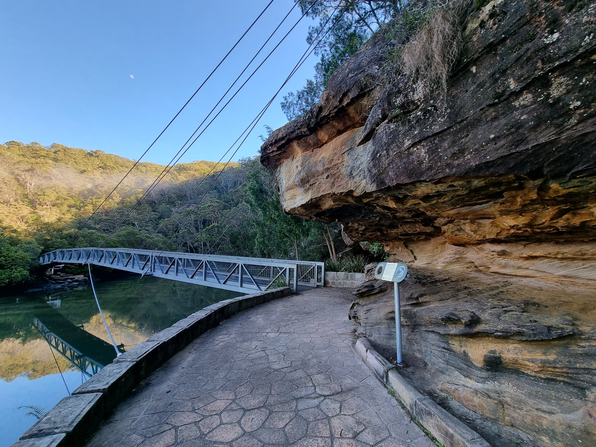
Suspension bridge through the mangroves

Bobbin Head Mangrove Boardwalk

Located in the Kuring-gai Chase National Park, access to the Bobbin Head Mangrove Boardwalk will cost $12.00 per car for a day. This will cover you for any other parts of the National Park you visit on that day too. The fee allows you to use the picnic areas and walking tracks in the area, which are well maintained by NSW Parks and Wildlife. Payment can be made at the entry gate as you drive in.

Our first stop was Empire Marina, where the still morning are provided amazing reflections on the water of the boats and surrounding forest. After this we drove to the southern end of the Bobbin Head picnic area, where the boardwalk starts.

The Boardwalk

The boardwalk meanders through the mangroves and there are information signs to help you learn more about the environment and plenty of opportunities to see the mangroves and crabs up close. Because it was low tide when we went, we didn’t see any crabs, only the openings to their burrows.

The boardwalk is 552 meters long and takes about 15 minutes to complete. Along the way we had more amazing reflections in Cockle Creek as well as views of the mangroves.

The track continues into the forest as Gibberagong Track, which we followed for a short distance to get more views over the creek.

This was a great little walk with amazing views. We were the only ones there during our visit early on a winter morning, but in summer it is very busy.

Suspension bridge through the mangroves
Suspension bridge through the mangroves Bobbin Head Mangrove Boardwalk
Suspension bridge through the mangroves
Metal sculpture of Cunningham's Skink Bobbin Head Mangrove Boardwalk
Metal sculpture of Cunningham’s Skink
Cowan Creek Bobbin Head Mangrove Boardwalk
Cowan Creek
The boardwalk through the mangroves
Eroded sandstone Bobbin Head Mangrove Boardwalk
Eroded sandstone
Trees growing in the sandstone on the river bank
Brush Turkey Bobbin Head Mangrove Boardwalk
Brush Turkey
Stone steps at the end of the boardwalk
View over Cowan Creek Bobbin Head Mangrove Boardwalk
View over Cowan Creek

Our photos are available for purchase on

To see what else there is to do in New South Wales, please see some of our other stories.

Palona Cave Walk

Sunrise at the start of the track Palona Cave Walk

Palona Cave Walk

Located in the Royal National Park, near Sydney the Palona Cave Walk is a short and easy bush walk. It takes you through beautiful temperate rainforest to a large limestone cave and a cascading waterfall.

Getting There

We drove to Royal National Park, arriving just after sunrise, so that we could catch the sunrise. Parking at the intersection of Lady Carrington Drive and Sir Bertram Stevens Drive was easy as only two other cars were there. On our return though, it was full, and many cars were parked along the road. Access to the National Park is charged per vehicle and you can pay at the entrance gate or main office. If you plan to visit several parks during the year, an annual pass is available from NSW National Parks and Wildlife Service.

Entrance near the carpark

The Track

Starting at the car park the historic Lady Carrington Drive trail leads into the forest. This is a wide and well-maintained dirt trail that follows the course of the Hacking River. Originally a road, it was closed and is now a dedicated bike and hiking trail. The trail takes you through temperate rain forest and our early morning start meant that it was quiet and peaceful.

After about 750 m, we reached the junction with the Forest Path, which is another scenic walk in the park. From here we continued along Lady Carrington Drive to Palona Cave track.

Palona Cave

After another 1 km, a sign for Limestone Cave on the left side of the track points off to the right. Unfortunately, a tree now obscures it, so keep a look out as the path to the cave is easy to miss, being very narrow. If you reach the Palona Brook crossing, you have gone too far. From here you leave the main trail and follow a narrow bush track that leads uphill to Palona Cave. The track is rough and rocky in places, so watch your step. When we visited it was also very overgrown and disappeared in several spots.

Palona Cave is a large overhang with stalactites and stalagmites formed by water dripping through the limestone rock. You can explore the cave and see the different shapes and colours of the formations. There is also a small stream that flows next to the cave and forms a waterfall. We were lucky it had rained recently because this creek is often dry.

This was a great walk with the reward of a waterfall and cave at the end. Remember to wear good boots as the second part of the track is rough. At around 5.3km return, it took us around two and a half hours, with plenty of stops for photos and cave exploring.

To see what else there is to do in New South Wales, please see some of our other stories.

Our photos are available for purchase on