Category: Australia

  • Power Station Pump House Balmain

    Power Station Pump House Balmain

    Power Station A Pump House Balmain

    Located on the shore of the Parramatta River, the Power Station Pump House previously housed the pumps used to pump cooling water to the Balmain Power Station. Ceasing operations in 1976 and demolished in 1998 this old coal-fired power station made way for an apartment complex.

    This heritage listed building is in very good condition despite the removal of its interior machinery. Built in 1934, the building is an interesting reminder that power stations previously operated within the inner-Sydney suburbs.

    Some confusion often arises, as old copper lettering spelling out “Power Station” have been placed on one of its interior walls. However, these were salvaged from the actual power station and have no relationship to this building.

    Locked gates prevent entry, however, the they have widely spaced bars, so it is possible to get a good view of the interior. On one exterior wall, an information board provides a history of the pumphouse.

    Getting There

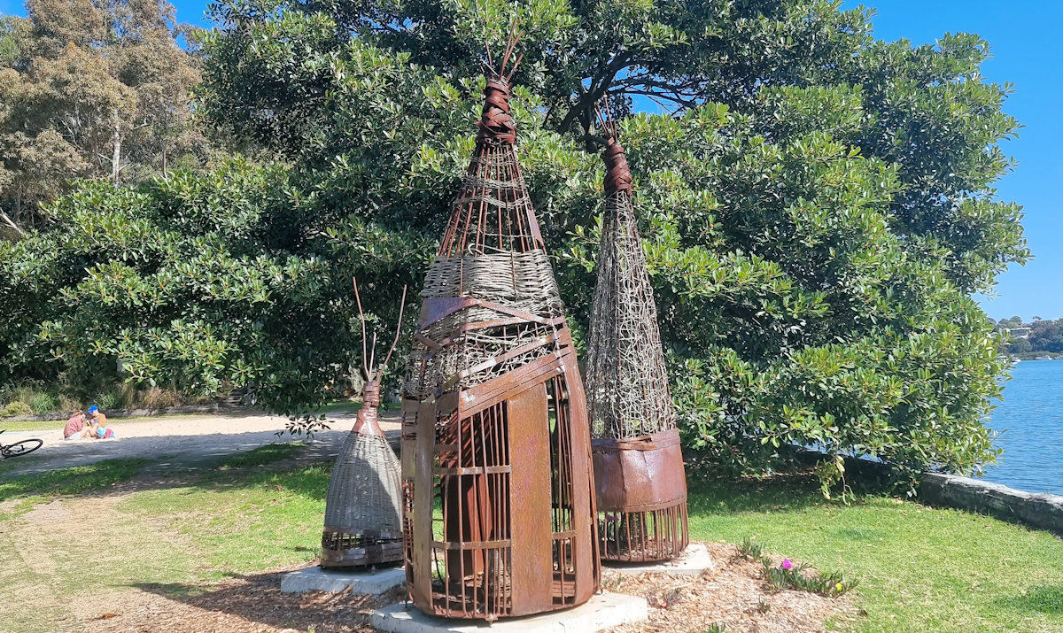
    We travelled by bus from the Sydney CBD, getting off at the Rozelle Bridge and walking 10 minutes to the old building. The walk along the river is nice, with well maintained paths. Also in the area, on the other side of Iron Cove Bridge is a monument to the indigenous inhabitants of the area. Consisting of a sculpture of the fish traps used before white settlers displaced the Aboriginal occupants, it’s also worth the short walk to have a look at.

    Our photos are available for purchase on

    To see what else there is to do in New South Wales, please see some of our other stories.

  • Tanilba Bay Australia

    Tanilba Bay Australia

    Tanilba Bay Australia

    Located on the Tilligerry Peninsula, Tanilba Bay is a suburb of the Port Stephens local government area in the Hunter Region of New South Wales, Australia.

    Entrance to Tanilba Bay
    Entrance to the town

    Tanilba House

    The centrepiece of the town is Tanilba House, a beautiful and elegant home which is one of Australia’s oldest historical buildings. Built for Lieutenant William Caswell, a naval officer who had received a land grant of 20.2 hectares in 1831. Caswell established farm sites at Seaham (23 km north) and Salt Ash and opted to build his homestead on the land at Tanilba.

    Tanilba Bay House
    Tanilba House

    The Temple of the Stork

    Built from local rock quarried from Mallabula and completed in 1933, The Temple of the Stork is an ornate stone and shell temple. The floor and ceiling of the temple feature reversed images while patterns of 8 appear mystically in the design. Henry F. Halloran who owned Tanilba House at the time was responsible for its construction.

    The Temple of the Stork
    The Temple of the Stork

    Water Gates

    The Centenary Gate, also known as the Water Gate, were constructed from 1929 to 31 March 1931. It was built to mark the centenary of European settlement at Tanilba Bay by the original grantee, Lieutenant William Caswell.

    Henry F. Halloran designed the gate from round and broken quartz porphyry embellished with white feldspar gathered from Tanilba foreshore and a quarry at Mallabula.

    The metal arch suspended between the rock pillars reads ‘Tanilba Bay’ and was designed to be viewed from the water when many visitors arrived by boat.

    Tanilba Bay Water Front

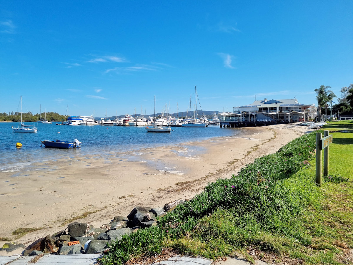
    The town’s waterfront has a nice sandy beach ideal for watersports or relaxing. Bordered by grassed areas with street parking the waterfront is a nice place to stop after arriving. When we visited there was a mobile coffee van in one of the carparks which was great after a 90 minute drive to get there.

    Mallabula Beach
    Mallabula Beach Looking West
    Mallabula Beach Looking East
    Mallabula Beach Looking East
    Looking Over Tanilba Bay
    Looking Over Tanilba Bay
    Small sandy Beach at Tanilba Bay
    Small sandy Beach
    Looking over Tanilba Bay
    Looking over Tanilba Bay

    Tilligerry Habitat

    The Tilligerry Habitat and adjacent boardwalk is a great place to wander through. Consisting of rehabilitated sand mining areas, it is now a sanctuary for birdlife and koalas. Unfortunately we didn’t see any on our visit, but we were assured they are there. A longer blog with more pictures of the Tilligerry Habitat can be found here.

    Boardwalk through mahogany paperbark forest Tilligerry Habitat
    Boardwalk through mahogany paperbark forest

    Our photos are available for purchase on

    To see what else there is to do in New South Wales, please see some of our other stories.

  • Carradah Park Sydney Australia

    Carradah Park Sydney Australia

    Carradah Park Sydney Australia

    History of the Site

    The BP refinery at Carradah Park in Waverton has a rich history that dates back several decades. Here is a brief overview of its historical significance:

    The refinery was established in 1926 by the Anglo-Persian Oil Company, which later became British Petroleum (BP). Its location in Waverton, a suburb of Sydney, Australia, was strategically chosen for its proximity to deep water, which facilitated the transportation of crude oil.

    During World War II, the refinery played a crucial role in supporting the Australian war effort. It supplied petroleum products to the military and contributed to the nation’s energy security. The refinery expanded significantly during this period to meet the increased demand.

    In the following years, the refinery underwent several upgrades and modernizations to improve its efficiency and environmental sustainability. It became a key player in the Australian petroleum industry, supplying a significant portion of the country’s fuel needs.

    However, as environmental concerns grew, the refinery faced criticism for its impact on the surrounding area. Issues such as air and water pollution led to community protests and pressure for improved environmental practices.

    In 2012, BP announced its decision to close the Carradah Park refinery due to economic factors. The closure marked the end of an era for the facility, and its refining operations ceased in 2014. BP shifted its focus towards fuel importation and distribution in Australia.

    Since the closure, the site has undergone a transformation. The refinery land has been repurposed for various purposes, including commercial and residential developments. The redevelopment has aimed to restore and revitalize the area while preserving its heritage.

    Current Use

    Carradah Park in Waverton has undergone a remarkable transformation in recent years, thanks to the rehabilitation efforts carried out on the site previously occupied by the BP refinery. The rehabilitation process aimed to restore the natural beauty and ecological balance of the area, making it a welcoming green space for both the local community and visitors to enjoy.

    One of the primary goals of the rehabilitation was to address the environmental impacts left behind by the refinery. Extensive remediation works were conducted to clean up contaminated soil and water, ensuring the preservation of the ecosystem and the safety of those using the park. This process involved the removal of hazardous substances and the implementation of sustainable land management practices.

    During the rehabilitation, the focus was not only on remediation but also on the enhancement of biodiversity. Native vegetation was reintroduced, creating habitats for various plant and animal species. This has not only contributed to the park’s aesthetic appeal but has also promoted a healthier ecosystem by attracting local wildlife.

    Furthermore, the park’s infrastructure underwent significant upgrades to improve accessibility and provide amenities for visitors. New walking paths, seating areas, and picnic spots were established, encouraging people to explore the park and take advantage of its recreational opportunities. The inclusion of sustainable features, such as rain gardens and water-efficient irrigation systems, further reflects the commitment to environmental responsibility.

    How To Get There

    We travelled by train to Waverton Station because parking in the area is limited. Walking from the station, we stopped at Botanica Garden Café for a coffee before heading to Carradah Park via Waverton Park.

    Carradah Park

    Walking through the park, information boards explain the area’s past. It’s amazing how much work has been undertaken to transform it from a contaminated industrial site to a beautiful park.

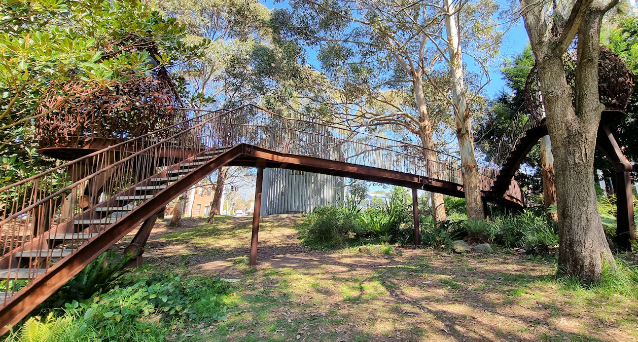
    Meandering through the park, several paths lead you through the revegetated bush. Viewing platforms from the upper section provide fantastic vantage points to see Sydney Harbour as well as the bridge and city. From here you can also look down to where giant fuel tanks once stood but have been transformed into green circles.

    At the southern end of the park, two old wooded piers, one of which has collapsed are still visible in Berrys Bay. From here we walked to the Coal Loader and its derelict Coal Loading Wharf before finishing our day at Balls Head Reserve.

    Our photos are available for purchase on

    To see what else there is to do in New South Wales, please see some of our other stories.