Category: Beach

  • Patonga on the Hawkesbury River

    Patonga

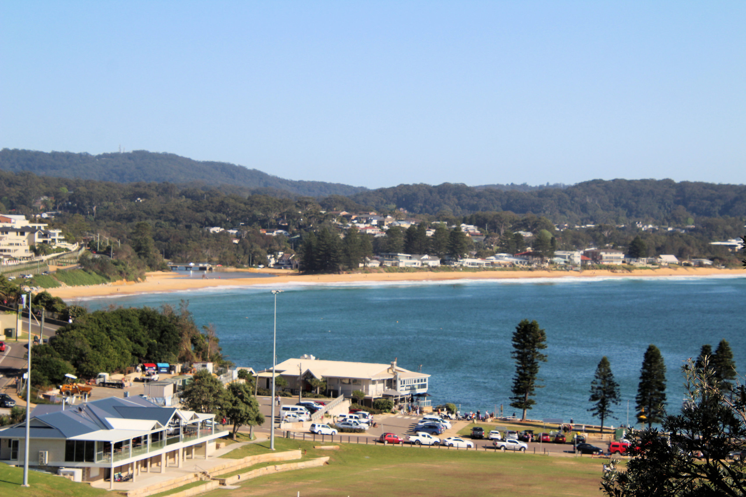
    Located on the Hawkesbury River, Patonga is a small community of around 200 inhabitants. Surrounded by Brisbane Water National Park, it is a great place to go bushwalking, or enjoy the water. A beautiful beach extends along the front of the town on the shores of Brisk Bay.

    Shops opposite the beach offer meals and drinks, where you can dine in or eat on the beach.

    Patonga means “oyster” in the Guringai people’s language, whose country stretches from the north side of Port Jackson to the southern end of Lake Macquarie.

    Having just completed the Pearl Beach Patonga Fire Trail, we were looking for something to eat and somewhere to relax. We bought take-away coffee and morning tea at the cafe before walking to the beach to relax and eat.

    What Did We Think?

    A great place to stop and relax on the beach, or go boating. If you like bush walking, this is one end of the Fire Trail that leads to Pearl Beach, so is a great place to relax before or after you do the walk.

  • Bouddi Coastal Walk with Beautiful Views

    Bouddi Coastal Walk with Beautiful Views

    Bouddi Coastal Walk

    The 8km Bouddi coastal walk runs from Putty Beach to MacMasters Beach. Known as one of the most beautiful central coast walks, because of its beaches, boardwalks and birdlife.

    If the whole 8km walk is too much, it can be broken into shorter sections:

    Putty Beach to Maitland Bay (3km)
    Maitland Bay to Little Beach (3.5km)
    Little Beach to MacMasters Beach (1.7km)

    If starting at Maitland Bay, you will also walk the Maitland Bay Track. Read about this track here, so that you know what to expect.

    Getting there

    Located 90 minutes north of Sydney and 1 hour and 45 minutes south of Newcastle via the M1 Pacific Motorway, the Bouddi National Park is easy to find

    Parking


    If you start from MacMasters Beach, park near the Surf Life Saving Club on Marine Parade, which has a large car park. Follow the stairs in between houses 85 & 87 Marine Parade.

    To start from Putty Beach, park at the end of Putty Beach Road in Killcare Heights. Drive to the end of the road, where the car park is located. A parking fee of $8 per day applies, but if you have an annual NPWS pass, it is free. We have an annual pass and have found it saves us lots of money as well as not having to bother with paying for day tickets.

    If you want to pick up Bouddi Coastal Walk from Little Beach or camp, park at the end of Grahame Drive in the car park and follow the signs to the beach.

    If you want to pick up Bouddi Coastal Walk midway from Maitland Bay, park at the Bouddi National Park Information Centre on the Scenic Road in Killcare Heights. Follow the Maitland Bay Track and when you reach the beach turn left to follow the track to MacMasters Beach. If you want to walk to Putty Beach take the Bouddi Coastal Walk off shoot on the right before you reach the beach.

    Putty Beach to Maitland Bay Beach

    Putty Beach

    Located in Bouddi National Park, Putty Beach is a large sandy beach that is almost completely framed by National Park. The Bouddi Trail, starts on the north-eastern end of the beach. and a large car park and campsite. Putty Beach is a patrolled beach, making it safe to enjoy the water as long as you swim between the flags.

    Putty Beach camping area is a spacious, grassed area with easy access to the beach. Facilities include drinking water, flush toilets, open-air showers, rubbish bins and barbecues, both gas and electric although wood fires not permitted. During peak periods, campsites must be booked up to three months in advance.

    The Track

    Located at the end of the beach near the car park is a sign and stairway. This is the start of the track, which is well maintained and easy to walk. A large amount of the track here is boardwalk, or formed steps and stairs. Views over the ocean and along the track are magnificent, so take your time and admire the scenery, as there are plenty of places to stop.

    Tessellated Pavement

    Not far along the track from Putty Beach is a tessellated pavement,located on the cliff edge. Information boards detail how it formed, which is great for those who don’t know much about geology.

    Bullimah Beach

    Surrounded by cliffs, Bullimah Beach, is a small, yellow sand beach at Gerrin Point Headland. From the beach and the boardwalk above, you get views over the South Pacific Ocean to the Barrenjoey and Avalon headlands.

    Gerrin Point Lookout

    Situated high on the cliffs, overlooking the ocean, this lookout provides fantastic views of the coastline.

    From here, the track becomes rougher along with more steps and stairs, but it passes through some great coastal bushland, along with more great views.

    Maitland Bay Beach

    The walking track ends at Maitland Bay Beach. This is a lovely sandy 500m long stretch of beach that is great for a swim or relaxing on. Have a look at the rocks and small cliff faces and you will find some interesting weathering patterns in the rocks.

    From the beach you can either walk up the Maitland Bay Track to the car park, or continue on down the beach. On the beach, we found some sculptures made from driftwood, which looked really amazing, and was something we didn’t expect to find.

    Walking along the beach, you will find steps leading up the headland, which are the continuation of the Bouddi Coastal Walk.

    Driftwood Art on the Beach

    Rocks and Geology

    Bouddi Point

    At the north end of the beach is Bouddi Point.  This is the area where the SS Maitland came to grief. We had a look and could not see any wreckage. The volunteer at the Information Centre told us later that it would have to be a very low tide to see much. Still, the rocks were fun to climb over.

    Bouddi Point Maitland Bay Track Bouddi National Park
    Bouddi Point
    Bouddi Point Maitland Bay Track Bouddi National Park
    Bouddi Point

    Maitland Bay to Little Beach

    The Track

    Maitland Bay to Little Beach is by far the hardest part of the track, because of the numerous hills you climb and descend. During our walk, there was not much of a breeze and it was very humid, so we became hot very quickly. Remember to take plenty of water with you, because you don’t want to get dehydrated.

    Although the walk is hard, the views are magnificent, and there is not need to rush, so take your time.

    Once the walk meets the Bombi Moor Fire Trail, the worst of the steps are finished. This 1.2 km. trail is covered with the wood chips, which makes it easy to walk on.

    The Views

    Native Flowers and Plants

    During our walk, we came across many native flowers in bloom, because of the time of year. Spring really is a great time to walk, with great weather and the flowers everywhere.

    Little Beach

    Little Beach, is a small 100m-long stretch of sand and rocks, facing the ocean. The beach is backed by a gully and sided by steep rocky headlands. The beach has a south easterly aspect and has its own campsite.

    Little Beach campsite is a small grassed area, set back from the beach with six designated sites, a composting toilet, rubbish bins, Gas barbecues and a shelter, but has no drinking water. If you camp here, everything will need to be carried down the hill from the car park.

    This beach is not patrolled.

    MacMasters Beach

    The Coastal Walk ends at MacMasters Beach. A beautiful sandy beach with great water and car parking available. Located at the south end is a coffee shop selling meals and drinks. After such a huge walk this is a great place to relax and refuel. If you don’t feel like a swim in the ocean there is an ocean pool near the surf club.

  • Caves Beach Amazing Beautiful Views

    Caves Beach Amazing Beautiful Views

    Caves Beach

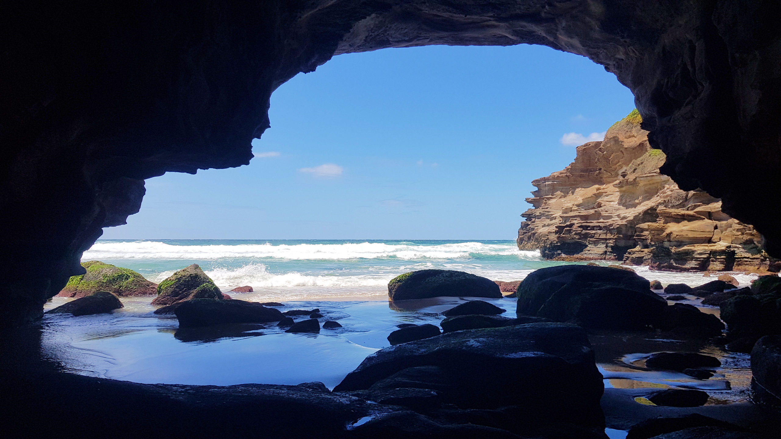
    Located only 40 minutes south of Newcastle, Caves Beach is a relaxed southern suburb of Lake Macquarie.  Named after the network of sea caves to the south of the beach, it is a great place to relax and explore the coast. If you want to explore the cave, make sure you go at low tide because at high tide, the cave is flooded, and access is cut off.  You can check this on the internet.  During the week we have found it to be quiet, but on a sunny weekend, it will be crowded, with people swimming and exploring the cave.

    If you want to swim in the ocean, check that a lifeguard is on duty in the tower and swim between the flags to be safe.

    Near the lifeguard tower is a steel sculpture, Norfolk 2019 by Kelly-Ann Lees, which reflects the seed cones dropped by the Norfolk Pines which are found in the area.

    The Caves

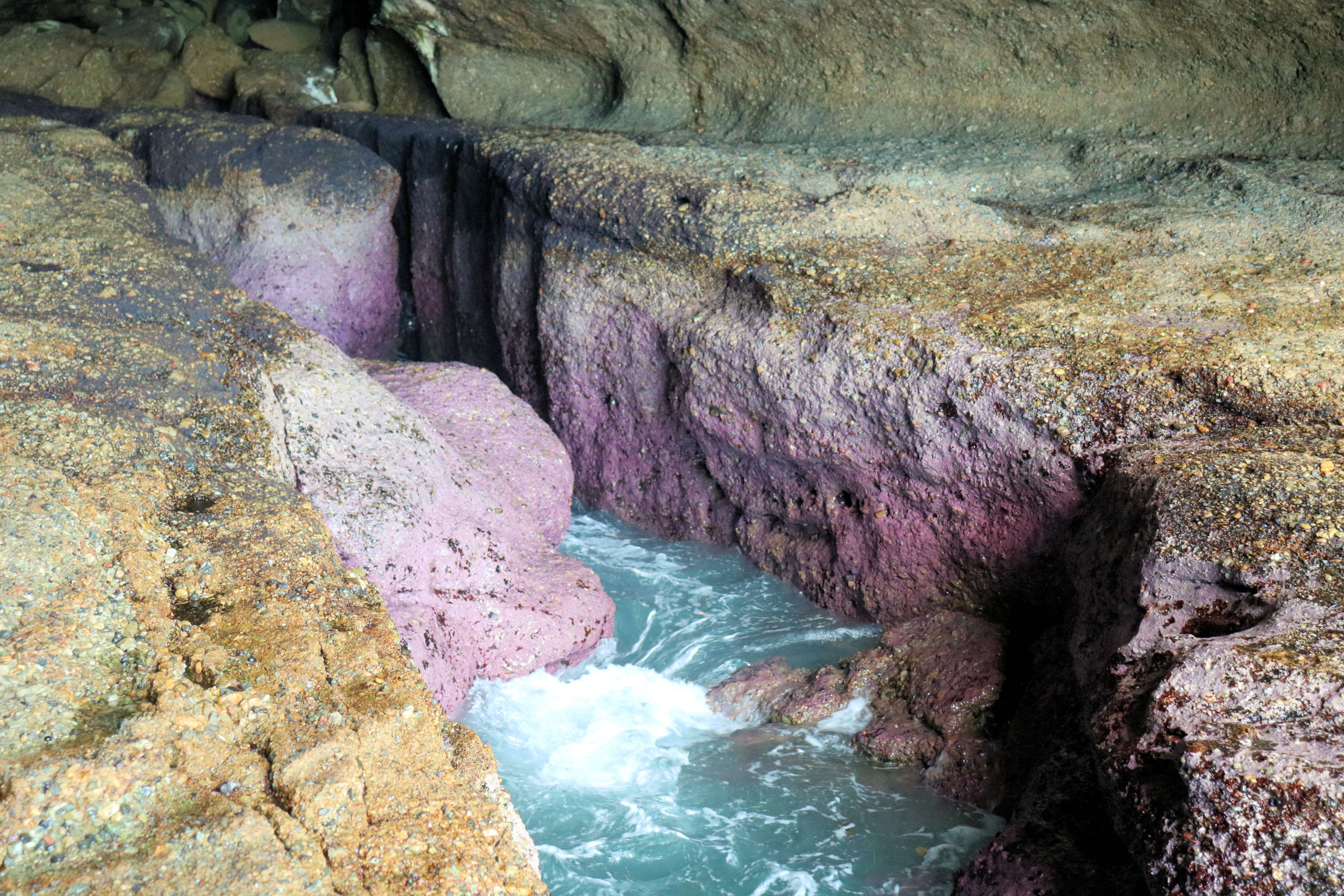
    Entering the cave is not dangerous.  There are no warning signs and access is free. You can walk through the cave and out the other side to a rock platform.  The cliff here also has some smaller caves to look at.  The platform itself is quite interesting, with rock pools with algae growing in them.  Be careful of your footing because the rocks can be slippery. Remember to check the tides, because the cave and rock platform are flooded at high tide.

    Food and Refreshments

    There is a kiosk next to the beach selling snacks and cold drinks during the week.  Not far before the entrance to the carpark, you will find cafes and restaurants, if you want something more substantial. The beach area near the surf house also has barbecues and picnic area, along with a change house and toilets.

    Caves Beach to Pinny Beach The Wallarah Coastal Walk

    For some excellent views of the coast and to see some nice beaches, there is a walking trail from Caves Beach to Pinny Beach. The trails are rough in places and there are steps to climb, but it is generally an easy three kilometer one way walk. Along the way, lookouts let you look over beaches and rock platforms. Small trails also allow access to the beaches, which is a great way to extend your exploring of the area.

    Spoon Rocks

    Originally built by a mining company for coal transportation, the breakwater’s shape is how this Spoon Rocks received its name. The spoon shape is visible on your way down the track to the beach.

    The mining venture, with Silver Valley Minerals, didn’t proceed after it’s construction. However, the breakwater remains and provides protection from the swell at the beach. Although the water looks inviting, Spoon Rocks Beach is not patrolled, so swimming is not advised.

    Pinny Beach

    Located in Wallarah National Park, the Coastal Walk passes through locked vehicle gates. Designed to stop cars accessing the National Park, not people on foot, it’s safe to go past them. The views over the beach are amazing, but this was the end of our walk, so after a break for a snack, we returned to Caves Beach.

    To see what else there is to do in New South Wales, please see some of our other stories.

    Our photos are available for purchase on