AdBlock Detected

It looks like you're using an ad-blocker!

Our team work realy hard to produce quality content on this website and we noticed you have ad-blocking enabled.

Beautiful Piles Creek Loop Track

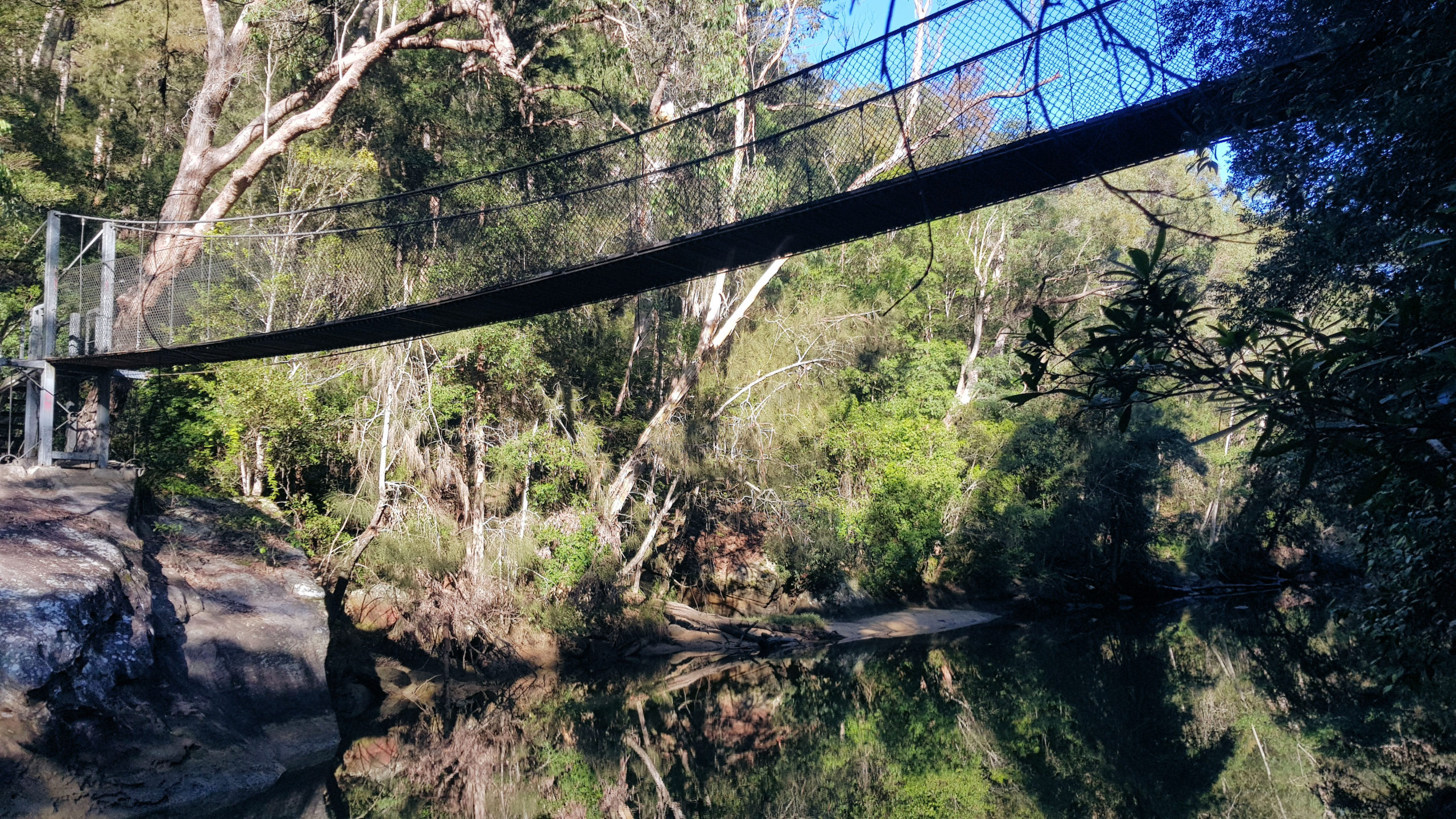
Phil Houghton Bridge

Piles Creek Loop Track

Located in Brisbane Water National Park, Piles Creek Loop Track is a grade 5 challenging walk threading through dry eucalypt forest along Piles Creek, passing waterfalls and crossing a suspension bridge. Managed by NSW National Parks and Wildlife Service, the track is in good condition, but the Grade 5 rating reflects unformed paths, steep climbs and limited direction signs.

Getting There

A one-hour drive north of Sydney on the M1 Pacific Motorway, take the Central Coast Highway exit, then:

  • Take the first left onto Wisemans Ferry Road
  • Then take the first left onto Old Pacific Highway
  • Take the first left onto Quarry Road
  • The picnic area, where the trail begins, is through the tunnel and straight ahead.

Be aware of the carpark’s closing time, as rangers lock the gates after hours.

Car Park

The carpark is small, and becomes full early, because the park is popular. Additional spaces are available on the road leading to the car park, although this means a longer walk. A ticket machine in the car park allows you to pay the entry fee on arrival.

Piles Creek Loop Track

Starting at the same spot as the Girrakool Loop Track, the Piles Creek track follows the creek to the south west. The walk takes you through eucalypt forest and past steep rock faces of the Piles Creek Gully. Spaced along the walk are fenced lookout, which enable to to admire the scenery in safety.

Several small creeks are crossed with bridges or walkways. In several places there are stepping stones, which are fun to use. The Rat Gully crossing uses steps cut into boulders in the creek, which need to be used with care to avoid slipping.

Although it hadn’t rained recently, several areas were muddy, including some steps, so we took things slowly to avoid slipping.

This four kilometer loop took us 3.5 hours to complete, which we really enjoyed because of the challenge and amazing scenery.

Signage and Directions

Generally well sign posted, several signs are ambiguous, so stay alert to your location. We found the track quite well defined, where others had used it, which made finding the right direction easy.

Phil Houghton Bridge

The Phil Houghton Bridge is a metal suspension bridge that crosses Piles Creek. It is part of the Great North Walk and replaces an older bridge, with parts still visible upstream. The bridge can hold up to 8 people and feels very stable. There are great views both up and downstream half way across this bridge.

At this point, there is an option to extend the walk to the Old Mooney Mooney Bridge, by following the Hawkesbury Track. This track will take you 2.2 kilometers along Piles Creek and then Mooney Mooney Creek to the old bridge. Alternatively, should you wish to do this section, it it accessible from the Pacific Highway, which makes the overall walk shorter.

We chose to take the return trip straight away by following the track back to the Girrakool car park.

Hawkesbury Track From the Old Mooney Mooney Bridge to Phil Houghton Bridge

This is only a small section of the Hawkesbury Track at 2.2 kilometers one way, making it an easy walk taking around an hour return.

Getting There

Located on the Pacific Highway, the Old Mooney Mooney Bridge has a small area nearby where cars can park. From here we walked over the bridge to look at the creek and surrounding eucalypt forest. We then walked down a track to the creek, where the structure of the bridge can be seen.

This section of the track can also be walked from the Phil Houghton Bridge if you are doing the Piles Creek Loop Track, adding 4.4 kilometers to that walk.

Old Mooney Mooney Bridge

Old Mooney Mooney Creek Bridge on the Old Pacific Highway is a steel truss bridge built in 1930. The bridge forms part of the Pacific Highway between Calga and Kariong near Gosford. The bridge also forms part of the Great North Walk which is a popular walking trail connecting Sydney and Newcastle.

There are great views of the creek from on top and under the bridge, as well as the interesting structure of the bridge itself.

The Hawkesbury Track

The track near the bridge is very easy to walk because it is flat and follows the creek. However, once it reaches Piles Creek and a marshy area, the track climbs up the gorge wall becoming steep in places. Passing through the eucalypt forest, it crosses several creeks, which have bridges are walkways over them.

The forest and views over the creek are amazing, with fern trees and mossy boulders to be found amongst the trees.

When you reach the Phil Houghton Bridge, you can continue on and complete the Piles Creek Loop Track, or return to the Old Mooney Mooney Bridge. Piles creek is a grade 5 four kilometer loop, that takes around three and a half to four hours to walk.

Hawkesbury Track
Track Down From the Pacific Highway
Mooney Mooney Creek
Mooney Mooney Creek
Hawkesbury Track Along Mooney Mooney Creek
Hawkesbury Track
Moss Covered Boulder on the Hawkesbury Track
Ferns
Ferns on the Hawkesbury Track
Trees
Trees on the Hawkesbury Track
Trees
Trees on the Hawkesbury Track
Ferns
Ferns on the Hawkesbury Track
Small Creek Crossing

What did We Think?

Kangaroo Valley New South Wales Australia
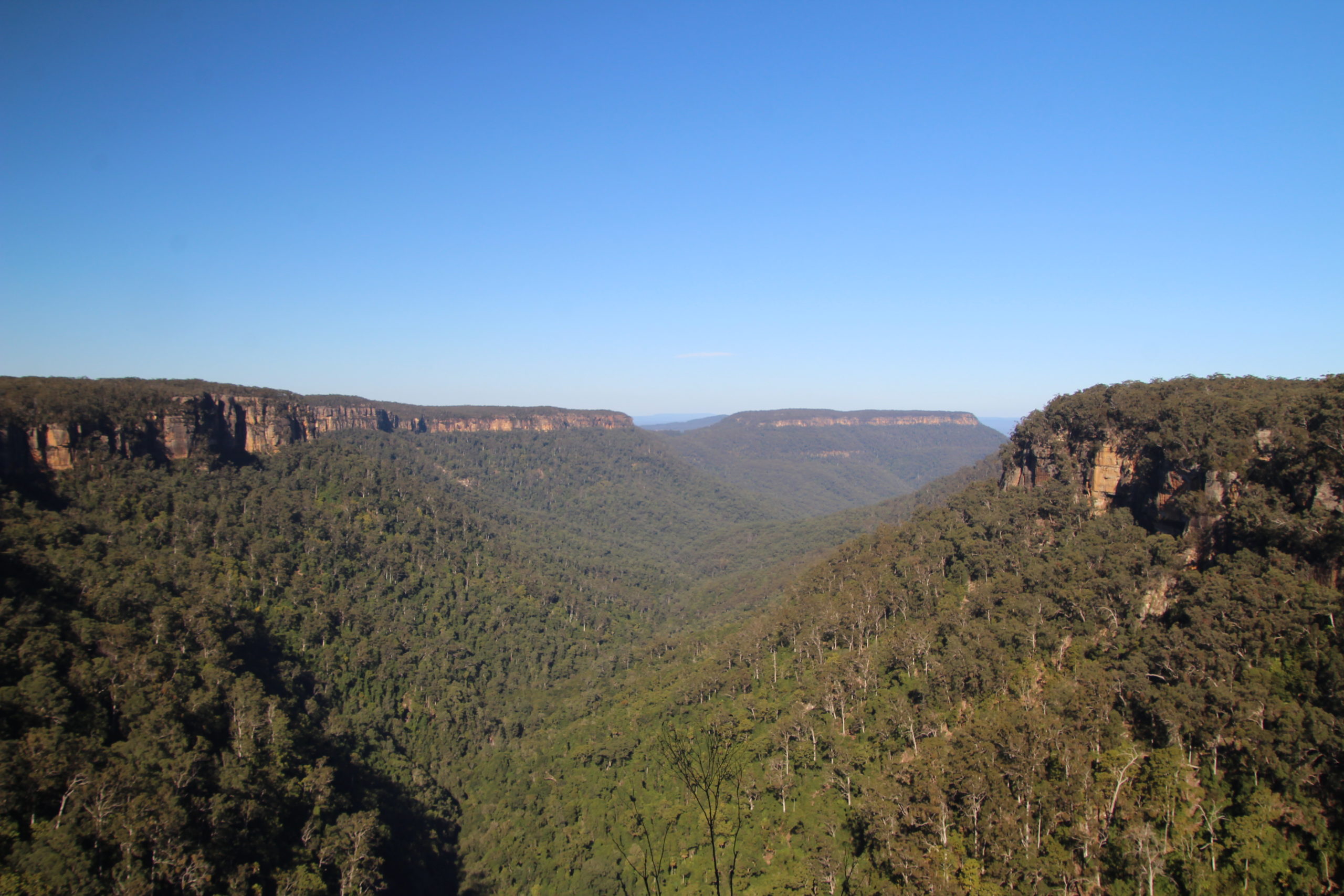
View of the Valley

Kangaroo Valley

Two hours from Sydney, or 30 minutes from Nowra (to Hampton Bridge in the middle of Kangaroo Valley), this is a great place to escape the big city. We stayed in Nowra and explored from there, but there are many closer places to stay, especially if you go camping. During our time we went bush walking, explored local history and admired the amazing scenery.

Hampden Bridge Kangaroo Valley

Built in 1898 to replace an older wooden structure, Hampden Bridge features four large crenellated turrets made of locally quarried sandstone. Named after Lord Hampden, Governor of New South Wales from 1895 to 1899, it is a tourist attraction in Kangaroo Valley, because of its distinctive appearance.

Parking is easy due to the on street and off street car parks at either end of the bridge. From the Nowra side of the bridge, a stairway descends to the Kangaroo River, to view the underside of the bridge.

Pioneer Village Museum Kangaroo Valley

Set in 8 hectares of bushland, the one hectares pioneer village contains building built like like those of the late nineteenth and early twentieth century. Displayed are a dairy, forge, school house, settler’s cottage, a Museum, war remembrance room and suspension bridge on one of the bush trails.

Cambewarra Mountain Lookout

Located at the top of Cambewarra Mountain, the lookout provides panoramic views out the the coast and at 678m above sea level gives you views from Coolangatta Mountain in the north all the way to Sussex Inlet in the south.

Around 20 minutes drive from Nowra, it is easy to get to, but the drive up the mountain is slow, with narrow, twisting roads in places.

Apart from the views, a cafe offers snacks and a lunch menu, with inside and outside seating, depending on the weather. On our visit, it was a great place to warm up after a cold morning start and relaxing by a warm fire was wonderful.

Tallowa Dam

Constructed across the Shoalhaven River, Tallowa Dam is popular with tourists and locals, because of water sports and picnic opportunities. For a relaxing day, the picnic area has a nice grassed area, while nearby, the water is easily accessible. Organised trips by local tour operators, provide the opportunity to kayak downstream.

The dam wall is not accessible, but a track leads to the downstream side, where you can view the wall and some infrastructure.

We were luck on our stop there to see some kangaroos that were relaxing in the picnic area.

Kangaroo at Tallowa Dam

Fitzroy Falls

One of the highlights to Kangaroo VAlley is a visit to Fitzroy Falls, not only for the waterfall’s 80m drop, but also the surrounding eucalypt forest and views over the gorges and valleys. Parking in the large car park and paying the park’s entry fee, we first stopped at the Visitor Centre. It contains loads of information about the local history, wildlife and birdwatching and walks. With wheelchair-accessible facilities and a short boardwalk to the scenic views of the waterfalls, you do not need to go bushwalking to enjoy yourself.

West Rim Walking Track

After a stop at the Visitor Centre, we started on the 3.5km return West Rim Track, which is graded at level three, being slightly undulating but very well maintained. Along the way we found more views of the falls, and amazing views over the valley.

After finishing the walk, we found that a mobile coffee van had setup shop in the car park. A great surprise after the walk.

Belmore Falls

Managed by NSW Parks and Wildlife, Belmore Falls Walking Track is well maintained and although graded 3, has a lot of steps. After parking the car and paying the entry fee we took around 45 minutes to walk the track. We stopped many time to look at the scenery, so if you don’t stop you may be quicker.

Arriving in the afternoon, the sun was in a bad position for photos. We would advise doing the walk in the morning for a better sun angle.

Belmore Falls
Belmore Falls

What Did We Think of Kangaroo Valley?

A great place to get away to for a few days or a week. During our visit, we only scratched the surface on what’s available here, as the number of walking tracks is huge. Highly recommended for anyone who like nature and the outdoors.

Our photos are available for purchase on

To see what else there is to do in New South Wales, please see some of our other stories.

Picton New South Wales

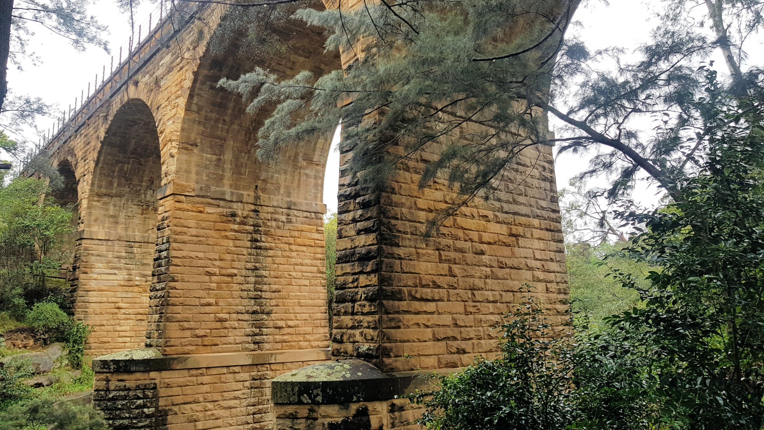
The Picton Viaduct

Picton New South Wales

Stopping at Picton on our way south to Jarvis Bay, we spent some time looking around town to break the driving and get a coffee. Picton’s Main Street contains several old and historic buildings which we stopped to take photos. There was also a variety of cafes and restaurants to choose from if you wanted something to eat and drink. There is plenty of parking.

Picton Viaduct

Not far from the Picton railway station is the viaduct, a huge sandstone bridge spanning a gully and small creek. Parking is limited as no dedicated car park is available, but we found parking in a side street.

There is a walkway down to the creek where you can cross to the other side of the viaduct from a different perspective.

The Picton Viaduct From Stonequarry Creek
The Viaduct From Stonequarry Creek
The Picton Viaduct
The Picton Viaduct

The Mushroom Tunnel at Picton

Another rail related attraction is a disused rail tunnel  that you can visit called the Mushroom Tunnel. We missed the entrance the first time as it is quite small. The dirt road into the tunnel can be rough so drive carefully. The tunnel itself is quite interesting,  having been repurposed from a train tunnel to a mushroom farm (hence its name) and now a tourist attraction. We drove though it in the car, then turned around and drove back before walking through it. Remember to take a torch.!

Mushroom Tunnel Piction New South Wales
Mushroom Tunnel

New South Wales Rail Museum Thirlmere

How to Get There

Only a 10-minute drive from Picton is the NSW Rail Museum Rail Museum. The museum houses the majority of Transport Heritage NSW large collection of historic locomotives and rolling stock. The importance of this collection means that it is well protected and mostly housed under cover as well as having a modern display hall containing the most important items.

Parking is on the road outside of the museum in marked parking bays. Entry is via the new building where the staff will give you a map of the museum and answer any questions you may have.

The Collection

The main building houses the historic E18 and E78 trains as well as the Governor’s train.

Oldest Loco E18 New South Wales Rail Museum Thirlmere
Oldest Loco E18
Locomotive E78 New South Wales Rail Museum Thirlmere
Locomotive E78

The majority of the collection is held outside under cover and away from the elements. This huge collection would take many hours to explore if you wanted to examine it all in detail. There are arrows painted on the walkways to make walking around the collection easier.

Old Carriages New South Wales Rail Museum Thirlmere
Old Carriages
Rail Pay Bus New South Wales Rail Museum Thirlmere
Rail Pay Bus
D55 Class Locomotive 5595 New South Wales Rail Museum Thirlmere
D55 Class Locomotive 5595

As well as the trains and rolling stock, there is other memorabilia at the museum.  As you walk around you will find old station clocks, time-table departure boars and baggage carts.

Old Departure Time Board New South Wales Rail Museum Thirlmere
Old Departure Time Board
New South Wales Rail Museum Thirlmere
Baggage Cart

Unfortunately the on site café was not open when we visited,  but there are options available just a few minutes walk away at the Thirlmere shops.

Train Photographs

More photographs fro the NSW Rail Museum can be found here.

Thirlmere Station

While at the New South Wales Rail Museum have a look at the Thirlmere station and station master’s house as they are well maintained and make some great photos.

Thirlmere Station New South Wales Rail Museum Thirlmere
Thirlmere Station
Boom Gates at Thirlmere New South Wales Rail Museum Thirlmere

The old boom gates where the road into Thirlmere crosses the rail tracks are also worth having a close look at.

To see what else there is to do in New South Wales, please see some of our other stories.

Our photos are available for purchase on