AdBlock Detected

It looks like you're using an ad-blocker!

Our team work realy hard to produce quality content on this website and we noticed you have ad-blocking enabled.

Cape Tourville Freycinet Tasmania

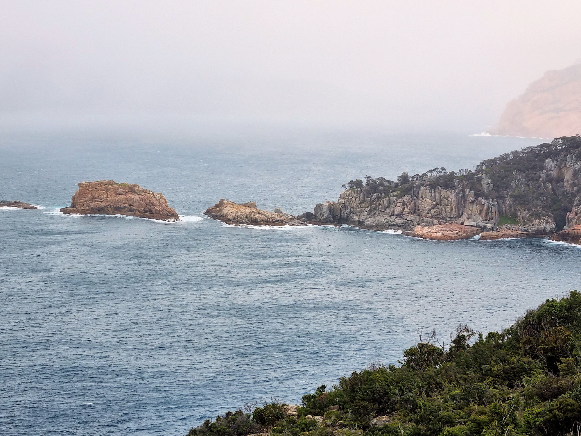
Looking Over Carp Bay From Cape Tourville

Cape Tourville Freycinet Peninsula Tasmania

Offering remarkable coastal views of Freycinet National Park and a well-constructed walkway, Cape Tourville is a great way for everyone to experience Freycinet. The well made track loops around the automated lighthouse, providing fantastic panoramic views.

The track is wide, with even surfaces and gently graded slopes. Much of the walk is on a raised boardwalk which, at times, takes you right to the cliff edge. Not only can you see the coastal cliffs, but also nearby offshore rocks known as The Nuggets.

Information boards along the track provide details of wildlife often seen here. This includes sea birds, sea-eagles, whales, seals, and dolphins, but will vary due to the time of year. During our visit, there was low cloud and scattered showers, so we were not able to see any. Instead, we took in the views which were stunning and looked great because the low clouds added amazing character to the scenes.

Markings on the board walk measure out the length of whales and dolphins, which really puts their huge size into perspective.

Cape Tourville Lighthouse

The climb up to the lighthouse is over gravel, or you can take some steps half way along the walk. The lighthouse is automatic , so you are unable to enter. From this height you get slightly different views than from the track.

Cape Tourville Lighthouse

What Did We Think?

This was a very easy 600m loop, which we loved because of the amazing views, but would be very exposed on a wet and windy day.

To read other posts about Tasmania, click here.

Our photos are available for purchase on

Cape Baily Track Kamay Botany Bay

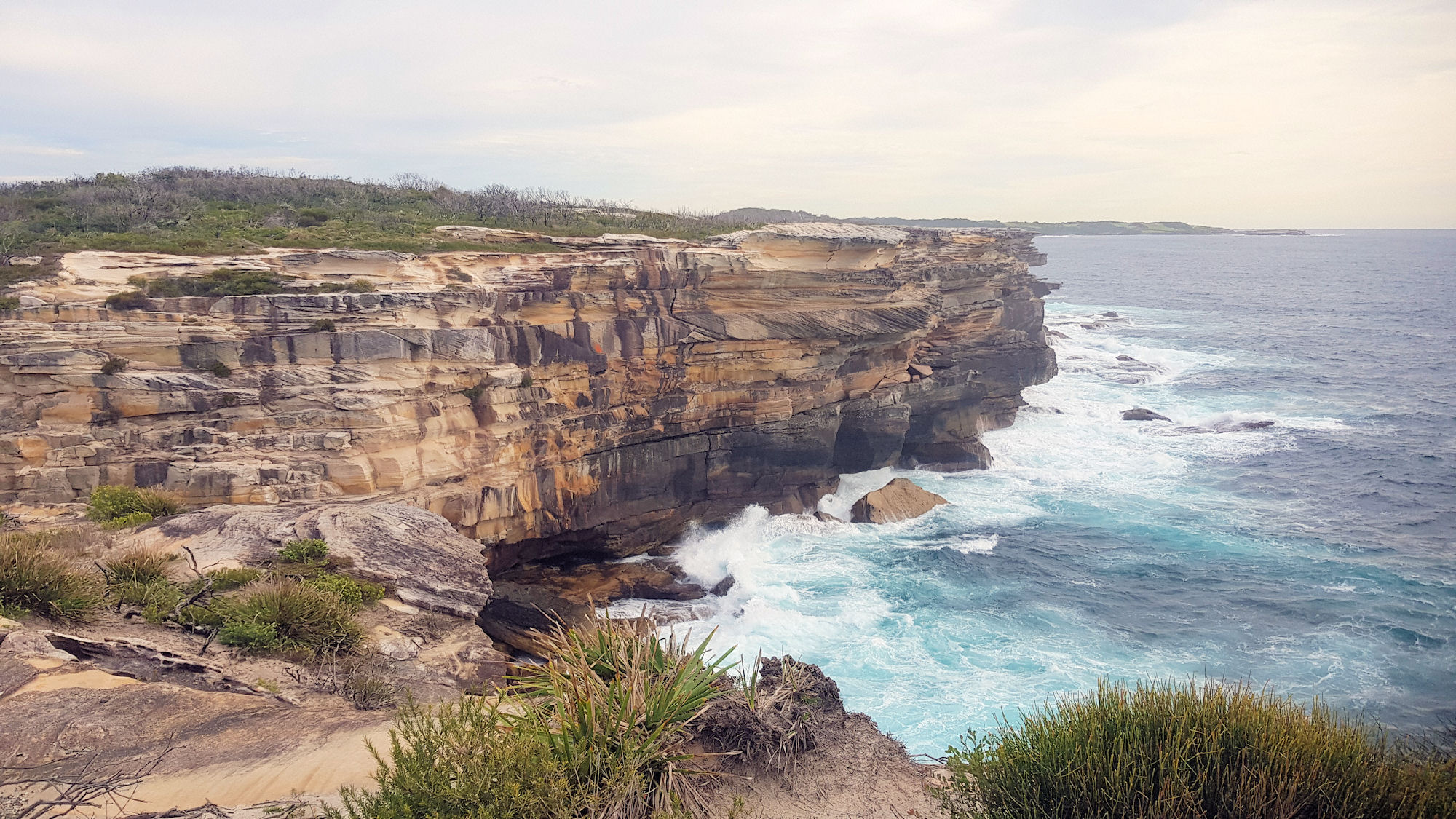
Sea Cliffs and Waves Cape Baily Track

Cape Baily Track Kamay Bay National Park

Getting There

Located in Kamay Botany Bay National Park, the Cape Baily Track winds along coastal cliffs with amazing ocean views. The track starts at the end of the park’s road, past Cape Solander. A car park next to a helicopter landing pad provides easy access to the start of the walk.

The Cliff Under the Car Park

Cape Baily Track

The track is well maintained and in many places is a formed board walk, which makes the hike easier than walking over rough terrain. As we walked, the surroundings changed from coastal scrub to bare sandstone rock. Several areas had steps, but these were in excellent condition and easy to climb and descend.

At 4 km each way and often exposed to strong winds and heat in summer, remember to take plenty of water and sunscreen. There are no facilities on the track, so take what you need for the walk, which takes around 2.5 hours.

Ocean Views

The amazing sandstone cliffs which line the ocean side of the walk are beautiful. Lookouts along the walk provide great vantage points to see them, but obey the signs and don’t go near the edge.

We might be biased, because we’re local, but in our opinion they are far better than the Cliffs of Moher in Ireland. Not only are they high with vertical drops to the ocean, but they are not as crowded and more scenic.

Tabbigai Cliff Dwellers

Fishermen built dwellings on some of the cliffs and lived there from 1920 until the 1960s. As can be seen in the photo from that time they were precariously perched on the cliffs, although some were quite extensive. We had not heard of these buildings before the walk and found out about them from the information boards on the trail.

The Department Of Lands ordered their eviction and removal of structures in the 1960s.

Cape Baily Lighthouse

At the end of the track the Cape Bailey Lighthouse sits high on the cliff, warning ships of the rocks. It isn’t a particularly interesting building, being plain and functional. There are many more lighthouses of note around Sydney, such as Macquarie and Hornby Lighthouses. We didn’t do the hike for the lighthouse but for the scenery, so we’re not disappointed.

Norah Head Lighthouse and Beaches

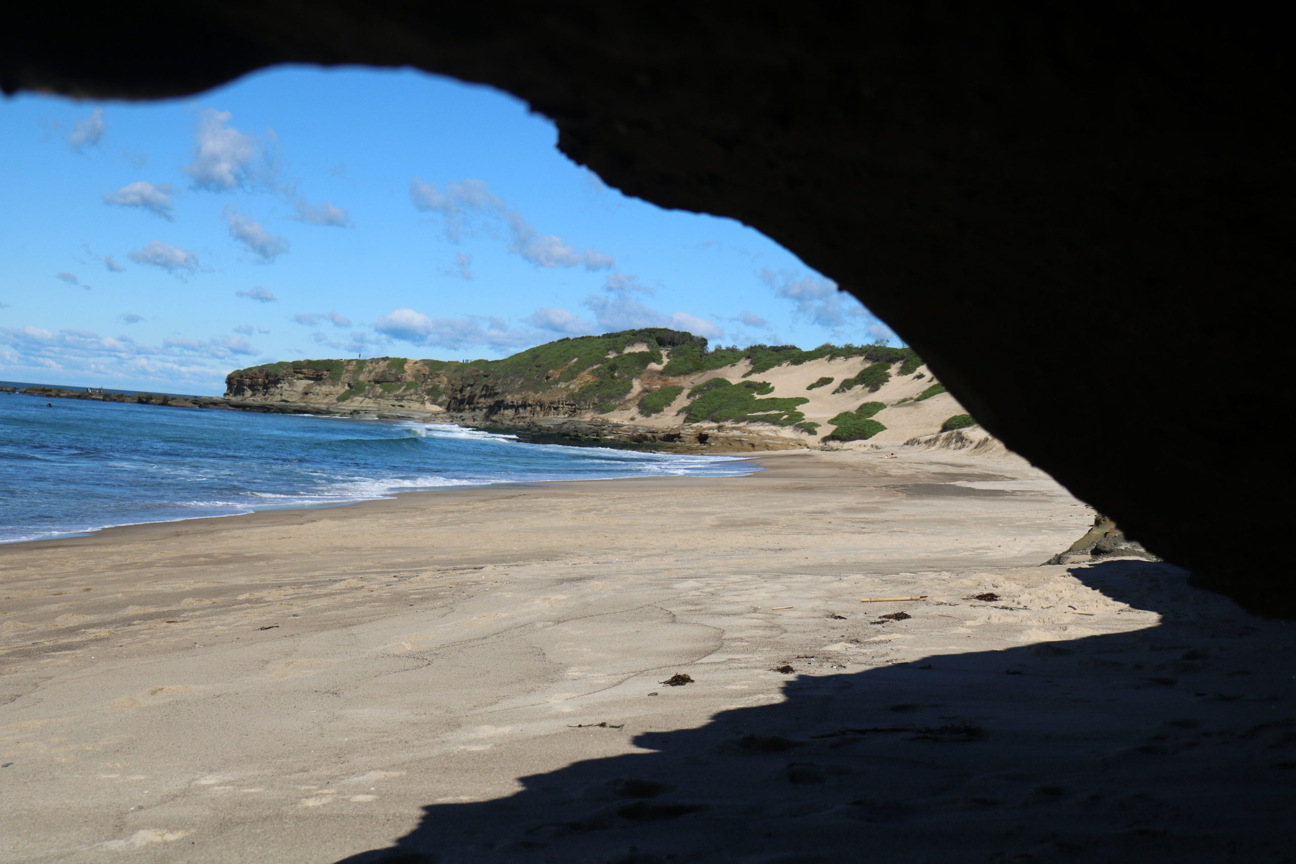
Looking Towards Soldiers Point and Pebbly Beach

Norah Head

Norah Head is home to beautiful beaches and a historic lighthouse, as well as the Merchant Mariners’ Memorial, making it a great place to visit.

Merchant Mariners’ Memorial

The memorial commemorates merchant mariners who have died in service or have been killed in action in times of conflict. Located in a beautiful setting overlooking the ocean, the main memorial is surrounded by plaques commemorating ships lost locally.

Norah Head Lighthouse

Norah Head Light is an active lighthouse located at Norah Head, a headland on the Central Coast, New South Wales, Australia, close to Toukley. It is the last lighthouse of the James Barnet style to be built, and the last staffed lighthouse constructed in New South Wales.

Officially displayed for the first time in 1903, the original vaporized kerosene burner was upgraded in 1923, electrified in 1961 and automated and de-manned in 1994, after more than 90 years of being staffed. It celebrated its centenary in 2003.

The concrete block tower is 27.5 metres (90 ft) high, topped by a bluestone gallery. On top of the gallery is the original Chance Bros. lantern. This lantern holds the original housing of the Chance Bros. 1st order bivalve dioptric Fresnel lens.

Tours of the lighthouse are not currently available, however these may resume in the future, so you should check to see if they are running.

Norah Head Lighthouse

Norah Head Beaches

From the lighthouse, steps lead down to the rock platform and beach, making access easy. However, because of the uneven rock surface, the area is not suitable for prams and wheelchairs. Popular for fishing, the rock platform also offers some interesting geological formations to look at. Weathering has left some interesting patterns on rocks and the waves have cut channels in the platform.

Following the shoreline south, you will find a nice sandy beach. However, to get there means climbing over some rocks, which we enjoyed, but others may not, as they are slippery, high and uneven. If the tide is fully out you maybe able to access the beach to get around them. At the edge of the beach are several small caves which were fun to sit in and watch the surf crashing on the beach.

Further along the coast is Pebbly Beach, which has another rock platform and great views over the ocean.

Soldiers Beach

Located south of Pebbly Beach and the lighthouse, Soldiers Beach is a popular swimming spot. Easy access from the carpark means that more people visit here than the beaches to the north of Soldiers Point.

In addition to the excellent beach, walk over the point itself at low tide, there are some great rock pools to explore. A kiosk at the carpark serves snacks and drinks, which is great on a hot day.

The amenities block has a beautiful whale painting on it, turning an otherwise boring building into something beautiful.

Food and Drinks

If the cafe at the lighthouse is not open, another great option is the General Store on Bush street. It has plenty of parking nearby and seating available outside, so that you can enjoy the relaxed surroundings.