Category: Bushwalking

  • Arboretum and Bellbird Tracks in Strickland Forest

    Arboretum and Bellbird Tracks in Strickland Forest

    Strickland State Forest

    Two great walks located in the Strickland State Forest are the Arboretum and Bellbird Tracks. Located on the Central Coast of NSW, less than an hour’s drive north of Sydney, south of Newcastle, or a 10-minute drive west of Gosford, Strickland State Forest is a great place to visit.

    The forest is only five square kilometres but contains an impressive variety of flora and fauna species, along with extensive walking tracks. These wander through varying forest types, past waterfalls, under cabbage tree palms and along creeks.

    The forest has excellent picnic facilities including an all-weather shelter, picnic tables and toilets located at the Banksia Picnic Area

    Arboretum Loop Track

    Located at the end of the Strickland Forest Road, the car park for the Arboretum Loop Track is well maintained but has no facilities. You will find these at the Banksia Picnic Area, which you pass on your way in.

    From the car park, walk down the trail to Stoney Creek, which has rocks laid out as steppingstones. On our visit, the creek was running high, because of rain and many rocks were under water and slippery. We took our time crossing to make sure we didn’t slip.

    The trail then winds through forest, while staying close to the creek. On reaching Narara Creek, you will find a suspension bridge, which make the creek crossing easy, safe and, fun.

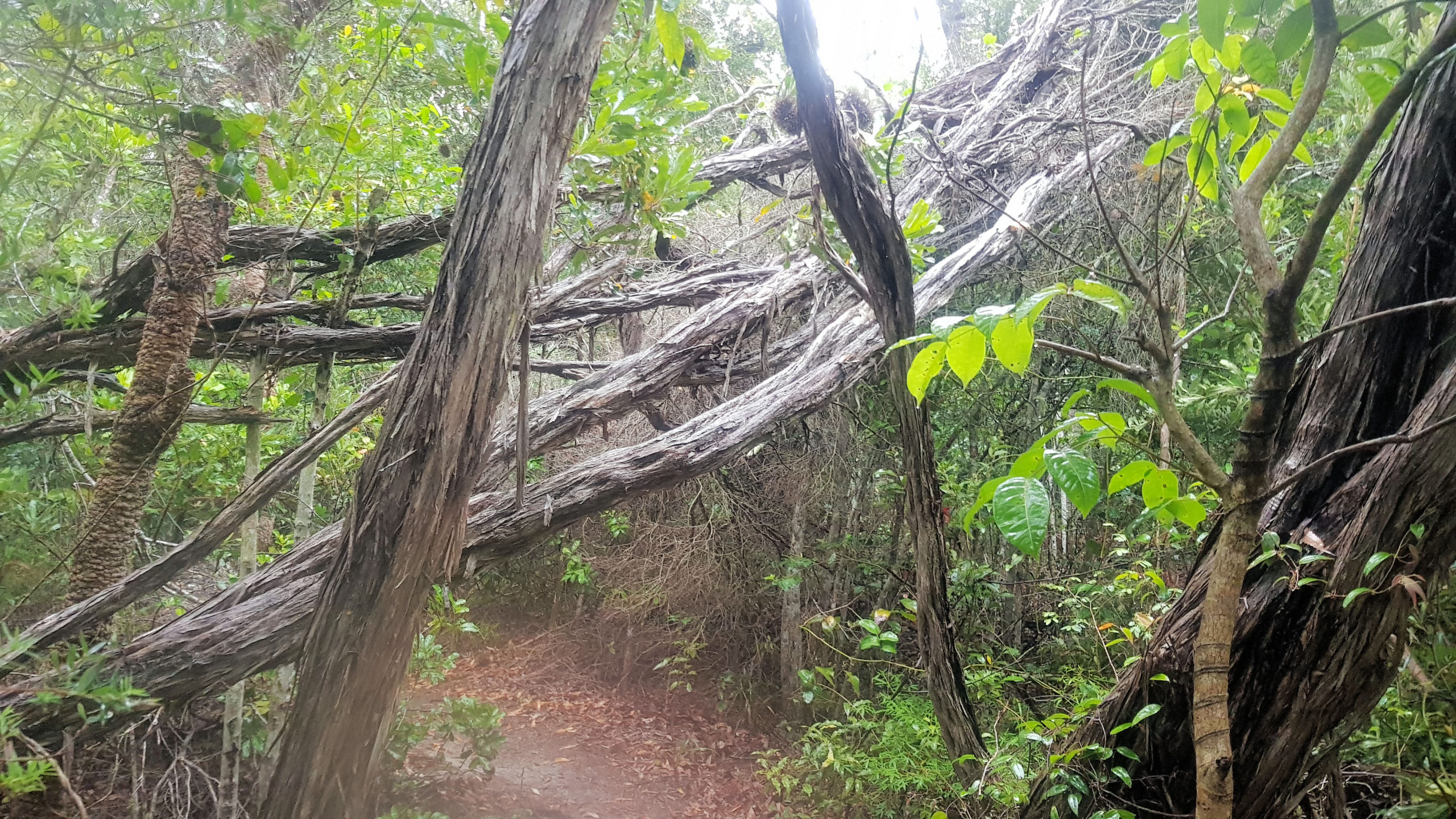
    Continuing along the trail you will come across a sign to the Arboretum Loop. This area is great to walk through as much of it was planted over 100 years ago making the trees large and mature. Many of the tree are have signs to show their species, which adds to the interest of the walk. At two points large trees have fallen over the creek, forming natural bridges, although they are covered in moss and slippery.

    Bellbird Track

    Located not far from the Arboretum Track, the Bellbird Track starts at a well-made signpost, making it easy to find. From here it winds through fern filled forest, before reaching a creek crossing. The creek was running high because of recent rain, which made the crossing difficult. Usually, the concrete steps are easy to use, but these were under water.

    We found leaches on our legs after the crossing, which we quickly removed. Leaches are common in the area, particularly after rain, so be prepared for them.

    Things to be Aware Of

    Falling Pinecones

    Signs at the car park warn of falling pinecones in some seasons, so be aware of this.

    Creek Crossings

    Depending on the tracks you take, several creek crossings may be required. After heavy rain the water will be higher and the rocks in the water may be slippery when standing on them to cross the river, so be careful.

    Leaches

    Leaches live around the creeks and in the wet undergrowth, especially after rain when they are very active. Assume that you will be bitten by them and come prepared with salt and anti-leech sprays as well as decent boots.

    What Did We Think?

    Apart from the leaches and the slippery creek crossings, we had a great time. It was wet and raining, but this added to the atmosphere in the forest, with everything being wet and damp.

  • Munibung Hill Lake Macquarie

    Munibung Hill Lake Macquarie

    Munibung Hill Lake Macquarie

    Located in Lake Macquarie, Munibung Hill provides amazing views over the Lake and nearby suburbs, making it a great place to visit. There are several possibilities for the meaning of the name, being either fruit, or the meeting of the tribes.

    There are several ways to reach the top, with the area having many trails, but we chose to start from Lawson Rd and walk to Lucilla Ridge where one track starts. This walk is along a dirt track, that has become badly eroded and slippery in places, so wear good walking shoes. Although some places are steep, they are also short, so take your time, it’s only a 500m walk to the top.

    From the ridgeline, the views are wonderful, because the elevations allows you to see over Lake Macquarie. You are also able to look over the surrounding suburbs and remnant bushland.

    A fence along the track prevents access to an old industrial site previously used as a smelter. Remediation works have been undertaken to remove the lead contamination the area, but access it still prohibited.

    Unfortunately, despite the cultural heritage in the area (aboriginal and European), no signage or information boards are located here. Remember to bring water with you and wear sunscreen, as there little shade and in summer it can be very hot.

    This is a fun, short walk which gives you great views over the area.

    To see what else there is to do in the Hunter Valley, please see some of our other stories.

    Our photos are available for purchase on

  • Terrigal on the Central Coast

    Terrigal on the Central Coast

    Terrigal

    Located on the Central Coast of New South Wales, Terrigal is a coastal town situated halfway between Sydney and Newcastle (90 minutes from both). Public transport connects via the train to Gosford and a connecting bus to Terrigal.

    We parked near the skillion, because it allowed easy access to the places we wanted to see.

    The Skillion

    Overlooking Terrigal and the surrounding coastline, the Skillion provides amazing views of the surrounding coastline and town. A walkway runs up the left side, making access easy, or you can walk on the grassed surface. At the top, a fenced lookout provides a safe place for viewing, because the nearby cliff is very high.

    At the base of the Skillion is a rock platform where the waves constantly splash and look amazing. Signs warn of the danger of walking in the area, not only from the waves, but from rocks falling off the cliff. A great way to see the rock platform is from Kurrawyba Lookout, which is safe and also gives a good view.

    Kurrawyba Lookout

    Situated on the headland opposite the Skillion, Kurrawyba Lookout is an easy five minute walk from the car park. This is the best place to get a safe view of the Skillion and the rock platform, because the platform itself is subject to falling rocks.

    Terrigal Boat Harbour

    We bought a coffee at the Cove Cafe and sat on a bench in the park next door, watching the boats in the harbour and a group of swimmers while we drank it. It was very relaxing, as everyone else there was relaxing and enjoying the morning as well.

    On our walk around the area, we noticed a lot of pelicans, including some on the powerpoles, watching everyone else.

    Terrigal Lagoon and Beach

    The Terrigal Lagoon, is a safe place where families can enjoy the day near the water. Protected from the surf, this tidal area had people paddle boarding, swimming, or just relaxing.

    At the end of the lagoon, was an interesting sculpture, adding to the interest in the area.

    Past the lagoon is the magnificent sandy Terrigal Beach. The beach is patrolled every day from October long weekend until the end of the April school holiday break, but remember to swim between the flags.