Category: National Park

  • Sawn Rocks  Mount Kaputar National Park
    Sawn Rocks Mount Kaputar National Park

    Sawn Rocks Mount Kaputar National Park

    Getting There

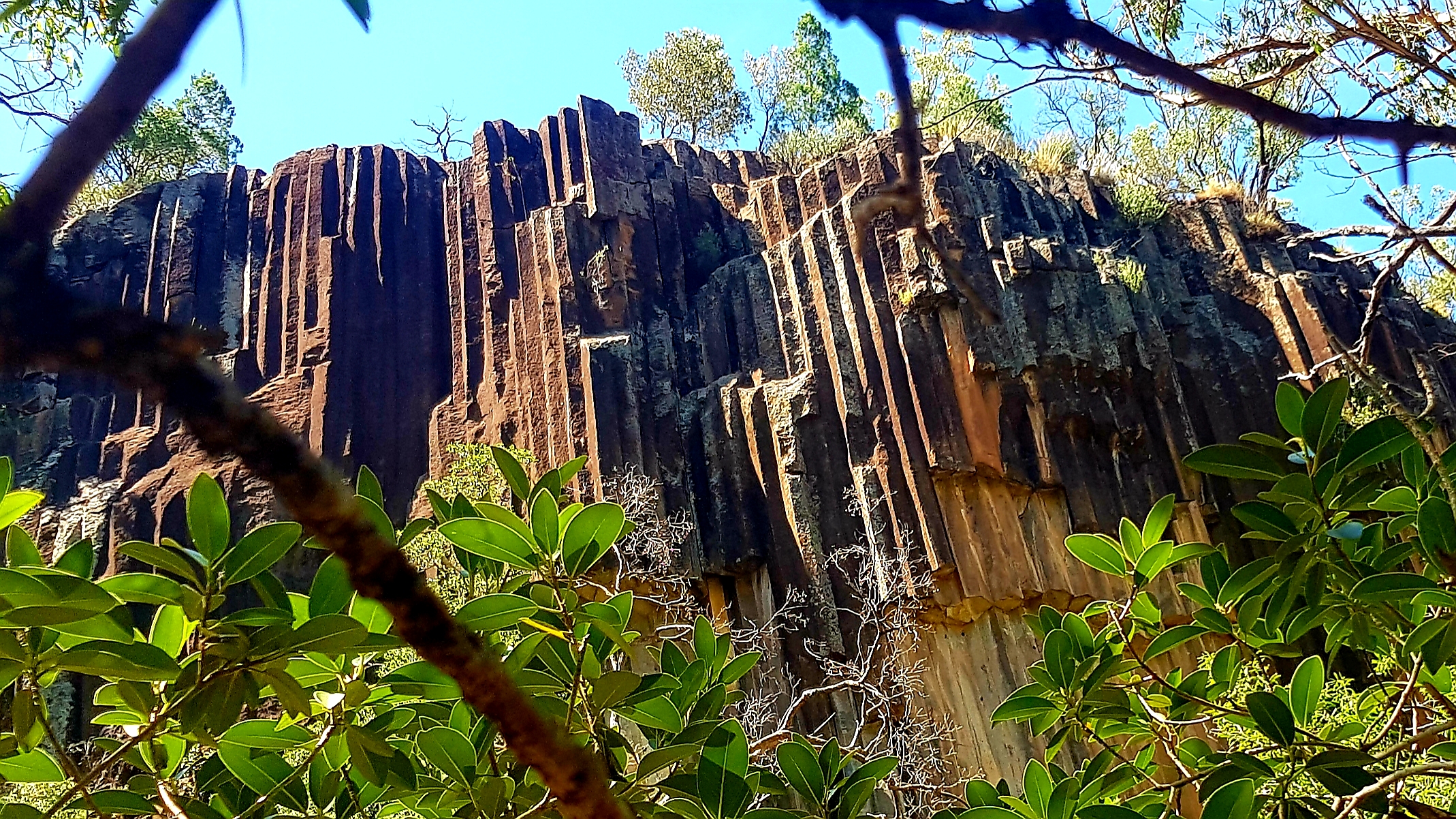
    Located around 40 km north east of Narrabri, Sawn Rocks is a geological formation of columnar basalt which resembles organ pipes. As part of the Mount Kaputar National Park, the area is managed by NSW National Parks and Wildlife Service, which ensures it is managed correctly.

    The road from Narrabri is fully sealed and was in very good condition when we visited.

    Car Park

    Designed for travellers, the car park has lots of space, so there is room for caravans to easily park. For somewhere so far from a town, the facilities are excellent, making it a great place to stop and relax. Next to the car park is a composting toilet. On the opposite side is a picnic area with sunshades and gas barbecues, which were in excellent condition.

    There is a series of information boards explaining the formation of Sawn Rocks, as well as other things to do in the area.

    Walking Track

    The track from the car park to the viewing area only takes around 15 minutes to walk, but remember to take water. Winding through the bush, it is either paved with bitumen, or is a metal walkway, which makes the walk easy.

    Sawn Rocks Viewing Platform

    On reaching the viewing platform you look directly at the cliff face which is perfect for taking photos.

    Creek Bed

    A short walk down from the viewing platform gets you to the creek bed. There is a path cut into the rocks to form a stairway, makes for and easy descent. The base of the cliff is littered with fallen boulders, so be careful of you footing and wear good walking shoes.

    You get a different perspective of the formation from here because you can look up at the cliff. Even the boulders on the ground are interesting, as they show the piping of the rocks and how they have a cross sectional polygon.

    This was a great place to visit, with an easy well maintained track, amazing views and great facilities.

  • Wyrrabalong National Park

    Wyrrabalong National Park

    Wyrrabalong National Park

    Getting There and Parking

    Located on the Central Coast Highway near Norah Head, Wyrrabalong National Park is an hours drive south of Newcastle. We parked in a small car park just past the Pelican Beach Road turn-off, which was small, but well maintained. Signs and an information board provide information about the park and its tacks.

    Lilli Pilli Loop Track

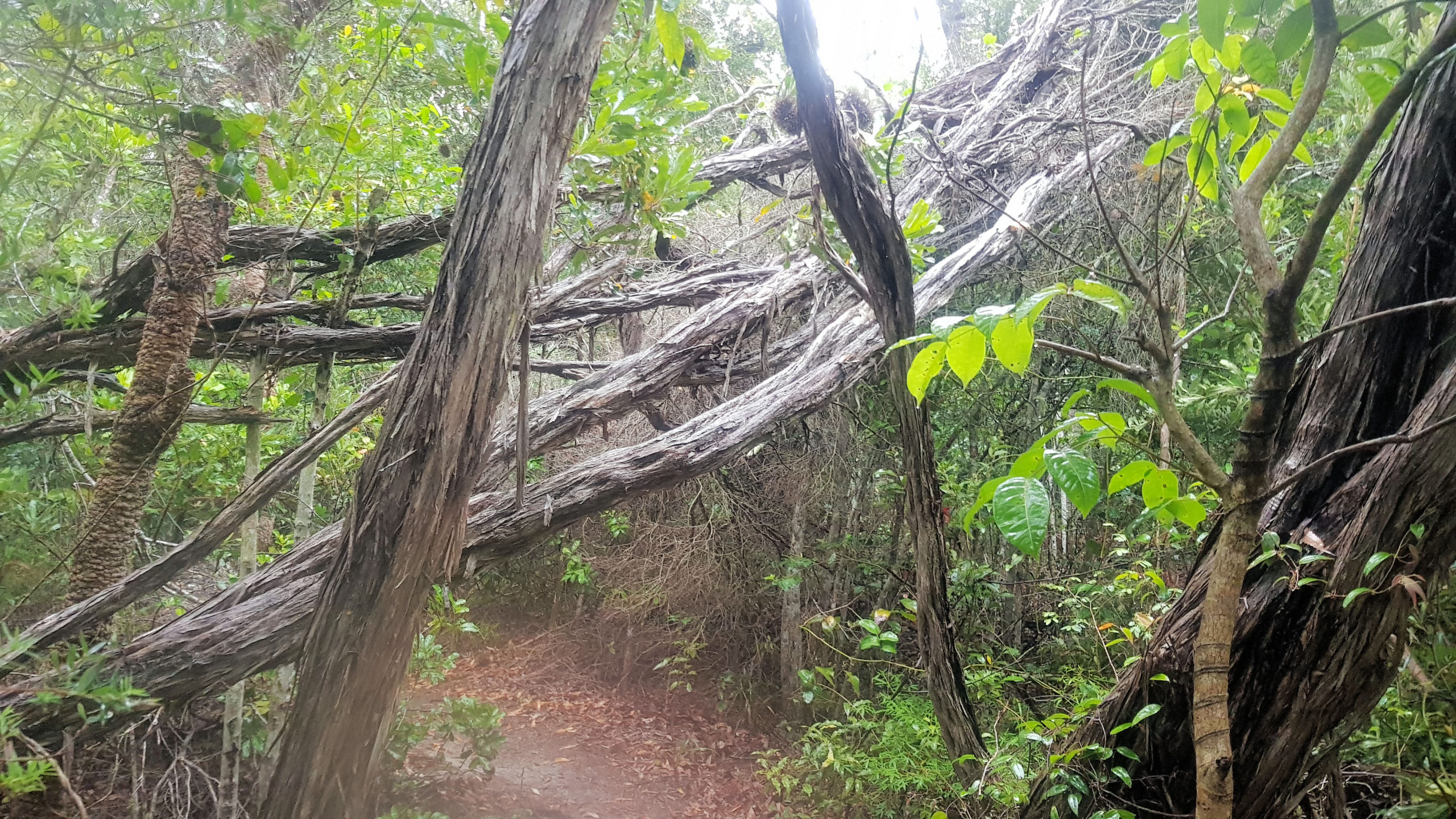
    The day we visited was wet and overcast, but this added to the fun of the walk, making the trails very atmospheric. The Lilli Pilli Loop Trail meanders through coastal rain forest along narrow bush tracks. The tracks are often made of sand, but have been reinforced with wooden boards to prevent erosion of this fragile environment.

    This is one of the few remaining intact areas of rainforest on the Central Coast, which makes it a very special place. An information board on the lake side of the track details the forest and its wildlife.

    The damp conditions encouraged mushroom to grow on dead trees which let us see some beautiful ones as we walked by.

    Red Gum Loop Track

    The Lilli Pilli Loop Track joins the Red Gum Loop, at this point you can either return to your car or continue on. We chose to walk the new track, because the vegetation changes to red gum forest, from the rainforest we had just walked through.

    The path down to the track is steep, but reinforce with sturdy wooden sleepers, making it safe to walk down. This also prevents erosion of the sand dune, so is environmentally safe too.

    The forest in this area is more open with less undergrowth, making views of Tuggerah Lake possible in places. Lookouts have been built in places where the views are best, but it was overcast during our visit, so the lake was not visible. On a clear day, the view would be great.

    What Did We Think of Wyrrabalong National Park?

    Both of the loop tracks in the Wyrrabalong National Park were fun to do, because of the different vegetation. We were also pleased we did it while it was wet and damp, as this added to the fun and the environment we passed through.

  • Strickland State Forest is Unique and Wonderful

    Strickland State Forest is Unique and Wonderful

    Strickland State Forest

    Located on the Central Coast of NSW, less than an hour’s drive north of Sydney, south of Newcastle, or a 10-minute drive west of Gosford, Strickland State Forest is a great place to visit.

    The forest is only five square kilometres but contains an impressive variety of flora and fauna species, along with extensive walking tracks. These wander through varying forest types, past waterfalls, under cabbage tree palms and along creeks.

    The forest has excellent picnic facilities including an all-weather shelter, picnic tables and toilets.

    Banksia Picnic Area

    We parked at the Banksia Picnic Area, as it was close to the walk we wanted to do, as well as having toilets and picnic facilities. There is also an information board showing the walks available, which is great if you are not sure what you want to do. The walks are clearly sign posted and easy to follow.

    Strickland Falls Trail

    We chose the Strickland Falls Trail for this visit, because it passes through cool forest areas, full of ferns and passes a waterfall. The trail is well sign posted and generally easy to walk, although it does have steps in many places. The return trail was far easier and passed through tall eucalypts on the ridge.

    Lower Trail

    The trail towards the waterfall led downhill through a valley where we were surrounded by ferns and trees. On a hot day it felt nice a cool, making us appreciate it even more. The track varied from steps made of stones to flat dirt tracks. On most of the trail, we were surrounded by the plants and trees that the forest is famous for.

    Strickland Waterfall

    The weather had been very dry prior to our visit, so the waterfall was little more than a trickle, but the surrounding area was wet and damp, giving it a wonderful atmosphere. Although we didn’t see the waterfall at its best, it was still a great place to stop and look around.

    From here, the track leads up to the ridge and dry forest above.

    Upper Return Trail

    The return trail starts with steps leading up from the waterfall, but once you have climbed to the top, most of the remaining track is flat. It passes through dry eucalypt forest, where you can also see Gymea lilies. These were in bloom when we went in spring, with their two to three metre flower stems and bright red flowers making a great display.

    The return trail ends near the Banksia Picnic Area, which was near where we had parked.

    What Did We Think of the Strickland State Forest?

    We loved the Strickland Falls Trail because it wandered through different forest types and was fun to walk. We will be going back to do some of the other walks in the future.