AdBlock Detected

It looks like you're using an ad-blocker!

Our team work realy hard to produce quality content on this website and we noticed you have ad-blocking enabled.

Ku-ring-gai Chase National Park West Head Beach
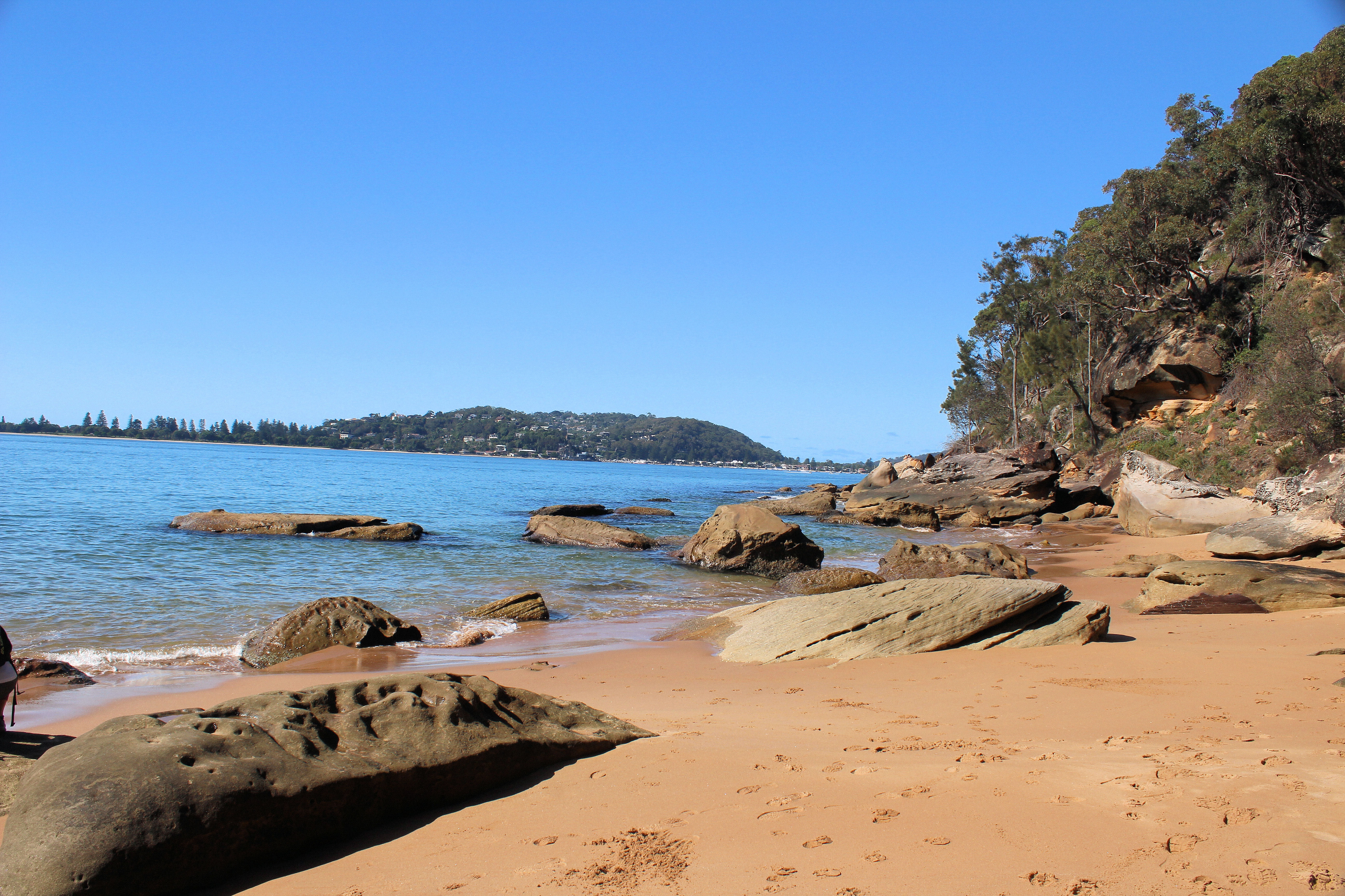
West Head Beach Ku-ring-gai Chase National Park

Ku-ring-gai Chase National Park

The West Head area of Ku-ring-gai Chase National Park has some wonderful bush walks with fantastic views over the surrounding waterways.

Driving into the park you get to see lots of natural scenery, whilst on a good sealed road. The road has a lot of hills – with poor visibility at times, this mainly refers to the huge amount of cyclists (there were groups and dozens of single riders on the road).  We had to  drive slowly as it was not always safe to pass then.

We chose to do the Red Hands Track and Resolute Track to West Head Beach. There is plenty of parking available in a well sign posted car park. For us the first track was a little disappointing, with uninspiring bush land and badly damaged aboriginal hand stencils. The second walk however made  up for it, being a challenging  grade 4 walk. We liked it because is provided a different challenge to the ordinary tracks,with more unpredictable laid out paths and natural rock formations that we needed to navigate to continue on the walk. At the same time it was still easy to find your way through. At the beginning of the tracks, there are maps with details of each walk. On the tracks, you will be rewarded with an amazing views, beaches, wildlife, and Australian bush scenery.

Red Hands Ku-ring-gai Chase National Park
Red Hands

West Head Lookout

The walk commenced at the West Head Lookout, which has great views.  Take a look at the picture below! We spent some time here enjoying the views over Broken Bay before, planning our walk on the Resolute Track.

View From West Head Lookout Ku-ring-gai Chase National Park
View From West Head Lookout

Resolute Track to West Head Beach

The Resolute Track took us through great bush scenery, climbing over rocks, enjoying varied stops to look out at the different views as we descended to the bottom towards West Head Beach. The track continues past the beach, but we turned here to walk down and enjoy all this little beach offered. 
The steps down and back up are steep, but the reward is a lovely little remote beach, with scenic inlet views and yacht watching.  If the weather is good, you could take your bathers and have a swim.  The walk is very hilly so wear good waking shoes, to protect your feet.  You can take your shoes off to walk in the water.

Walking around the beach we found some amazing weathered rocks looking like honeycombs as well as some great views over the water. We were the only ones there on our visit,  We sat on the rocks and had a bite to eat, it was very peaceful.

The return walk to the lookout was very steep, but we stopped regularly to enjoy the natural surroundings and take some photos.

The Resolute Track and West Head Beach were beautiful and we really enjoyed the opportunity to spend the morning walking, savouring the great scenery and the amazing  views in Ku-ring-gai Chase National Park.

To see what else there is to do in New South Wales, please see some of our other stories.

Bradleys Head

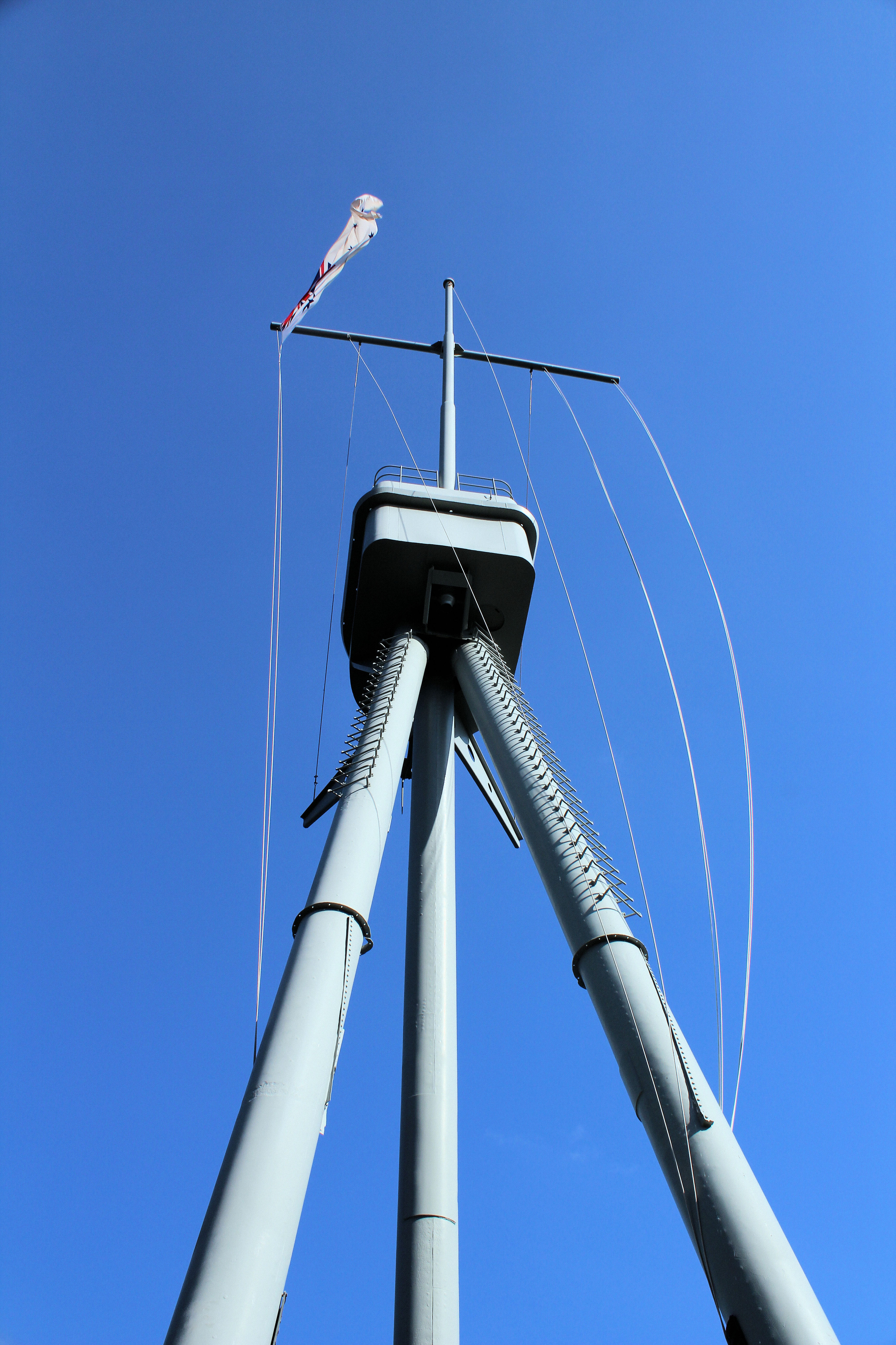
HMAS Sydney (I) Mast Bradleys Head

Bradleys Head

Many people using Sydney Ferries will have past Bradleys Head with its mast from HMAS Sydney, but many will not know its significance. This small headland holds memorials to the Royal Australian Navy ships lost during wartime.  The RAN considers this location the pre-eminent naval memorial in Australia.

HMAS Sydney Mast and Associated Memorials

The most striking feature on the headland is the mast of HMAS Sydney (I), because it stands tall above its surroundings. It commemorates all who served on the four ships named Sydney and forms the focal point for the other memorials. Walking around the gardens you come across memorials to individual ships, from the first submarine AE1 to HMAS Canberra.

Doric Column

Sitting off the headland is a Doric stone column in the waters of the harbour. It is from the demolished Sydney Post Office and in conjunction with the tower off Fort Denison, it was used for speed trials of vessels in Sydney Harbour. No longer used for this purpose, it is an interesting sight.

Bradleys Head Light

The Bradleys Head Light, completed in 1905, is located on the point of Bradley’s Head Peninsula. Used as a navigation marker and warning light, it also makes for a great photograph. The lighthouse is mounted on a rock and connected to shore by a footbridge.

Access to Bradleys Head is past the Taronga Park Zoo and down a narrow windy road. On the way down, you will pass the Rifle Wall, part of the old fortifications built to defend Sydney. Although probably not as interesting as the naval memorials, it is still historically important and worth stopping at.

A great little stop for a wander around, either before or after the zoo if you are interested.  Or you could add it to a visit to Middle Head and its fortifications.

To see what else there is to do in New South Wales, please see some of our other stories.

Dunns Swamp Wollemi National Park

Dunns Swamp Wollemi National Park

Dunns Swamp

Dunns Swamp in the  Wollemi National Park is a beautiful lake rather than a swamp and is a great place to camp, bush walk or go swimming. Located only 30 minutes from Kandos, it is a great getaway for a day trip or overnight stay. Created by the Kandos Weir, the lake is full of bird life and surrounded by reeds and trees, making it a really beautiful place.

Campsites are available for overnight stays as well as plenty of day visitor parking. The camp site has covered eating areas and toilets available for use.

Pagoda Lookout

As well as the lake, bush walking is available around the area. We chose to walk to the long cave, while looking at the Kandos Weir and pagoda lookout on the way. The turn off to pagoda lookout is about 1km from the camp ground. This short 150m Walk is marked for experienced bush walkers only, so be careful if you decide to do it. The difficulty is because of the steep rock faces, narrow paths and lack of barriers at the cliff faces. The view from the top is great and you are able to see some of the weathered rock formations that look like pagoda temples.

Kandos Weir

The walk then continues along the Cudgegong River, which gives you some excellent views of the surrounding bush land. Several sections of steep stairways need to be negotiated, with two sections also having handrails and chains to assist going up and down. The Kandos Weir is a concrete dam wall and spillway. Unfortunately access onto the dam wall is prohibited, but you can walk to the base of the downstream face of the dam. From here it is possible to take some great pictures,

Long Cave

The long cave is only a few hundred metres from the weir, along a flat access road. The cave is really a rock overhang that has the base eroded by the river when it floods. So don’t expect to see a cave. It is still an interesting spot to investigate and take pictures.

Dunns Swamp is a great place to visit either for a day trip or a camping expedition. There are other walks in the area besides those we did that would keep you entertained.

To see what else there is to do in New South Wales, please see some of our other stories.