AdBlock Detected

It looks like you're using an ad-blocker!

Our team work realy hard to produce quality content on this website and we noticed you have ad-blocking enabled.

Echo Point Blue Mountains

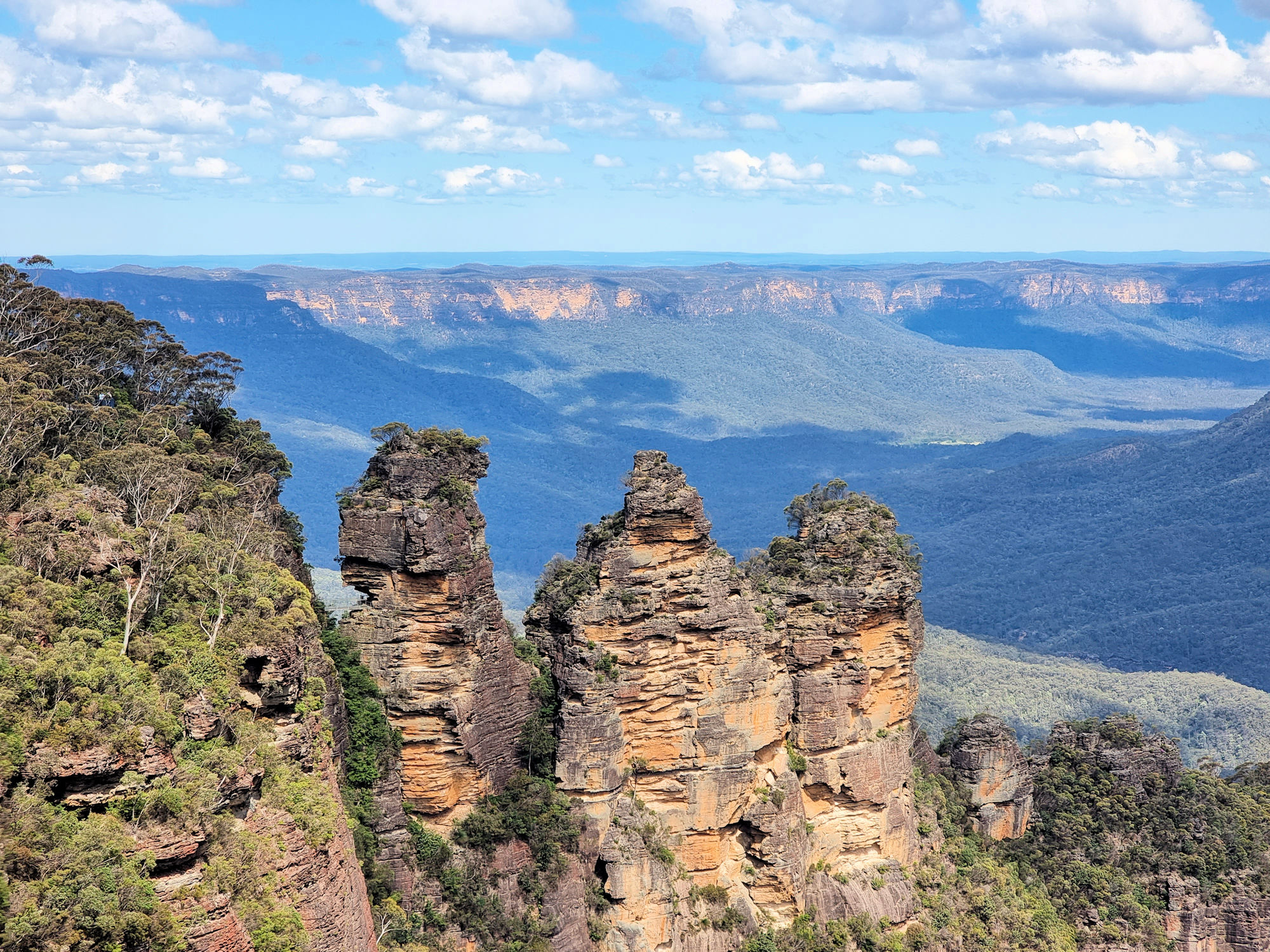
The Three Sisters From Echo Point

Echo Point Blue Mountains

Probably the best place to start your trip to the Blue Mountains, Echo Point in Katoomba has amazing views, access to several walks and an information centre. Parking is available in the surrounding streets, where parking meters ensure no-one visits for free.

Our first stop was the Visitor Information Centre because recent rain had closed many tracks and we needed to find out which ones were still open. After speaking to the helpful staff, we walked around the viewing area which has fantastic views of the Three Sisters and the Megalong Valley. The Three Sisters are probably the most famous rock formation in the Blue Mountains with this being the best pace to see them.

A small track behind the Visitor Information Centre leads to Spooners Lookout with more great views over the valley and an end-on view of the Three Sisters. This is a paved track, people even took prams along one section of it. From here stairs lead down to the Sisters and the Giant Stairway (800 steps), but were closed for repair work). This small track also forms a section of the Prince Henry Cliff Walk which runs from Scenic World to Leura.

Unfortunately the Prince Henry Cliff Walk was cut in several places while storm damage was repaired. However, we walked a small section, seeing some amazing views.

Something to look out for on the way to Spooners Lookout is a series of metal sculptures of Australian wildlife. Placed onto rocks defining the track they make an interesting addition to the walk. These walks are relatively easy, and there are usually lots of people doing them., so can become busy!

Our photos are available for purchase on

To see what else there is to do in New South Wales, please see some of our other stories.

Cooper Park Bushwalking in the City

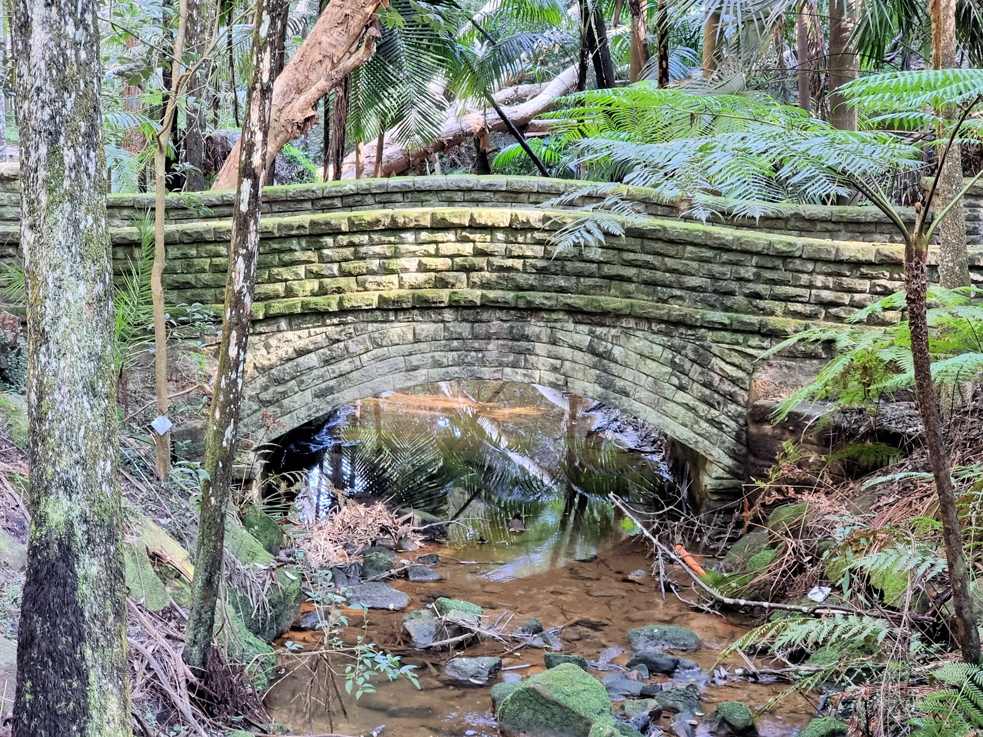
Stone arch bridge

Cooper Park

Located in Bellevue Hill, Cooper Park covers 15 Ha of bushland in the centre of Sydney’s eastern suburbs. Donated to the Woollahra Council as a park in 1913 by Sir William Cooper the park covers a gully from Victoria Road, Bellevue Hill to Manning Road, Double Bay. With tennis courts and cricket nets at one end and native parkland at the other it’s a wonderful place to visit.

How to Get There

We took the train to Bondi Junction and walked the 15 minutes to the park’s entrance. However, if you want to drive, carparking is available in Bunna Place. Because of the park’s location, there are many entrances off surrounding streets. These have steps leading down to the valley floor where they join the walking track.

The Park

Starting behind the tennis courts, a track winds through the valley floor following a small creek. An information board details the wildlife living in the park as well as the plant species. Scattered along the path are weather shelters, so if it rains there is somewhere to stop for a while.

We followed the well maintained track which wound through eucalypt trees with a fern understory. The creek has many small waterfalls and cascades which are easily accessible from the track.

The damp shady environment has led to most structures being covered in moss. We really liked the arch bridge and a bench seat because they were covered in it.

At the far end of the park, a large set of steps lead up and out to Victoria Road. Of course, you can also enter this way.

What Did We Think?

This is an amazing park, hidden away in Sydney’s suburbia. The walk through native bush, while following the creek was very relaxing and enjoyable.

Kanning Walk Kincumber Australia

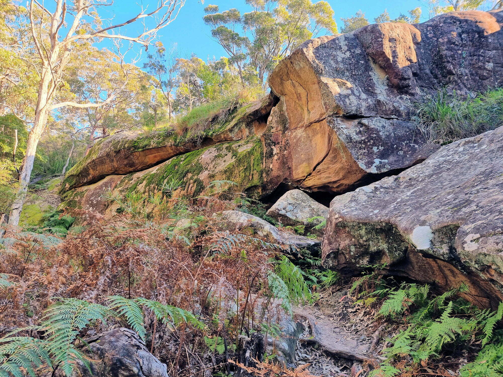
Exposed rocks and boulders along the Kanning Walk

Kanning Walk Kincumber Australia

Located near Kincumber on the New South Wales Central Coast, Kanning Walk is a 1.2 km track as well as a cave and beautiful scenic Australian bush to enjoy.

We parked near the “mud brick building“, which is also marked as a kiosk. Unfortunately, it is closed, so any thought of a coffee was put aside until we finished the walk. This area also has toilets, electric barbecues, tables and sun shades. Along with the large grassed area, this would be a great place for a family picnic in summer. Also located here is Honeman’s Rock, a small rock outcrop overlooking the picnic grounds.

Kanning Walk

The walk begins near the carpark, where a sign points the way to go. One of the first sights is the root system of a fallen tree, which you pass through at the start. The well maintained track leads through eucalypt forest which was very shady and peaceful dover their uring our visit early on a winter’s morning.

After 200m, the track follows the base of a small sandstone outcrop which contain several small caves (more like rock overhangs). Probably so that visitors don’t think this is the main caves, a nearby sign points to its location 150m away.

Surprisingly large, the main cave is around 7m by 9m and provides nice shade from the weather. During summer this would be a great spot out of the sun.

Continuing on the walk, we passed some interestingly shaped trees that have been sculpted by bushfires over the years. As the track neared the return trail, some banksias in bloom were seen growing in the more exposed areas.

Around 100m passed the cave, the walk meets the Yanina Trail, which is a wide fire trail. Well signposted directions show the way back to the mudbrick building or adventuring on to other walks..

This was a fun easy walk with an interesting cave to see along the way.