Tag: beach
-
Parsley Bay Bridge and Beach
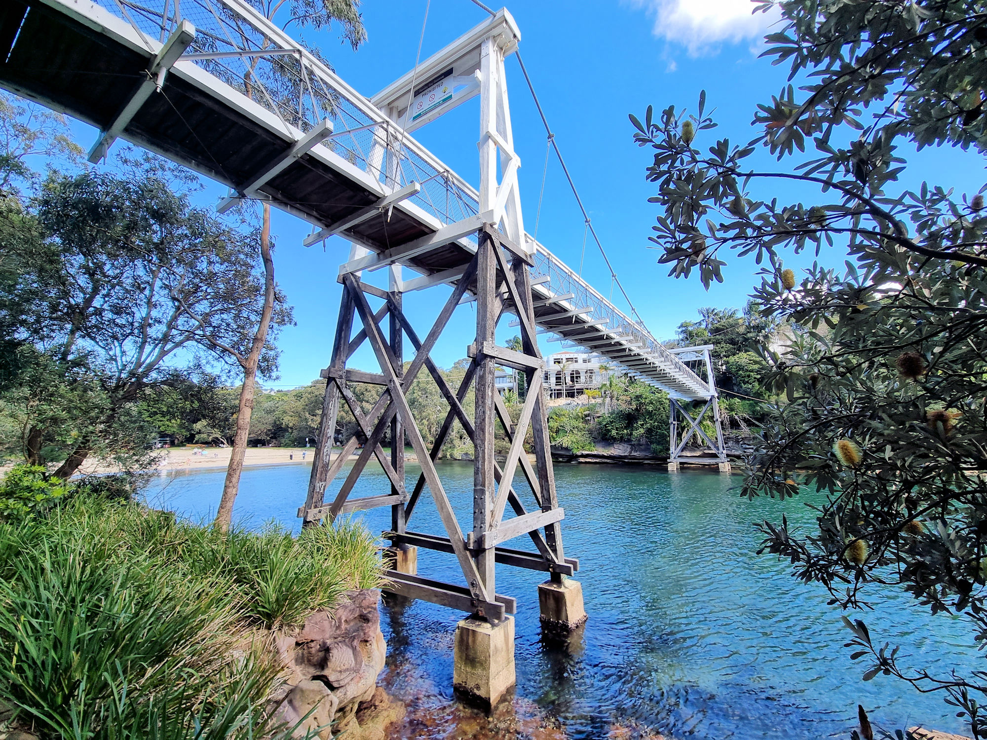
Parsley Bay Bridge Constructed in 1910, the cable suspension bridge over Parsley Bay connects both sides of the inlet while providing a great view of the beach and Sydney Harbour. Although originally built for practical reasons, it is now an attraction in itself, in addition to the lovely beach it overlooks. Getting There We walked… Read more
-
Hargraves Beach Rock Sculptures
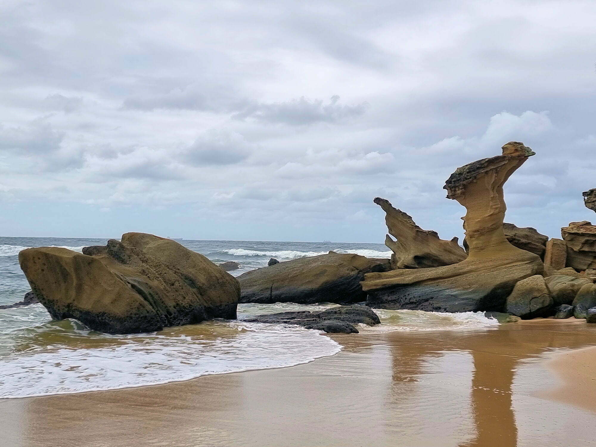
Hargraves Beach Rock Sculptures Central Coast New South Wales Australia These wonderful rock sculptures are on Hargraves Beach on the New South Wales Central Coast north of Sydney. Formed over thousands of years by wind rain and the sea, they have formed some amazing shapes. The largest one originally had a larger top, but too… Read more
-
The Orange Rocks of the Bay of Fires
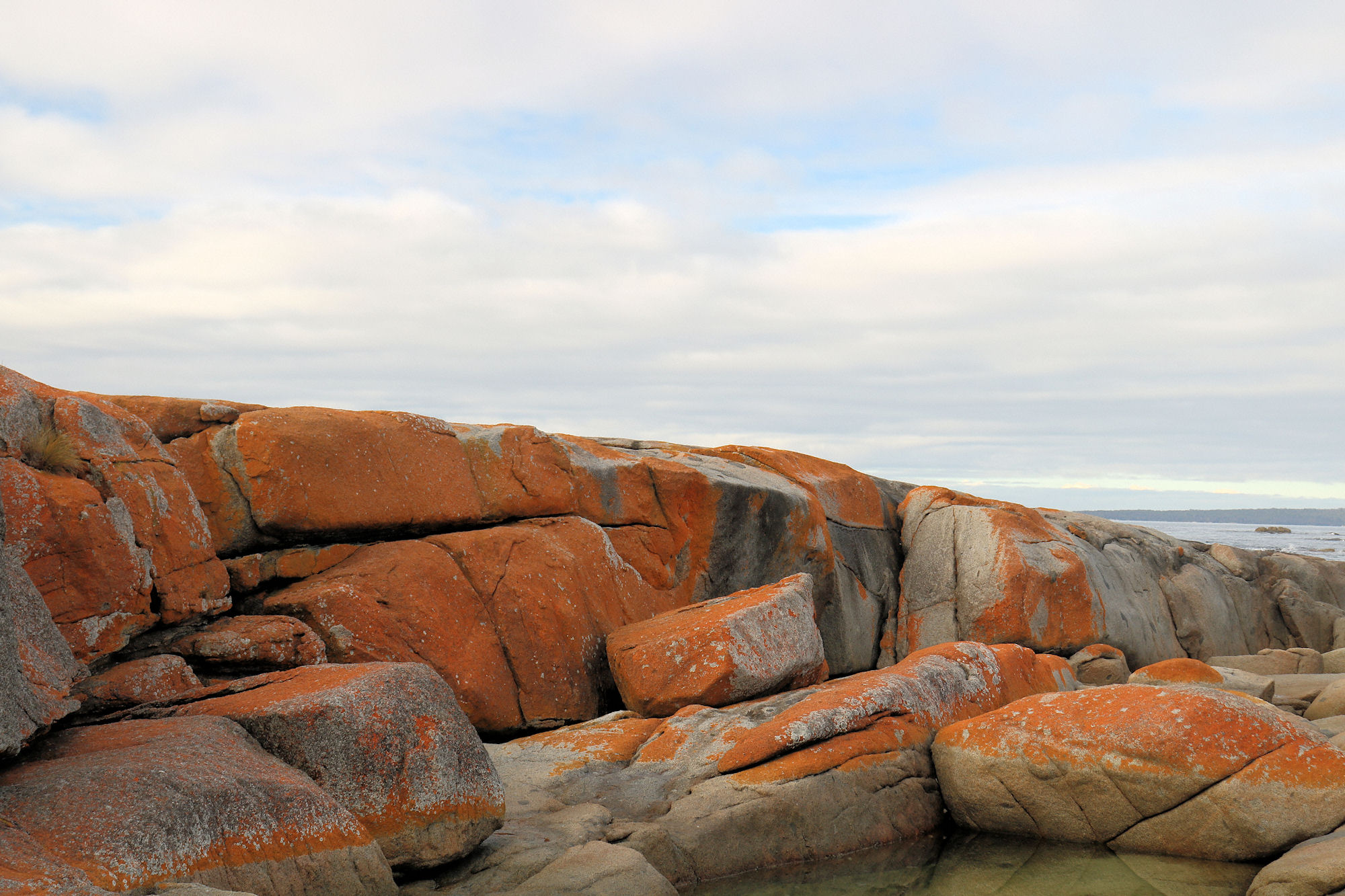
Bay of Fires Tasmania Famous for the stunning orange granite rocks that line the shore, The Bay of Fires is not, as we discovered named for this amazing feature. Instead, in 1773 when Captain Tobias Furneaux in Adventure, sailed past, he saw the fires of Aboriginal people on the beaches and gave it its name.… Read more