AdBlock Detected

It looks like you're using an ad-blocker!

Our team work realy hard to produce quality content on this website and we noticed you have ad-blocking enabled.

Heritage Walking Track Minmi

Heritage Walking Track

Heritage Walking Track

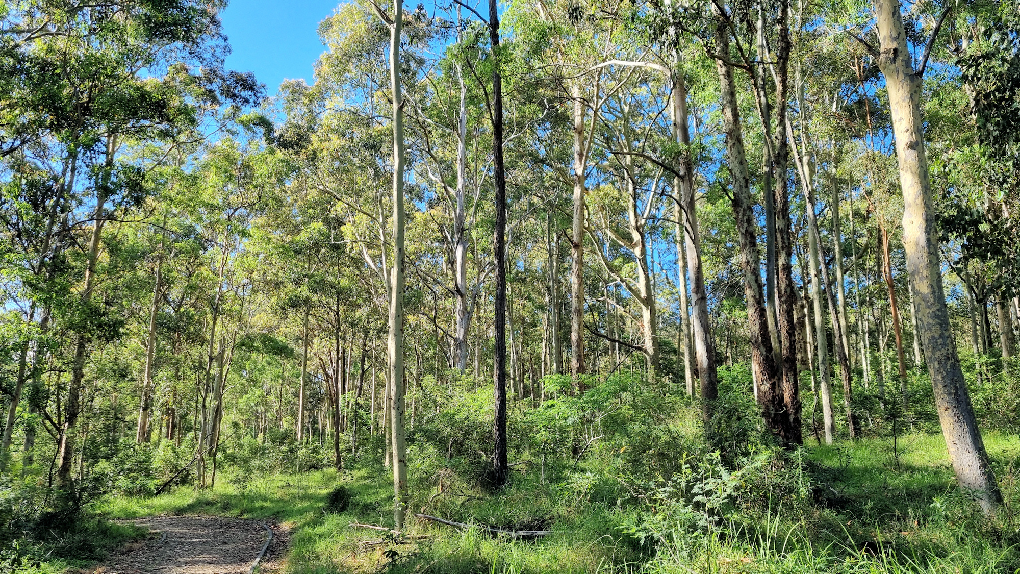
Originally a coal mining area dating from the 1840s, little remains to remind you of its past. Following its closure in the 1980s, rehabilitation and dedicated work by the Minmi Heritage Landcare Group have removed many of the scars. Plantings of native trees, the eradication of invasive plants and the installation of barbecues and picnic facilities have produced a beautiful community park. The Heritage Walking Track winds through the regenerated bushland.

Located near the outer western Newcastle suburb of Minmi, the park has plenty of parking and a small toilet block. The walking tracks are shown on an information board near the car park.

The Track

We chose the Heritage Walk because it includes the brick tower of an old ventilation shaft from the coal mine. Starting at the end of the car park, the track immediately splits into two paths. There are no signs to show which way to go, but the correct direction is to the right of the large white tyre. Not far from here, a track leads off to the left. Fortunately, there are two signs here showing that this is the way to go.

From the left turn, the well-maintained path follows a shady route through regenerated Australian bushland. We didn’t see any wildlife but could here plenty of cicadas.

The trail intersects another track, where you will find the brick tower. This remnant of the old coal mine used to provide ventilation to the mine’s underground workings. Turn right at the intersection, where another well-formed track takes you back to the car park.

Only a few minutes’ walk from the car park is the old Minmi Cemetery, where you can see the graves of many of the mine workers and their families.

What Did We Think?

A simple easy walk, it only took us 45 minutes, including stops for photos. The well-maintained path and shady trees made the walk enjoyable.

To see what else there is to do in New South Wales, please see some of our other stories.

Our photos are available for purchase on

Baiame Cave Milbrodale Hunter Valley

Baiame Cave Painting

Baiame Cave Milbrodale Hunter Valley

It’s amazing what you can find close to home that you didn’t know existed! It’s even on the local council website, but we somehow failed to see it. About 25 minutes down the Putty Road from Singleton, the Baiame Cave at Milbrodale contains a significant example of Aboriginal art.

Significance

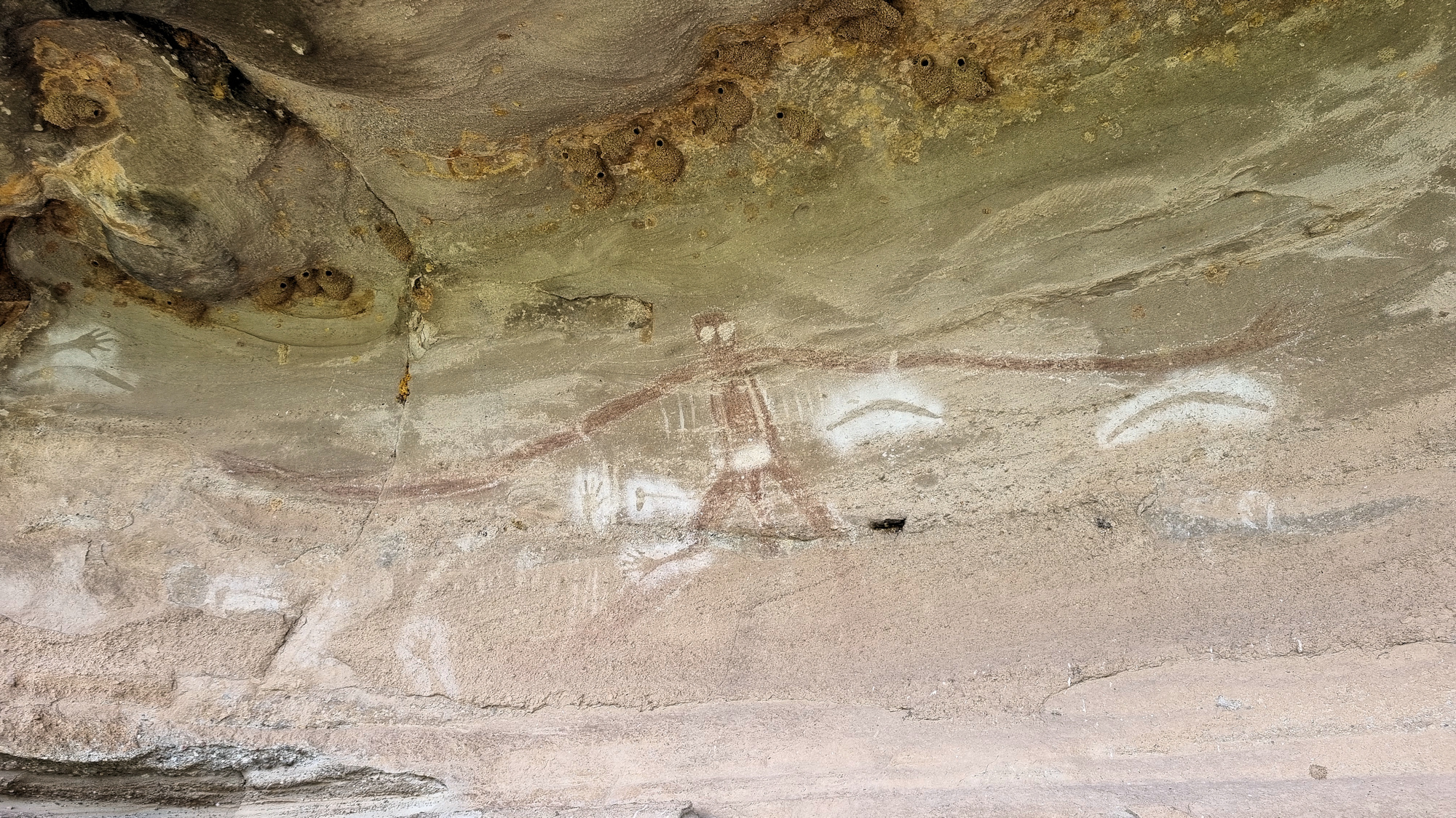
Connected to other sacred sites in the region, the cave and its artwork are culturally significant to the local Wonnarua people. Baiame is the creator and protector of the local people. In the painting he has widespread, larger than life arms. This signifies his status as protector of the local people. His eyes are also overly large, because he was all seeing and all knowing.

The choice of this particular cave is significant because it allows Baiame to look over the land of the Wonnarua. It also allows the local and visiting people to view the creator.

Getting There

Located on private property, access is via a dirt track just off Welshs Road. Although the property is privately owned, you are allowed access to the cave, but be respectful and remember no camping is allowed here. On our visit, a creek crossing just off the road, had been washed out. This meant we couldn’t drive all the way in, but it was only a short flat walk in. A sign at an intersection points in the direction to go.

The cave is located in the small escarpment to the left of the road, with a small path leading up. In the cave, a raised steel mesh platform provides a nice stable area to stand on and view the painting. Do not step off the platform, so as not to damage the cave. Remember the cave is heritage listed and protected.

The Painting

The painting depicts Baiame with arms outstretched looking over the river valley. Also visible are hand and arm stencils, representing the people who cared for and maintained the cave. There are also axe and boomerang stencil around the main figure.

What Did We Think?

This was a great place to visit, not only was it good to see, but we also learnt something else about the local Wonnarua people. The current access may be difficult for people with mobility issues, because you need to climb over the broken river crossing, but otherwise the track is flat and easy to walk.

The Swinging Bridge Cooranbong

The Swinging Bridge Cooranbong

The Swinging Bridge Cooranbong

Originally built in 1934 to allow access for workers to the nearby Sanitarium factory, the Swinging Bridge replaced rowing or swimming as the means to get to work. Crossing Dora Creek at Cooranbong the bridge can be tricky to find because it is located behind residential houses. We parked in Victory Street and walked down the public access track between Nos. 19 and 29. Once behind the houses the bridge is in front of you.

Crossing the bridge is fun as it bounces slightly as you walk. On the far side of Dora Creek, the old private access road to the Sanitarium Factory leads along the creek. Lined with palm and flowering trees, the old road looks great, especially as the trees were in bloom.

The Swinging Bridge Cooranbong
Looking Over The Swinging Bridge over Dora Creek
The Swinging Bridge Cooranbong
The Swinging Bridge over Dora Creek
Pathway after leaving the bridge The Swinging Bridge Cooranbong
Old Private Road to the factory

Following the creek, we saw palm trees lining the far bank which was unexpected. The creek passes the old factory which has been closed and changed hands. Visible through the surrounding fence, the old entrance would be nice to see up close. We made do with looking over the fence, because access is not allowed.

Palms on the bank of Dora Creek
The Old Sanitarium Factory

Sandy Creek Trail

Returning to the bridge, we decided to walk the Sandy Creek Trail, because it follows two creeks and goes through regrowth woodland. A sign showed other walks in the area, but this one held more interest for us. This walk is in yellow on the photo below. The well-maintained track follows Jigadee Creek until it meets Dora Creek. At this point the M1 Motorway from Sydney to Newcastle crosses the creeks several hundred meters down Dora Creek.

The track then follows Dora Creek back to the swinging bridge, where we crossed the creek and returned to our car.

Bush Track
Bush Track
Dora Creek Looking at the M1 Motorway
Map of the Tracks around Avondale

What Did We Think?

This was a great little walk, with some industrial heritage as well as the bridge and bush walking.