Elephant Rock Central Coast

Elephant Rock

Elephant Rock Central Coast

Located on the New South Wales Central Coast in Brisbane Water National Park, Elephant Rock is less than five-minutes drive from Patonga, 25 minutes from Gosford or 1 Hour 20 minutes from Sydney by car.

There are several ways to reach Elephant Rock, depending on how far you want to walk, or what other tracks you want to take. Having walked the Pearl Beach to Patonga Track before, we chose a short path off Patonga Drive.

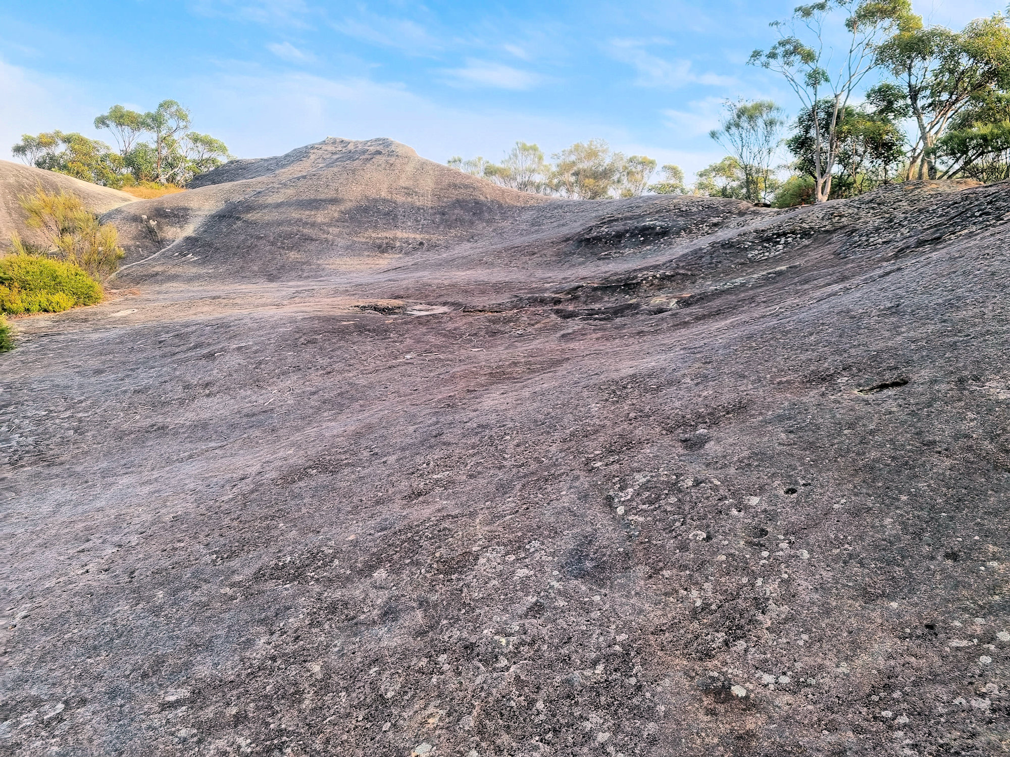
Apparently, the rock looks like an elephant from some directions, but a drone view seems to be the best way to see it. It also gives great views over Brisbane Water and the surrounding forest.

After parking in a small siding only big enough for two cars we followed a narrow track into the bush. Although only a short walk, the track was very narrow, often requiring climbing over boulders. If you are not stable on your feet, this is not a track for you.

Arriving at elephant rock not long after sunrise, we found the views over Brisbane Water covered in fog. Although disappointed not to see the view, the atmosphere was great with the fog rolled in, slowly covering the forest and then the rock.

Wild Flowers

Many native species were in flower when we walked here in June 2023. This was a great bonus and very colourful, with the trail surrounded by colour the whole way.

After returning to our car, we continued on to Patonga where we bought coffee and relaxed on the beach before returning home.

To see what else there is to do in New South Wales, please see some of our other stories.

Our photos are available for purchase on

Bobbin Head Mangrove Boardwalk

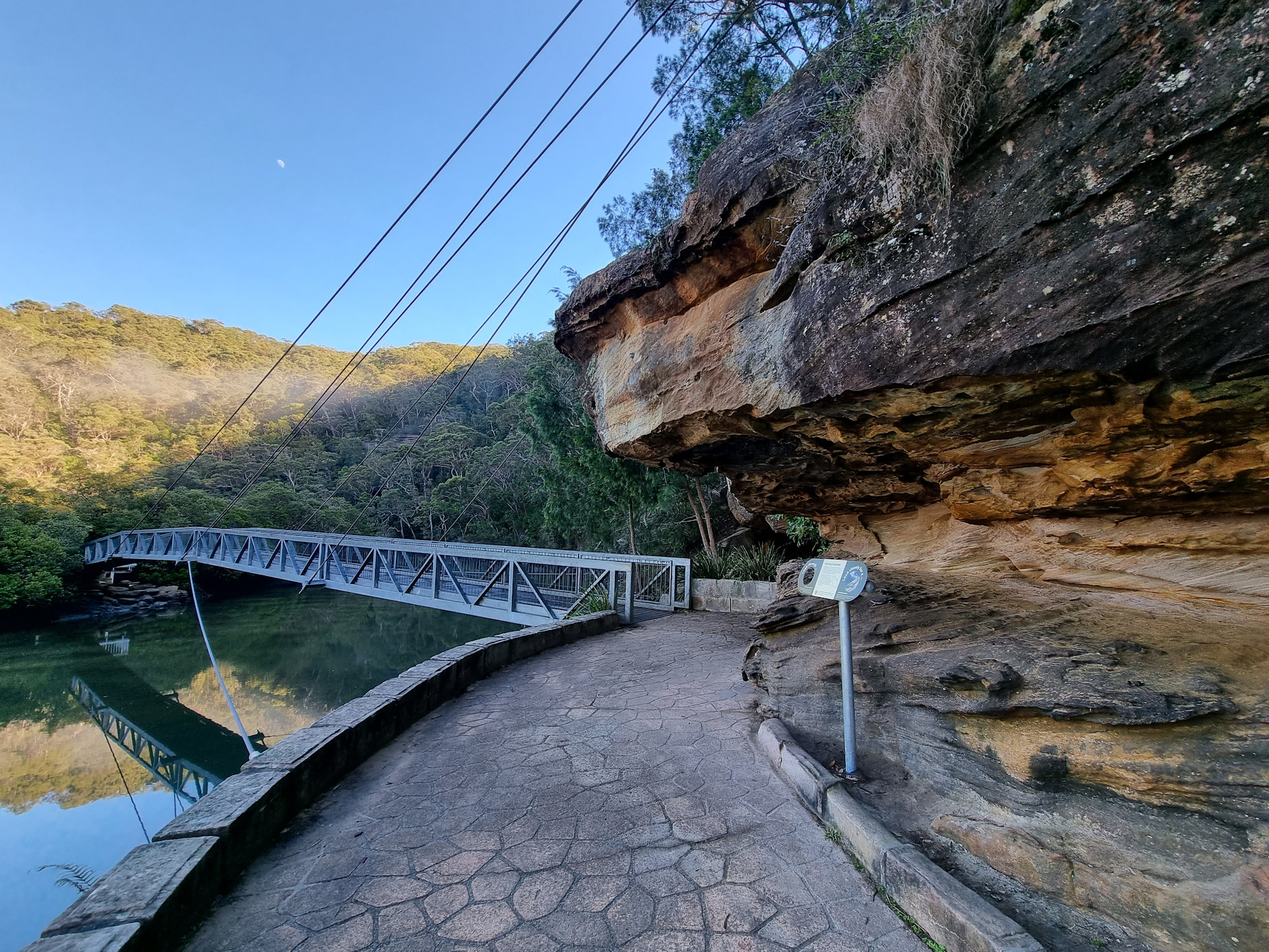
Suspension bridge through the mangroves

Bobbin Head Mangrove Boardwalk

Located in the Kuring-gai Chase National Park, access to the Bobbin Head Mangrove Boardwalk will cost $12.00 per car for a day. This will cover you for any other parts of the National Park you visit on that day too. The fee allows you to use the picnic areas and walking tracks in the area, which are well maintained by NSW Parks and Wildlife. Payment can be made at the entry gate as you drive in.

Our first stop was Empire Marina, where the still morning are provided amazing reflections on the water of the boats and surrounding forest. After this we drove to the southern end of the Bobbin Head picnic area, where the boardwalk starts.

The Boardwalk

The boardwalk meanders through the mangroves and there are information signs to help you learn more about the environment and plenty of opportunities to see the mangroves and crabs up close. Because it was low tide when we went, we didn’t see any crabs, only the openings to their burrows.

The boardwalk is 552 meters long and takes about 15 minutes to complete. Along the way we had more amazing reflections in Cockle Creek as well as views of the mangroves.

The track continues into the forest as Gibberagong Track, which we followed for a short distance to get more views over the creek.

This was a great little walk with amazing views. We were the only ones there during our visit early on a winter morning, but in summer it is very busy.

Suspension bridge through the mangroves
Suspension bridge through the mangroves Bobbin Head Mangrove Boardwalk
Suspension bridge through the mangroves
Metal sculpture of Cunningham's Skink Bobbin Head Mangrove Boardwalk
Metal sculpture of Cunningham’s Skink
Cowan Creek Bobbin Head Mangrove Boardwalk
Cowan Creek
The boardwalk through the mangroves
Eroded sandstone Bobbin Head Mangrove Boardwalk
Eroded sandstone
Trees growing in the sandstone on the river bank
Brush Turkey Bobbin Head Mangrove Boardwalk
Brush Turkey
Stone steps at the end of the boardwalk
View over Cowan Creek Bobbin Head Mangrove Boardwalk
View over Cowan Creek

Our photos are available for purchase on

To see what else there is to do in New South Wales, please see some of our other stories.

Palona Cave Walk

Sunrise at the start of the track Palona Cave Walk

Palona Cave Walk

Located in the Royal National Park, near Sydney the Palona Cave Walk is a short and easy bush walk. It takes you through beautiful temperate rainforest to a large limestone cave and a cascading waterfall.

Getting There

We drove to Royal National Park, arriving just after sunrise, so that we could catch the sunrise. Parking at the intersection of Lady Carrington Drive and Sir Bertram Stevens Drive was easy as only two other cars were there. On our return though, it was full, and many cars were parked along the road. Access to the National Park is charged per vehicle and you can pay at the entrance gate or main office. If you plan to visit several parks during the year, an annual pass is available from NSW National Parks and Wildlife Service.

Entrance near the carpark

The Track

Starting at the car park the historic Lady Carrington Drive trail leads into the forest. This is a wide and well-maintained dirt trail that follows the course of the Hacking River. Originally a road, it was closed and is now a dedicated bike and hiking trail. The trail takes you through temperate rain forest and our early morning start meant that it was quiet and peaceful.

After about 750 m, we reached the junction with the Forest Path, which is another scenic walk in the park. From here we continued along Lady Carrington Drive to Palona Cave track.

Palona Cave

After another 1 km, a sign for Limestone Cave on the left side of the track points off to the right. Unfortunately, a tree now obscures it, so keep a look out as the path to the cave is easy to miss, being very narrow. If you reach the Palona Brook crossing, you have gone too far. From here you leave the main trail and follow a narrow bush track that leads uphill to Palona Cave. The track is rough and rocky in places, so watch your step. When we visited it was also very overgrown and disappeared in several spots.

Palona Cave is a large overhang with stalactites and stalagmites formed by water dripping through the limestone rock. You can explore the cave and see the different shapes and colours of the formations. There is also a small stream that flows next to the cave and forms a waterfall. We were lucky it had rained recently because this creek is often dry.

This was a great walk with the reward of a waterfall and cave at the end. Remember to wear good boots as the second part of the track is rough. At around 5.3km return, it took us around two and a half hours, with plenty of stops for photos and cave exploring.

To see what else there is to do in New South Wales, please see some of our other stories.

Our photos are available for purchase on

Ads Blocker Image Powered by Code Help Pro

Ads Blocker Detected!!!

We have detected that you are using extensions to block ads. Please support us by disabling the blocker.

Powered By
Best Wordpress Adblock Detecting Plugin | CHP Adblock