AdBlock Detected

It looks like you're using an ad-blocker!

Our team work realy hard to produce quality content on this website and we noticed you have ad-blocking enabled.

Balls Head Reserve Sydney Australia

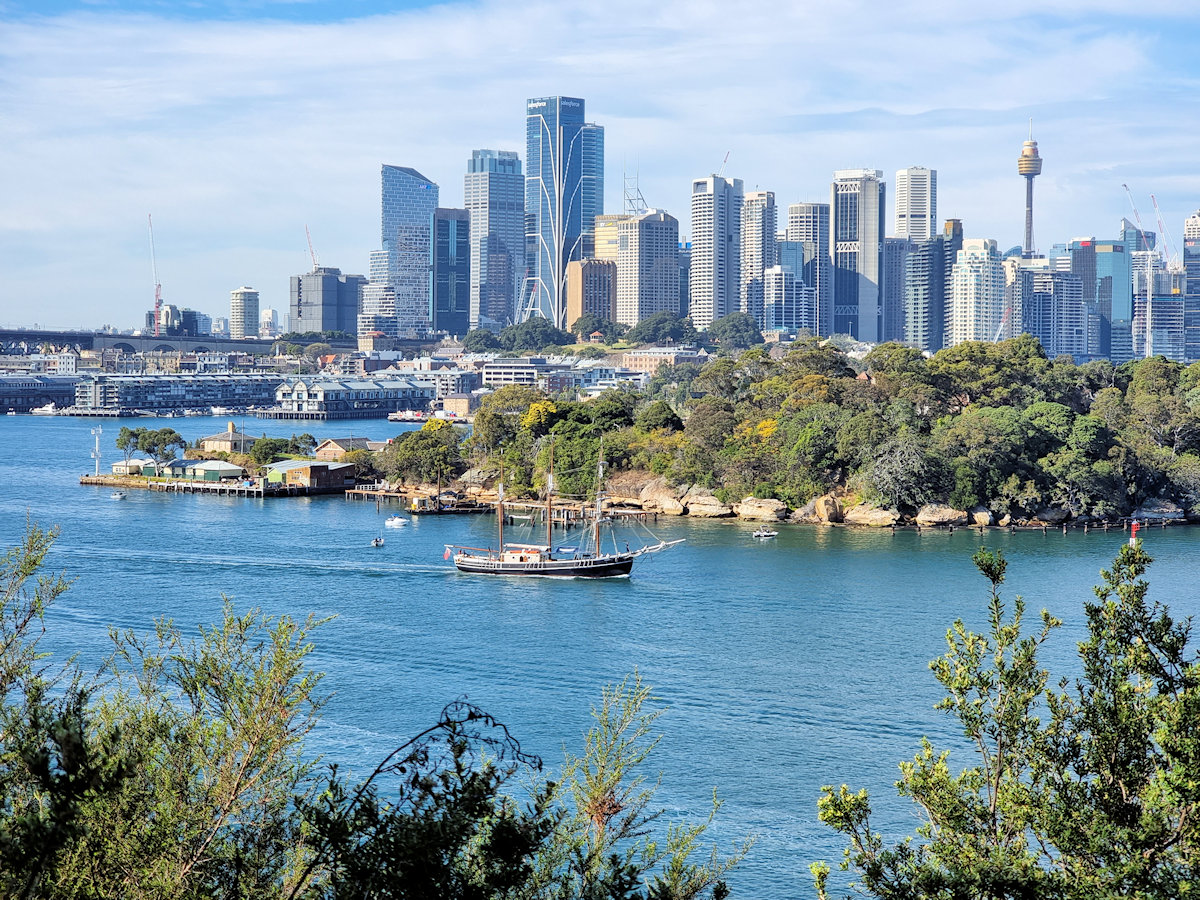
Sydney, The Harbour and a sailing ship from Balls Head Reserve

Balls Head Reserve Sydney Australia

Located on the northern side of Sydney Harbour, Balls Head Reserve is a scenic reserve offering breathtaking views of the harbour city and bridge. Winding tracks through regenerated native bushland let you experience the Australian bush without leaving Sydney.

History

The reserve was named after Henry Lidgbird Ball, who was a Royal Navy officer and the captain of HMS Supply during the First Fleet’s arrival in 1788.

During the 19th century, the area was utilized for quarrying and later for shipbuilding purposes. The remnants of the quarrying activity are still visible within the reserve. To the north of the reserve, Balls Head Coal Loader was an important export point for coal. The coal wharf and load out tunnels are still present and make a great addition to a visit to the area.

Getting there

Getting to Balls Head Reserve is relatively straightforward. We used the train and walked through Carradah Park and Balls Head Coal Loader before going to the reserve.

  • By public transport: Take a train to Waverton station and then enjoy a pleasant 15-20 minute walk through the picturesque streets of Waverton to reach the reserve. Alternately, walk through Carradah Park for more views of the harbour and see the rehabilitated BP site.
  • By car: It’s recommended to arrive early to secure a spot because there is limited street parking available.

Remember to check the current public transport schedules and any restrictions in place before planning your visit.

Balls Head Reserve

We entered the reserve through the tunnels from the old coal loader. This is a great way to enter the reserves because you walk from an industrial area to a rehabilitated bush environment. Although the tunnel is well lit the walkway is rough, so watch your footing.

Following the narrow track around the headland, we had some amazing views of the harbour. Several lookout provide great places to relax and take in the views. One even has a weather shelter carved from a large boulder. We brought some snacks and drinks, so this was a great place to stop and refuel while admiring the views. We were lucky to be there when one of the sailing ships went past, returning from one of its day trips.

The track varies from a wide shared roadway to narrow dirt tracks, so it’s a good idea to wear good shoes if you want to see the whole area. Several picnic spots with tables benches and toilets make it a great place to spend a few relaxing hours.

Coal Loading Tunnel
Coal Loading Tunnel

Our photos are available for purchase on

To see what else there is to do in New South Wales, please see some of our other stories.

Elephant Rock Central Coast

Elephant Rock

Elephant Rock Central Coast

Located on the New South Wales Central Coast in Brisbane Water National Park, Elephant Rock is less than five-minutes drive from Patonga, 25 minutes from Gosford or 1 Hour 20 minutes from Sydney by car.

There are several ways to reach Elephant Rock, depending on how far you want to walk, or what other tracks you want to take. Having walked the Pearl Beach to Patonga Track before, we chose a short path off Patonga Drive.

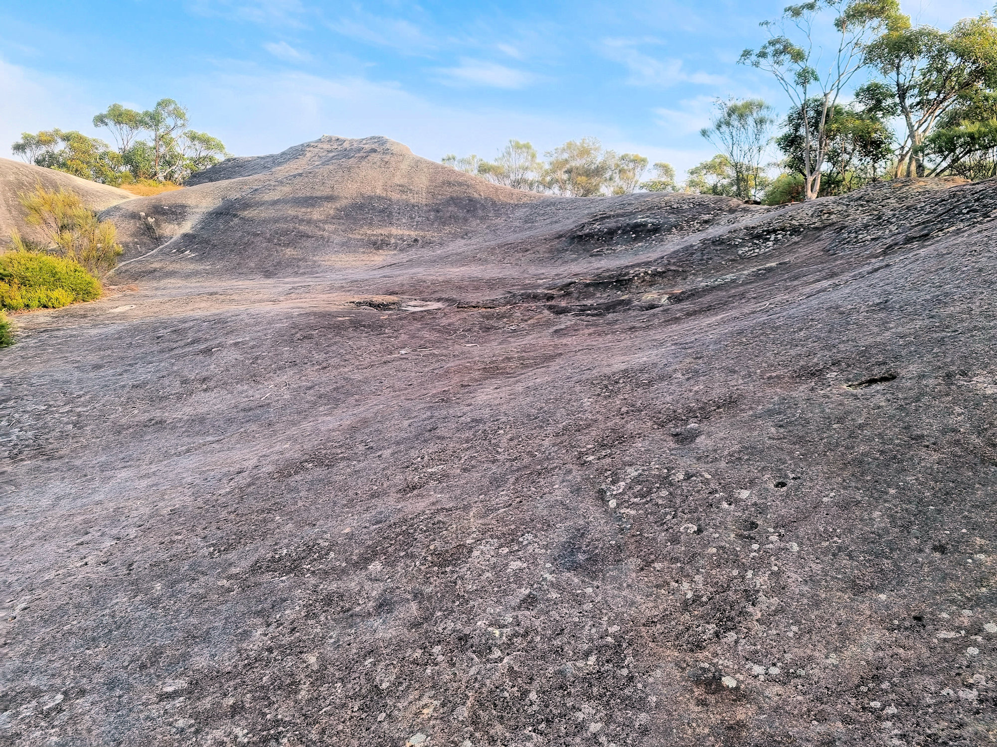
Apparently, the rock looks like an elephant from some directions, but a drone view seems to be the best way to see it. It also gives great views over Brisbane Water and the surrounding forest.

After parking in a small siding only big enough for two cars we followed a narrow track into the bush. Although only a short walk, the track was very narrow, often requiring climbing over boulders. If you are not stable on your feet, this is not a track for you.

Arriving at elephant rock not long after sunrise, we found the views over Brisbane Water covered in fog. Although disappointed not to see the view, the atmosphere was great with the fog rolled in, slowly covering the forest and then the rock.

Wild Flowers

Many native species were in flower when we walked here in June 2023. This was a great bonus and very colourful, with the trail surrounded by colour the whole way.

After returning to our car, we continued on to Patonga where we bought coffee and relaxed on the beach before returning home.

To see what else there is to do in New South Wales, please see some of our other stories.

Our photos are available for purchase on

Dangar Island and Brooklyn Ferry

driftwood on a beach Brooklyn Ferry to Dangar Island

Dangar Island

The first European to visit the area was Governor Arthur Phillip, who explored the lower river by small boat in March 1788 within weeks of the First Fleet’s arrival. He named it Mullet Island, for the abundance of fish in the local Hawkesbury River. The island was purchased in 1864 and renamed by Henry Cary Dangar, the son of Henry Dangar, a surveyor, pastoralist and parliamentarian.

Subdivided into residential plots in the 1920s while it still retains some areas for recreational use. Around 330 permanent residents call the island home.

Getting There

Dangar Island can only be accessed by water, either by ferry, private boat or water taxi. We used the ferry, which operates seven days per week. The ferry “Sun” is itself a historic boat, making the trip that little bit more interesting.

The ferry leaves from Brooklyn north of Sydney, where parking is available near the wharf. The Brooklyn train station is only a short walk from the wharf, making this a great option if you don’t want to drive. The ferry arrival and departure times coincide with the train’s timetable.

On the Island

The only vehicles on the island are the fire truck and council ute, with all other vehicles banned. Residents use wheel barrows to haul items from the wharf to their homes. As you leave the ferry, you will see a line up of wheel barrows on the side of the path. On the opposite side is a metal sculpture of a Stegosaurus.

Our first stop was the coffee shop next to the wharf. This also serves as the island’s only shop, because of the small population. Sitting outside was very relaxing, and a great way to start our visit before setting off to explore.

Walking Around

With only around 3km of roads, walking around the island does not take too long. You can download a map, to show various things to see on the island. However, we spent a lot of time at the beach, which had driftwood from recent storms washed up. Also near the beach the rocks are covered in oysters, although most have been removed by fishermen.

One small relic here dates from the Second World War when the Australian Army garrisoned the island and manned a cable boom across the river to protect the railway bridge. A small section of rusted steel embedded in the rocks is all that remains.

We visited at low tide and much of the beach was exposed. The exposed sand was covered in small mounds of sand from crabs that had burrowed down until the tide returned. From the amount of burrows, there must be a huge crab population here.

From the upper road, you get great views of the Hawkesbury and the railway bridge. A rock shelter previously used the local Guringai people before European settlement sits just off the upper road.

Returning to Brooklyn

After around three hours, we returned to the wharf where we had a cold drink while we waited for the ferry. Make sure you don’t miss the last ferry, or you will need to call the water taxi, which is much more expensive.

This was a fun relaxing morning out to somewhere that’s a little different. The locals and the atmosphere of the island is great and we had a great time, well worth a visit.

To see what else there is to do in New South Wales, please see some of our other stories.

Our photos are available for purchase on