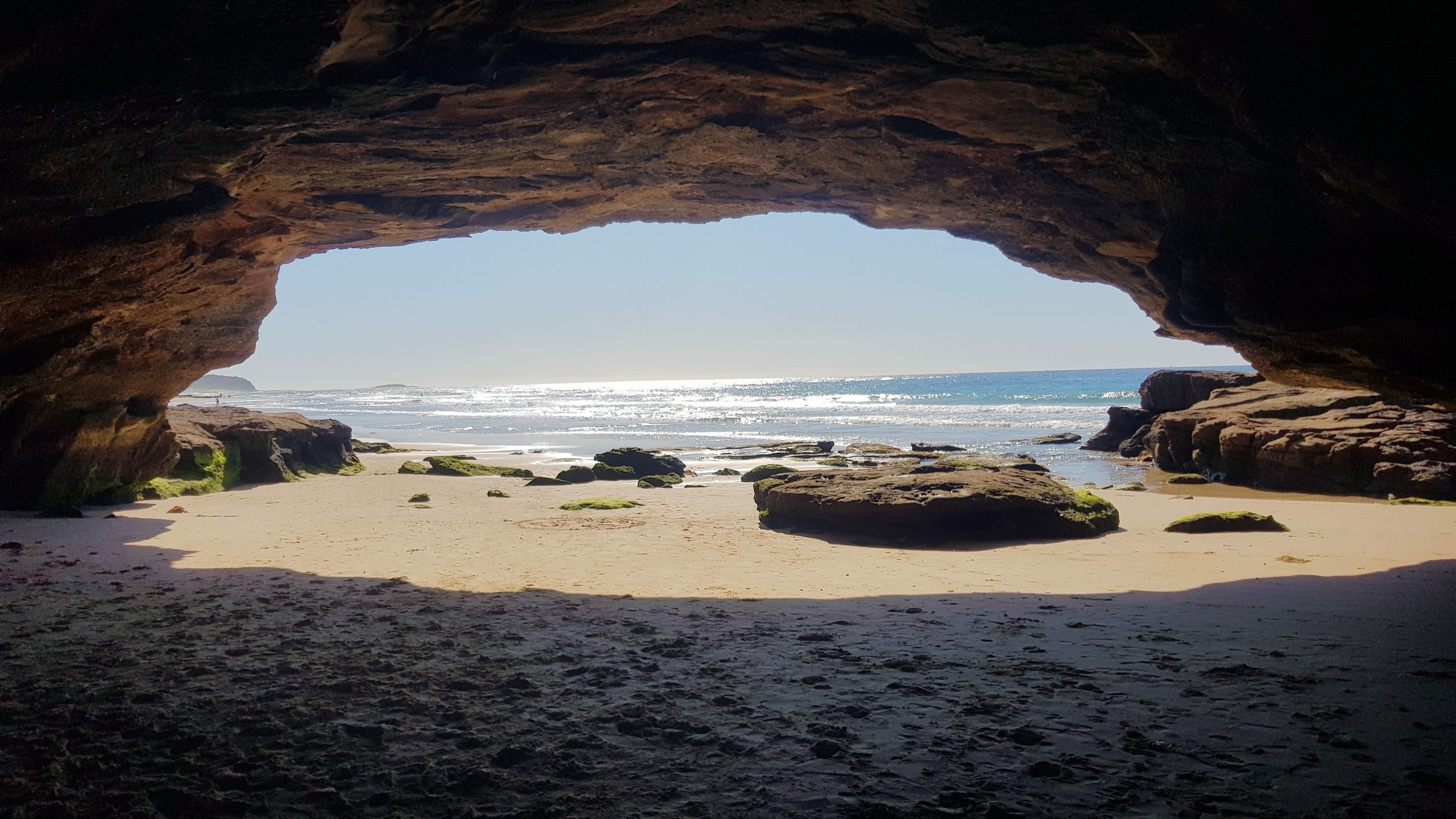
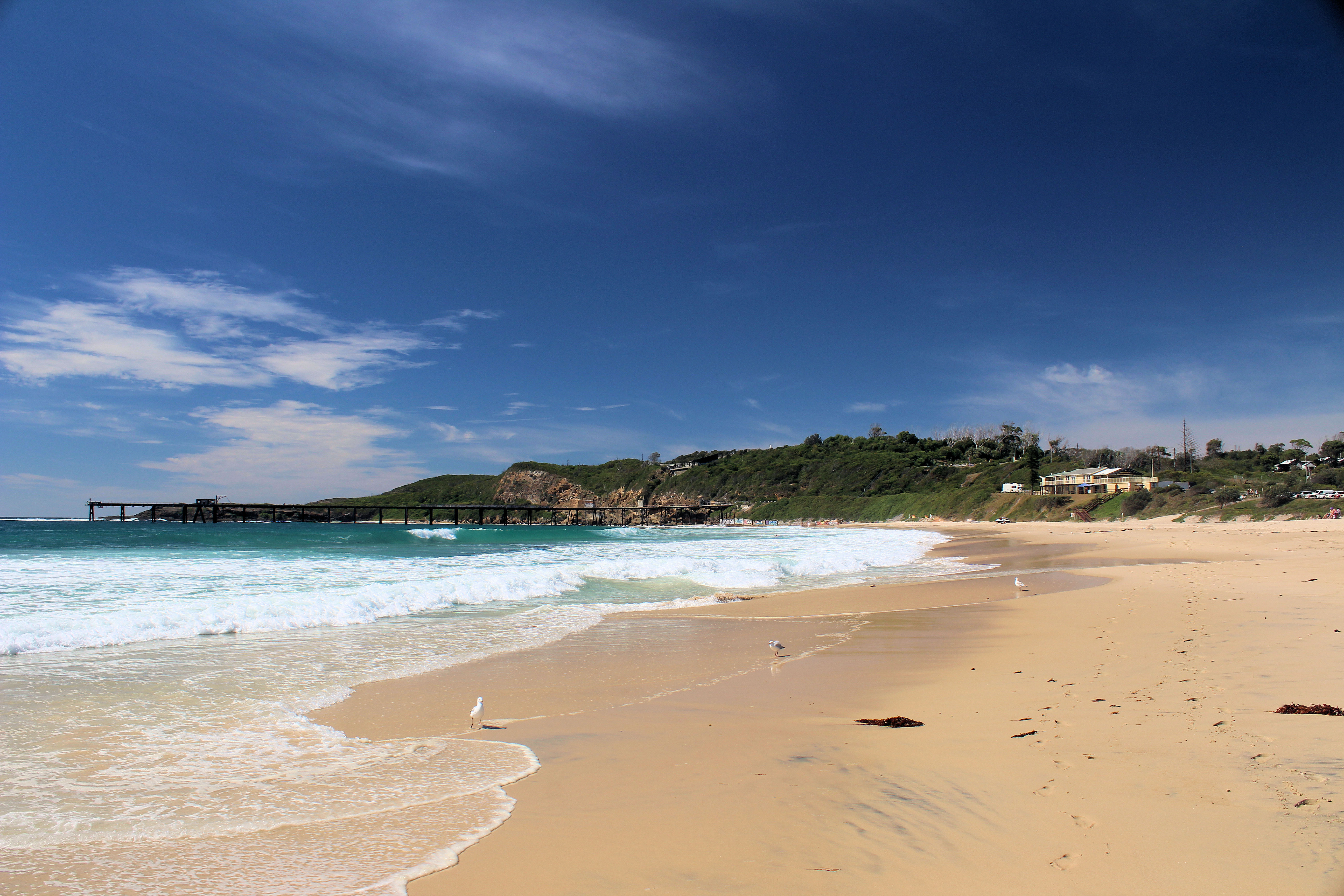
Located only 40 minutes south of Newcastle, Caves Beach is a relaxed southern suburb of Lake Macquarie. Named after the network of sea caves to the south of the beach, it is a great place to relax and explore the coast. If you want to explore the cave, make sure you go at low tide because at high tide, the cave is flooded, and access is cut off. You can check this on the internet. During the week we have found it to be quiet, but on a sunny weekend, it will be crowded, with people swimming and exploring the cave.
If you want to swim in the ocean, check that a lifeguard is on duty in the tower and swim between the flags to be safe.
Near the lifeguard tower is a steel sculpture, Norfolk 2019 by Kelly-Ann Lees, which reflects the seed cones dropped by the Norfolk Pines which are found in the area.
The Caves
Entering the cave is not dangerous. There are no warning signs and access is free. You can walk through the cave and out the other side to a rock platform. The cliff here also has some smaller caves to look at. The platform itself is quite interesting, with rock pools with algae growing in them. Be careful of your footing because the rocks can be slippery. Remember to check the tides, because the cave and rock platform are flooded at high tide.
Cave’s Beach Sea Cave at High Tide
The Large Sea Cave at Caves Beach
Looking Out of the Cave
the Sandy Entrance to the Large Sea Cave at Caves Beach
Looking out of the Main Cave
Rock Platform at Cave’s Beach
Looking Over The Rock Platform
Rock Pools
Food and Refreshments
There is a kiosk next to the beach selling snacks and cold drinks during the week. Not far before the entrance to the carpark, you will find cafes and restaurants, if you want something more substantial. The beach area near the surf house also has barbecues and picnic area, along with a change house and toilets.
Caves Beach to Pinny Beach The Wallarah Coastal Walk
For some excellent views of the coast and to see some nice beaches, there is a walking trail from Caves Beach to Pinny Beach. The trails are rough in places and there are steps to climb, but it is generally an easy three kilometer one way walk. Along the way, lookouts let you look over beaches and rock platforms. Small trails also allow access to the beaches, which is a great way to extend your exploring of the area.
Caves Beach Viewed From the Cliff Top
Sea Caves, Rock Platform and Beach
Coastal Cliffs
Spoon Rocks
Originally built by a mining company for coal transportation, the breakwater’s shape is how this Spoon Rocks received its name. The spoon shape is visible on your way down the track to the beach.
The mining venture, with Silver Valley Minerals, didn’t proceed after it’s construction. However, the breakwater remains and provides protection from the swell at the beach. Although the water looks inviting, Spoon Rocks Beach is not patrolled, so swimming is not advised.
Walking Trail Above Spoon Rocks
Spoon Rock
Walking Trail to Spoon Rocks Lookout
Pinny Beach
Located in Wallarah National Park, the Coastal Walk passes through locked vehicle gates. Designed to stop cars accessing the National Park, not people on foot, it’s safe to go past them. The views over the beach are amazing, but this was the end of our walk, so after a break for a snack, we returned to Caves Beach.
Pinny Beach
To see what else there is to do in New South Wales, please see some of our other stories.
There are some great beaches south of Newcastle as well as some interesting sights to view along the way. The beaches are nearly all fantastic and most of them are good for surfing as well as a swim or relaxing on the sand.
Lifeguards do not patrol all of these beaches, so if you plan a swim, you should go to a patrolled beach and swim between the flags. This way, if you or someone with you gets into difficulty in the water, a lifeguard is nearby.
Snapper Point is part of the New South Wales National Parks Monmouth State Conservation Area. As such you need to abide by any sign they have placed. There is a small car park when you arrive and a small fee for using the park. This was the only place we visited on the day with a parking fee.
As the name implies, it is a popular fishing spot. It is popular with rock fishers, who cast out into the ocean for the fish. From the number of memorials there, it has also proven fatal to some fishermen who have been swept from the rocks and drowned. There are now safety rings in place should anyone fall in.
We stayed clear of the lower wave washed rocks and admired the views from the top. There is a series of sea caves cut into the cliffs nearby and they are clearly visible from the lookout. The ocean views are great, but it was the sea caves that we came to see and watching the ocean waves rolling into them was amazing.
Snapper Point Sea Cave
Snapper Point
Frazer Beach
Frazer Beach is in
the Lake Munmorah State Conservation Area so is very close to Snapper Point and
adjacent to Bongon Beach. It has a camping ground right next to the beach or
you can pay for a day pass at the machines in the car park.
The beach is amazing
being wide and sandy with rock platforms on either side. Surfing is popular
here and a few groups were out in the surf when we arrived. This isn’t a
patrolled beach so swimming is not advised.
To the north of the
beach is Bongon Beach and Snapper Point while to the south is a large rock
platform, which we walked over. It has some interesting rock pools and
geological features although we found the rock pools at Bongon Beach to be
better. There were also a few rock fishermen here trying their luck.
Frazer Beach
Geological Formation South of Frazer Beach
Bongon Beach
Bongon Beach, located between Snapper Point and Frazer Beach is a very small sandy beach but has some very nice rock pools in the adjacent rock platform.
We walked to Bongon from Frazer Beach by climbing over the rock ledge dividing the two beaches. The platform near Snapper Point was very interesting as we arrived at low tide and all of the rock pools were exposed. Some were very nice with great colours and it was nice to watch the tide forcing the water into them. During the summer months these rock pools would definitely be the place to sit and relax.
Bongon Beach
Rock Pool Near Bongon Beach
Waves Filling a Rock Pool Near Bongon Beach
Catherine Hill Bay
Catherine Hill Bay is one of the best surfing spots on the coast. It has a great beach, surf house; and the town’s pub is legendary. Unfortunately for us there was a lot of road work being done in the town and the pub was full. So instead, we walked on the beach for a while and then checked out the old heritage listed coal loading pier.
Catherine Hill Bay Surf Club
Catherine Hill Bay Beach
The Beach at Catherine Hill Bay
Catherine Hill Bay Coal Loading Pier
It is a very pleasant spot and very relaxing. As we walked along the beach we were able to see people surfing and some old wooden piers sticking out of the sand, slowly being weathered away.
Coal Loading Pier at Catherine Hill Bay
Old Wooden Piers at Catherine Hill Bay
Caves Beach
Another of the great beaches south of Newcastle is Cave’s Beach named not surprisingly after the sea caves in the area. If you want to explore the cave, make sure you go at low tide. You can check this on the internet. At high tide, the cave is flooded, and access is cut off. During the week we have found it to be quiet, but on a sunny weekend, it will be crowded, with people swimming and exploring the cave.
Cave’s Beach Sea Cave at High Tide
Main Cave at Cave’s Beach
Main Cave at Cave’s Beach Looking Out
Looking out of the Main Cave
Rock Platform at Cave’s Beach
Rocks and Algae at Caves Beach
Entering the cave is not dangerous. There are no warning signs and access is free. You can walk through the cave and out the other side to a rock platform. The cliff here also has some smaller caves to look at. The platform itself is quite interesting, with rock pools with algae growing in them. Be careful of your footing as the rocks can be slippery.
There is a kiosk next to the beach selling snacks and cold drinks during the week. On the weekends, there is a bar that also opens.
A larger post on Caves Beach and surrounding walking tracks can be found here.
Swansea Heads and Reid’s Mistake
Swansea Headland looks over the entrance to the Swansea Channel and down onto Reid’s Mistake Head. There is a great view from here and if you drive to the end of the track, you will find the Maritime Rescue Station with more great views.
Below the headland, you can access the base of the cliff and the rock platform from a car park near Reid’s Reserve. If you look carefully at low tide, you will find the remains of a petrified forest that was destroyed by a volcanic eruption and buried in volcanic ash. The cliff is made of tuff, a stone made from the ash of the volcanic eruption.
Volcanic Tuff in the Cliff at at Reid’s Mistake
Reid’s Mistake Fossil Tree
Fossilised Tree Trunk
Rock Patterns
Reid’s Mistake Rock Platform
Redhead Beach
Our last stop heading north was Redhead Beach. This is a very popular Newcastle beach and has a big car park and facilities. The most striking feature, apart from the excellent beach is the old shark spotting tower perched on rocks in front of the club house.
Redhead Beach Shark Tower
So, if you want to visit some beaches south of Newcastle and do more than just swim or sunbathe, give some of these places a try.
As you drive along the highway, see if the can spot the Big Prawn on top of the sign for a closed shopping centre. Australia loves its “Big” things.
The Big Prawn
If you want to read about Newcastle Beaches, click here