AdBlock Detected

It looks like you're using an ad-blocker!

Our team work realy hard to produce quality content on this website and we noticed you have ad-blocking enabled.

Girrakool Loop Track Brisbane Water National Park
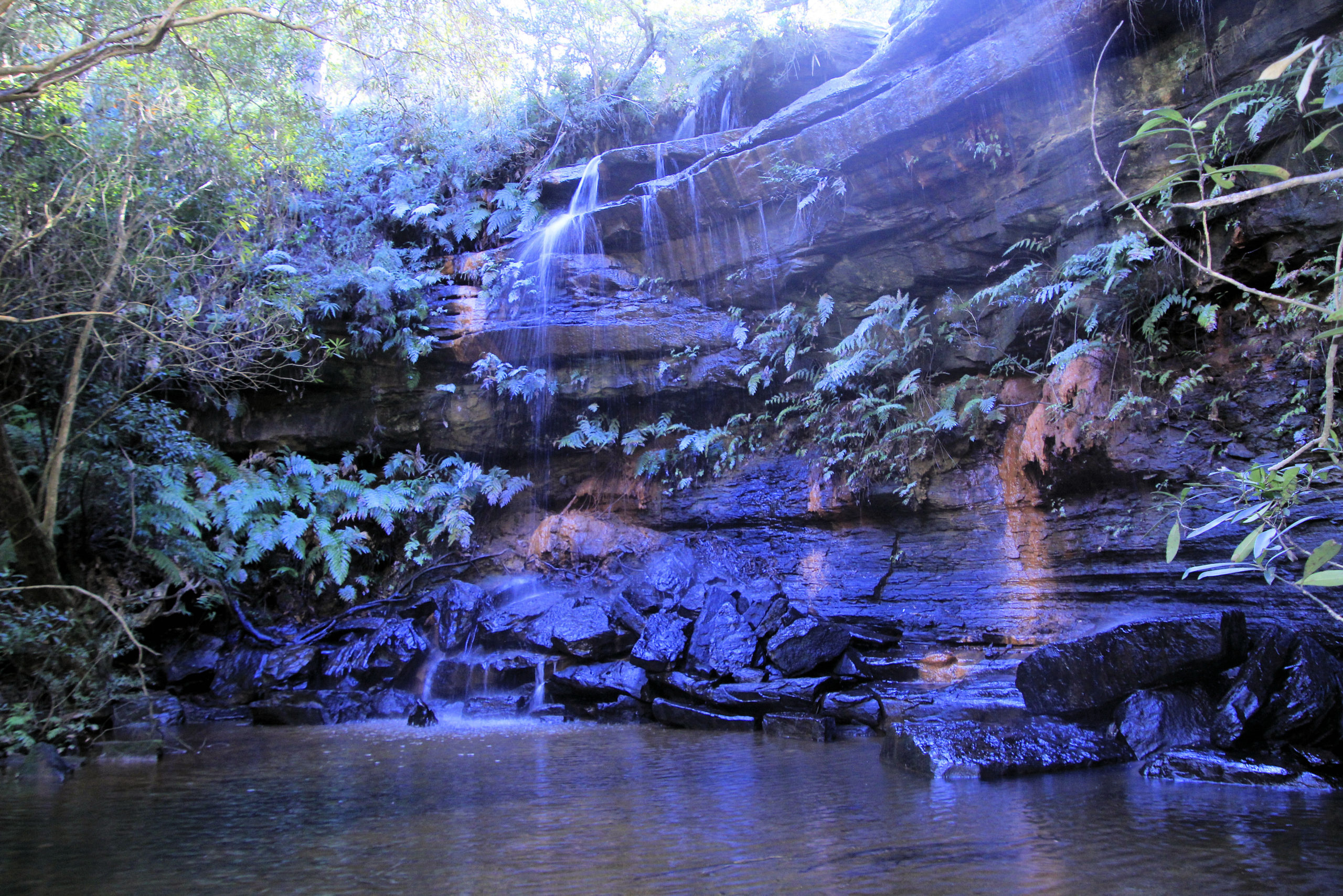
Waterfall at Andamira Lookout

Girrakool Loop Track

Part of the Brisbane Water National Park, the Girrakool Loop Track is managed by NSW National Parks and Wildlife Service. This ensures that the park is managed well and that tracks are maintained in good condition. A small fee applies which you pay in the car park.

Getting There

A one-hour drive north of Sydney on the M1 Pacific Motorway, take the Central Coast Highway exit, then:

  • Take the first left onto Wisemans Ferry Road
  • Then take the first left onto Old Pacific Highway
  • Take the first left onto Quarry Road
  • The picnic area, where the trail begins, is through the tunnel and straight ahead.

Be aware of the carpark’s closing time, as rangers lock the gates after hours.

Fungi Growing near the Girrakool Loop Track
Fungi Growing near the Track
Eucalypt on the Girrakool Loop Track
Eucalypt on the Track

Aboriginal Rock Engravings

One of the first stops on the track is a collection of Aboriginal rock engravings, which give an insight into indigenous settlement of the area. Signs warn visitors not to walk on them, while also explaining their significance.

Aboriginal Rock Engravings Sign
Warning Sign Next to Aboriginal Rock Engravings
Aboriginal Rock Engravings

Wildlife and Native Flowers

Wild flowers bloom in spring, so we missed them, however, we came across a bush turkey, which was the only wildlife we saw.

Bush Turkey on its Nest
Girrakool Loop Track

Waterfalls on the Girrakool Loop Track

Apart from the native forest and views, the waterfalls are the major drawcard for this walk. We though the one at Andamira Lookout was the nicest, as it was shady and quiet.

Waterfall at Andamira Lookout
Waterfall at Andamira Lookout on the Girrakool Loop Track
Shady Waterfall at Andamira Lookout
Waterfall at Andamira Lookout

What Did We Think

A great little walk taking about 45 minutes, passing forest and nice waterfalls. We had a great time.

To see what else there is to do in New South Wales, please see some of our other stories.

Our photos are available for purchase on

Karloo Pools Track Royal National Park
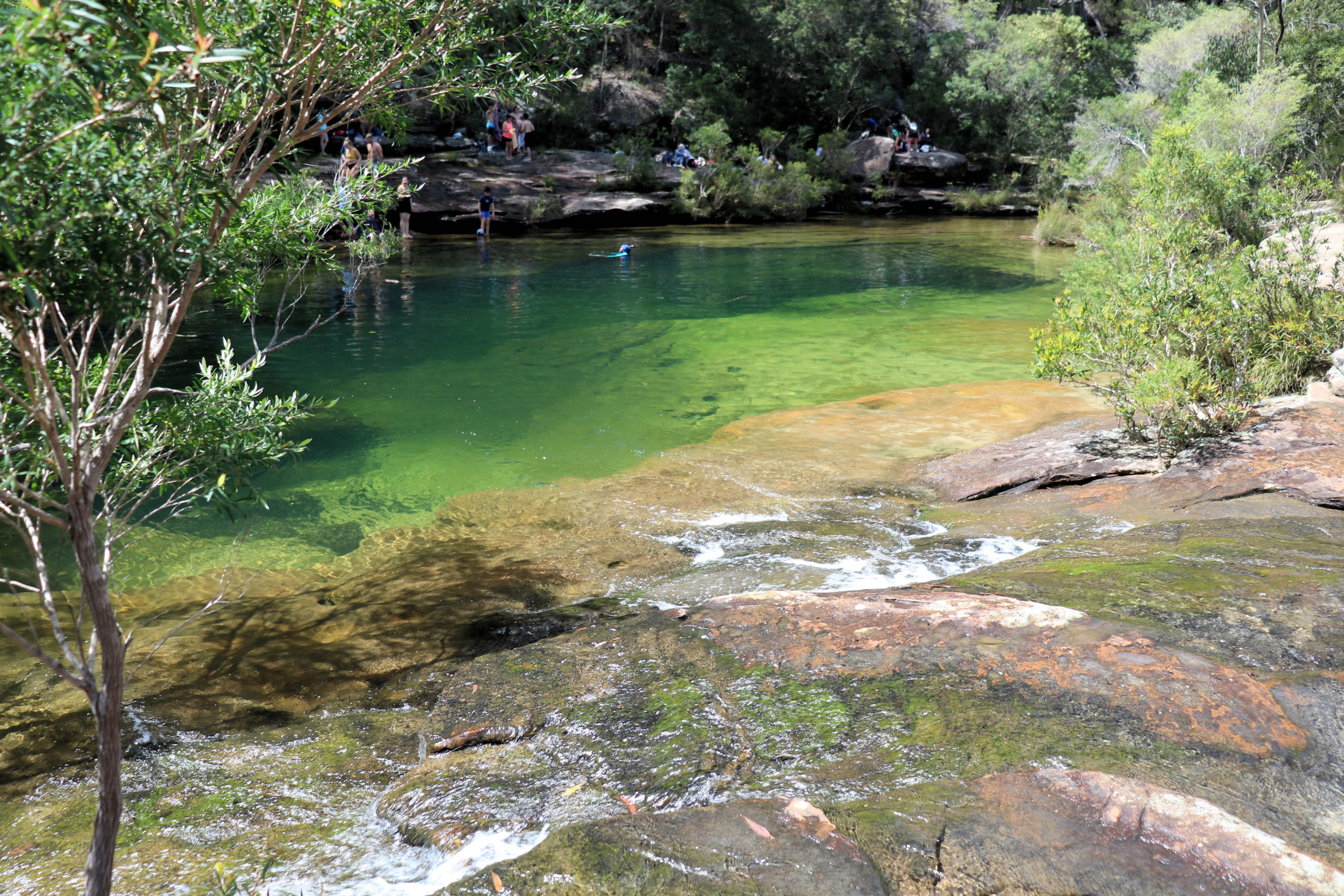
Karloo Pools

Karloo Pools Track

Getting There

Heathcote railway station is a great place to start the Karloo Pools Track, having ample car parking, or providing easy access from Sydney’s rail network.

We chose to use the train from Central Station, which was a quick and convenient trip taking just under an hour.

From the train station, walk through the car park, past the Sutherland Shire Rural Fire Brigade building to the start of the track.

Information Board
Information Board at the Start of the Track

The Karloo Pools Walking Track

NSW Parks and Wildlife maintain the track and manage the Royal National Park. They give the track a rating of three, meaning that it is well sign posted, with some steep areas and unformed paths and is moderately challenging.

Compared to other grade 3 and 4 tracks we have walked, this would be at the high end of grade 3. Several steep areas also had steep slopes adjacent to the track, so care was needed not to slip down.

The walk starts with an easy walk through eucalyptus forest, passing the outskirts of Heathcote before descending through the valley. In places you need to climb over rocks, but the scenery is amazing and worth the effort.

Climbing up to opposite valley, you are rewarded with views over the National Park. From here the track descends to the Karloo Pools.

Karloo Pools

Surrounded by forest and rock outcrops the pool’s setting is picturesque and rewards your hour’s walk to get there. Whether you want to relax in the shade, swim in the pool or sit on the rocks, it’s a great place to enjoy lunch.

This is a popular swimming hole, it is often crowded particularly in summer, so be prepared to share it with others. Although we only saw a few people on the walking track, several dozen were there when we arrived around 10:30am.

We relaxed there after the walk, had lunch and spent time taking photos before walking back to the train station.

What Did We Think?

We thoroughly enjoyed the walk and pools, as it was a little challenging, with a great reward. Remember to wear good walking shoes, because you will need them in some of the more difficult places. There is no lifeguard on duty so take care when swimming and supervise children. It is also important to check the the NSW National Parks and Wildlife Service’s page, because the park may be closed, or warnings in place.

Our photos are available for purchase on

To see what else there is to do in New South Wales, please see some of our other stories.

Barrington Tops National Park

Devil's Hole Lookout Barrington Tops National Park NSW Australia

Barrington Tops National Park

Aberdeen

Our drive to the Barrington Tops started at Aberdeen in the NSW Hunter Valley.  This is a small town, famous for its Scottish heritage and its annual Highland Games.  Also of interest as you pass through the town is St Mark’s Church.

Polblue Swamp Walk

Polblue Swamp Walk can be started in either the camping ground, or the nearby day parking area.  The walk forms a loop that passes through both areas. This was a nice walk that took us 30 minutes to complete.  The loop, skirts the swamp area and passes through wooded area, over several creeks (with bridges) and finishes with a board walk over part of the swamp.

We found the board walk to be the most interesting, as it had a variety of bird life and plants.

Devil’s Hole Lookout

The track to Devils hole Lookout is very short (about 5 minutes) and paved. The view is amazing over the Barrington Tops, because the viewing platform is placed well. 

Thunderbolt’s Lookout

Thunderbolt’s Lookout gives views similar to Devils hole, but also has a more interesting walk to the viewing area. You pass ferns, huge trees, and part of the path is enclosed overhead with tree branches forming a passageway.

Honeysuckle Walk

Honeysuckle Walk was our favourite in the Barrington Tops, because of its wonderful trees and undergrowth. The walk starts at the Honeysuckle Picnic Ground and then loops around through the forest before returning to the picnic area.

The walk passes through Antarctic beech forest with an undergrowth of tree ferns. Many of the trees have moss covered trunks are a spectacular sight. This walk took us 30 minutes, but could be quicker if you don’t stop to admire the surroundings.

Mountain Maid Gold Mine

Hidden Treasure track is an easy walk through dry rain forest following Copeland Creek beneath the rain forest canopy. This hike also takes you past remnants of the area’s mining history. Along the track you will pass mine adits that have been barred shut. Some are now home to micro bats and you can smell the guano from the entrance.

We took 90 minutes to complete this track. Be careful of the signage and take a map (or photograph the map at the start of the walk), because some signs are not obvious.

The Basin Loops track takes 3 1/2 to 4 1/2 hours and is an extension of the Hidden Treasure track.  We didn’t have time to complete this one, so left it for another day.

What Did We Think?

Our trip finished in Gloucester, where we had a late lunch at a cafe on the main street before the drive home. The Barrington Tops was a great day out with some lovely walks and scenery. There are many places to stop and admire the scenery as well as walks for beginners to the more adventurous.

To see what else there is to do in New South Wales, please see some of our other stories.