AdBlock Detected

It looks like you're using an ad-blocker!

Our team work realy hard to produce quality content on this website and we noticed you have ad-blocking enabled.

Urunga Lagoon Footbridge

Urunga Lagoon Footbridge

Urunga Lagoon Footbridge

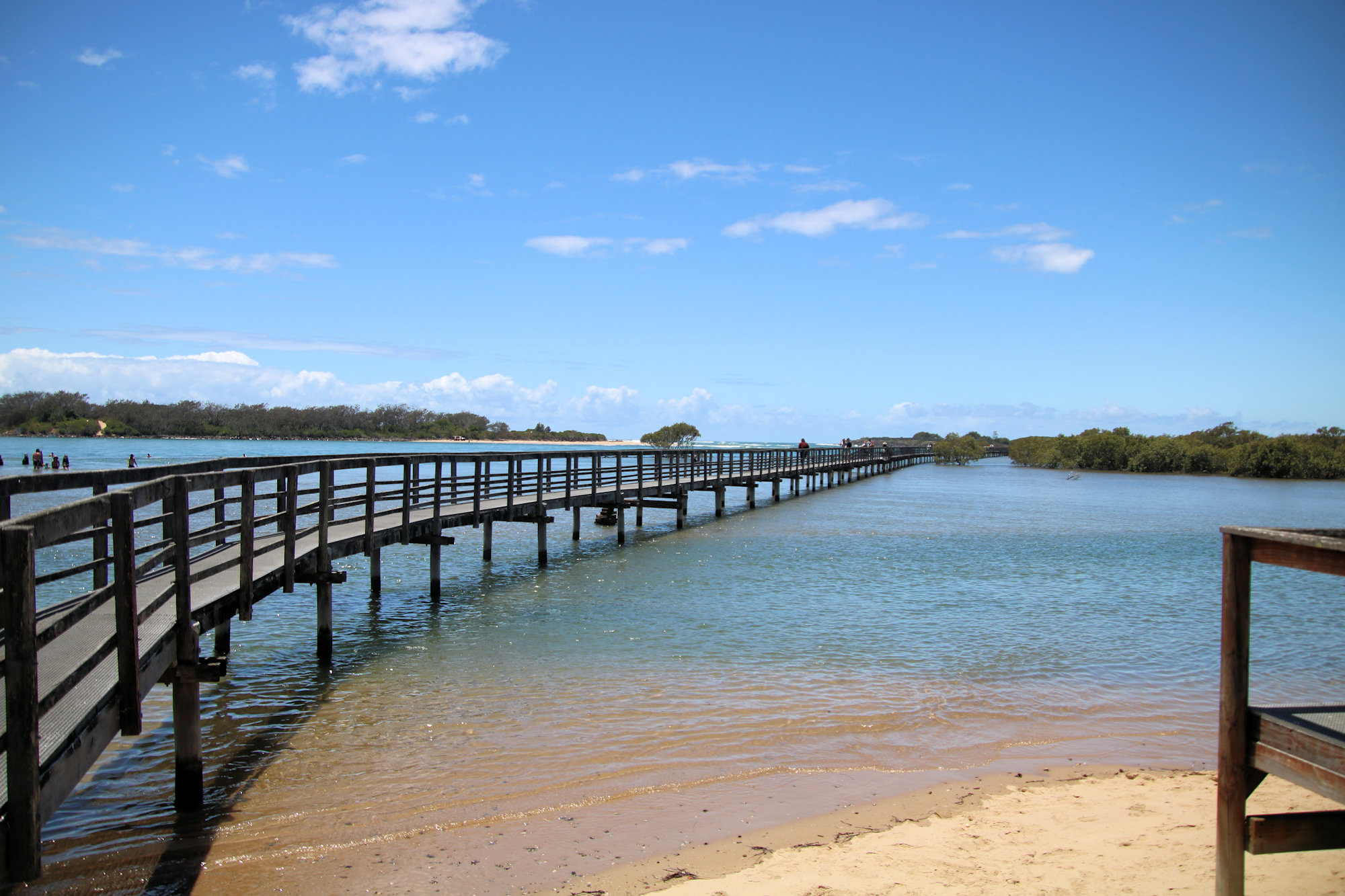
Located in Urunga on the NSW mid-north coast, the Urunga Lagoon Footbridge is a 1km long walkway through mangroves to the Pacific Ocean. Commencing in 1988, construction continued in three stages, until final completion in 2010. This wheelchair friendly walk is a great way to experience the coast from a sheltered lagoon to mangrove swamps and the surf of the Pacific Ocean.

Getting There

Urunga is a 90 minutes drive north of Port Macquarie, or a 30 minute drive south from Coffs Harbour. The small carpark near the caravan park quickly becomes full, but we were luck and found a spot straight away.

Facilities

A toilet block and change rooms allow you to change before and after swimming. Showers also let you wash the sand and salt water off before you leave.

When we visited, a coffee van was selling refreshments and snacks, which was great as we bought some and relaxed before walking on the footbridge.

Urunga Lagoon Footbridge

At around 1,000m long and flat this is an easy walk, which also makes it popular. Families were having a great time, with kids jumping off into the water and swimming around. Remember to check the tides and water depth though, as the area is not patrolled by lifeguards.

Around 300m into the walk, a second path diverges to the right into the mangroves. Badly damaged, this section is closed while awaiting repairs.

Walking along the footbridge, we had a great view of the Urunga Lagoon and surrounding mangrove forest. Extending as far as the mouth of the Bellingen River, the footbridge finishes on a surf beach where you can see the Pacific Ocean.

What Did We Think?

This was a great place to sit and relax and then have a nice easy walk. We came here after visiting the Urunga Wetlands Boardwalk. This is a good order to do them, as there are no facilities at the wetlands and access to the water is not allowed. Doing them this way would let any kids have a swim, go to the toilet or buy some drinks and snacks.

Trial Bay Gaol

Inside the Gaol

Trial Bay Gaol

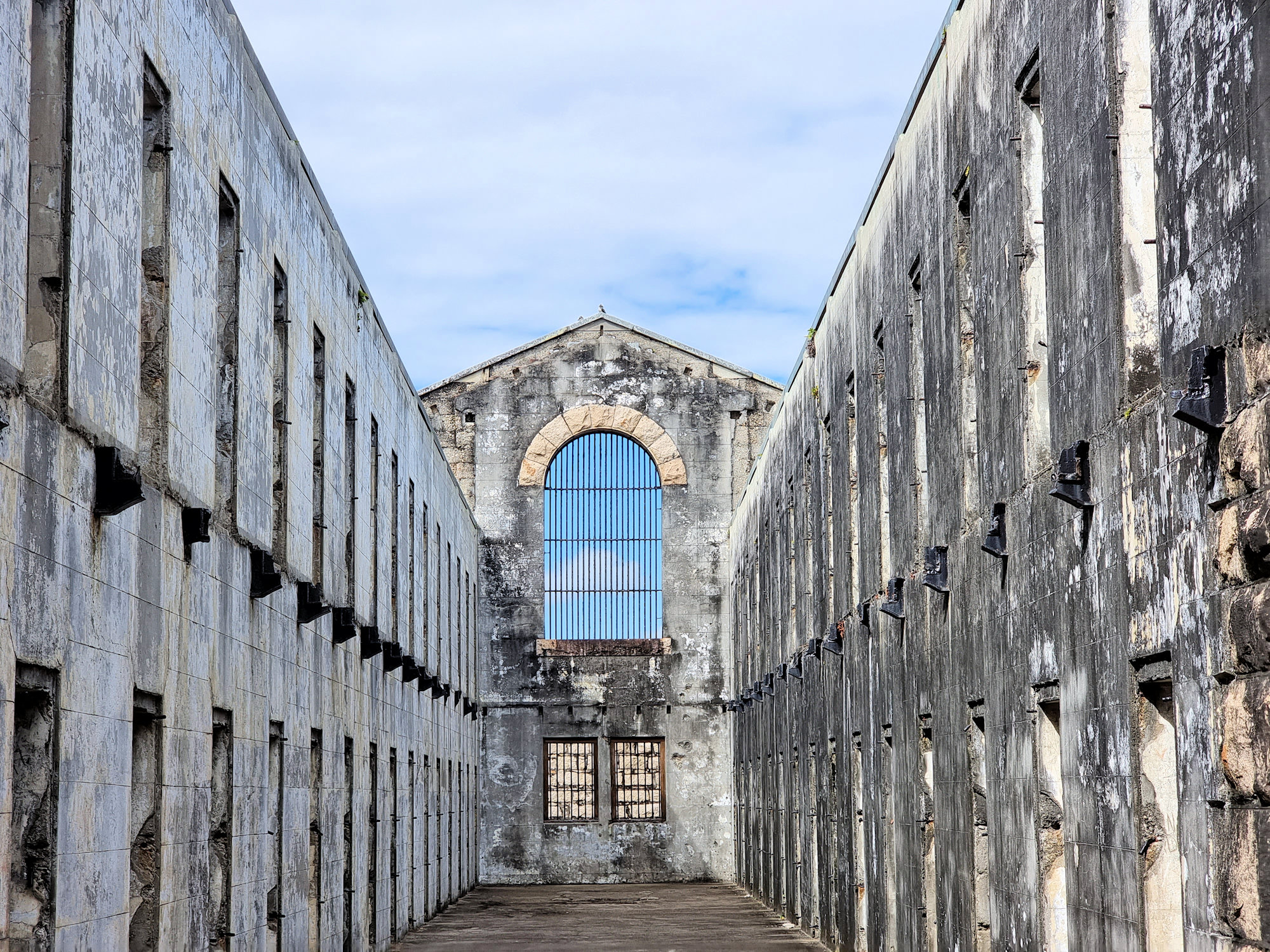
Now a heritage listed ruin, Trial Bay Gaol originally served as housing for a prisoner labour force to build a nearby breakwater. The breakwater was intended to provide a safe harbour for ships sailing up the eastern Australian coast. Construction of the gaol commenced in 1877, with work on the breakwater following in 1889 after delays caused by funding shortfalls.

Planning however underestimated the strength of local storms with the work constantly washed away. By 1903 only 20% of the breakwater had been completed, but with huge cost over-runs. Improvements in sea-going vessels and with an overland route established, the project was cancelled and the gaol closed.

The gaol found a renewed purpose with the commencement of World War One, when it was used as an internment camp. High ranking Germans and prominent German businessmen were housed here until July 1918 when they were moved to Holsworthy Interment camp.

Following its second closure, all moveable fittings were sold. It then fell into disrepair and became the runs we see today.

Getting There

Located in the Arakoon National Park and managed by the National Parks and Wildlife Service Trial Bay Gaol is roughly an hour’s drive north of Port Macquarie on the New South Wales mid-north coast. We drove from Port Macquarie and made it a day trip in the area, including nearby South West Rocks.

Walking through the ruins shows how bleak living here would have been. The cells are small and would have been cold in winter and hot in summer. The roofless buildings and hollow interiors have a haunting atmosphere and were great fun to walk through.

Watch out for the resident kangaroos, there were around ten there when we visited. One even had a joey in its pouch.

Views over the coastline are spectacular especially from the guard towers on the walls.

Once we had finished with the gaol, we drove through the nearby camping ground for a close-up look of the coast. The area is very popular with campers many of them were on the water fishing in boats.

What Did We Think?

We really enjoyed our visit here because of the ruins and spectacular views. Its also easy to get to with many other great things to see nearby.

To see what else there is to do in New South Wales, please see some of our other stories.

Our photos are available for purchase on

Mungo Rainforest Walk Myall Lakes

The Lake shore at Dees Campground

Mungo Rainforest Walk Myall Lakes

Set in the Myall Lakes National Park New South Wales Australia, the Mungo Rainforest Walk is an easy 1.5km walk near the lake shore.

Getting There

A 45 minutes car trip from Bulahdelah will take you via the Bombah Point Ferry. Running every 30 minutes the ferry cost us $5.50 (in April 2022) for a car. They take cash only as they have no eftpos facilities. Caravans cost more and the ferry only takes six cars at a time. We haven’t used this ferry before so that added something extra to the day. If you don’t want to use this option, driving via Hawks Nest will add 40km to the trip.

We parked at Mungo Brush Campground, although you could park at Dees Corner Campground, because the walk is a loop. The area is managed by New South Wales Parks and Wildlife, so an entry fee is payable.

The Track

Starting at Mungo Brush Campground, the track heads into the forest, where we found an information board. This showed the track and detailed animals and birds we might see. The blue area crossed by the track is a depression that floods in wet weather. Fortunately, an alternate path is available, which we had to use because of recent rain.

The Rainforest

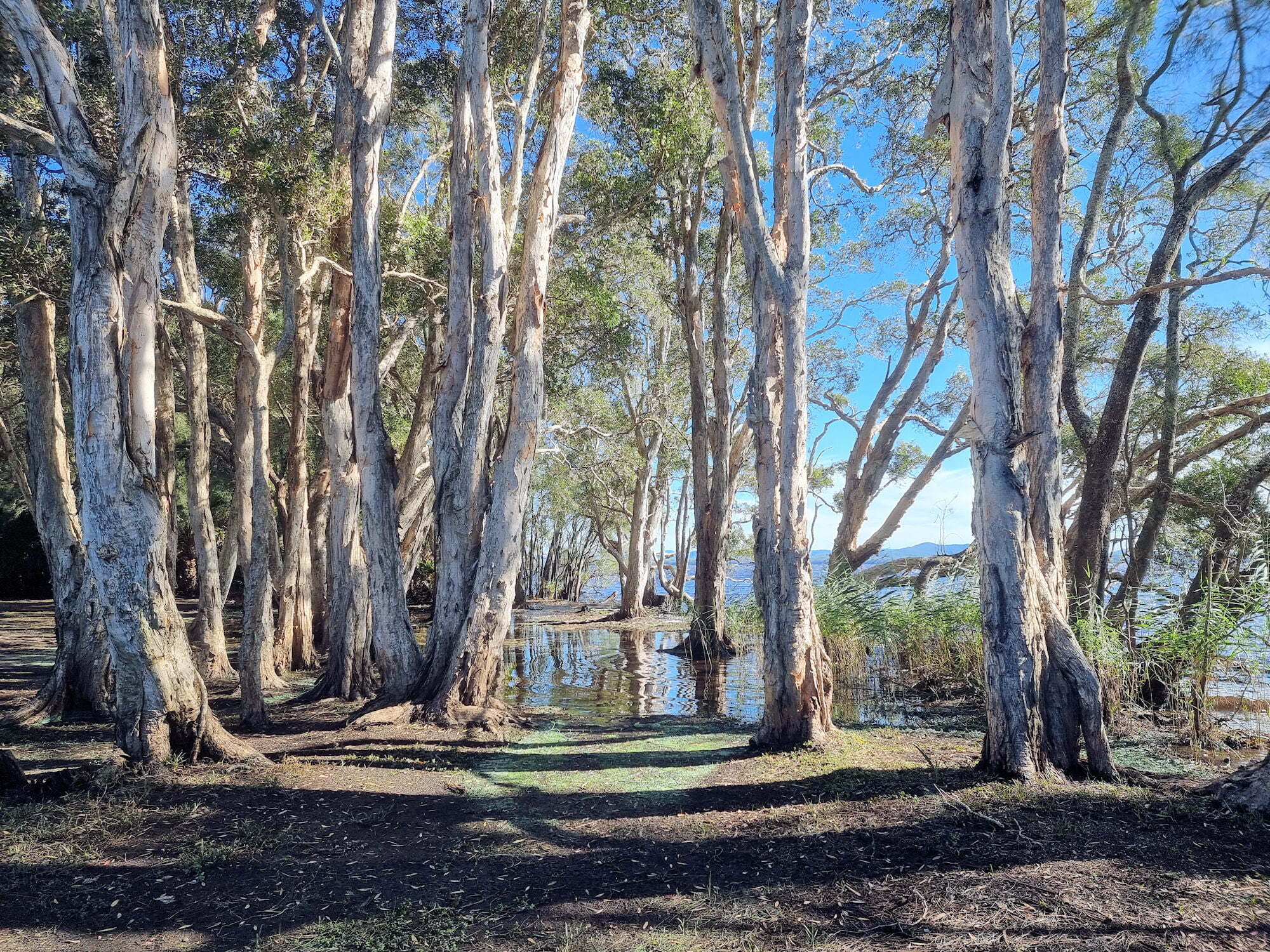
The track loops through the rainforest which consists of cabbage tree palms and coastal rainforest trees. At times it gets close to the lake where you are able to see the trees growing into the lake shore. Generally flat, the track was well maintained and apart from stepping over tree roots did not have many obstacles.

Track to Dees Corner Campground

The track comes to a T-intersection, pointing to the wet or dry weather tracks. If you want to see Dees Corner, take the dry weather track (it’s dry to Dees Corner). I would suggest wearing walking boots to cater for what ever conditions you come across.

Wet and Dry Weather Sign

Dees Corner Campground

Following the dry weather track takes you to the campground which was closed when we visited due to storm damage. This is a great little area with the gum trees growing down and into the lake.

From here you can take the track back to Mungo Brush.

What Did We Think?

This was a great little walk. Flat, and easy going with lots of rainforest and lake views to see.

To see what else there is to do in New South Wales, please see some of our other stories.

Our photos are available for purchase on