AdBlock Detected

It looks like you're using an ad-blocker!

Our team work realy hard to produce quality content on this website and we noticed you have ad-blocking enabled.

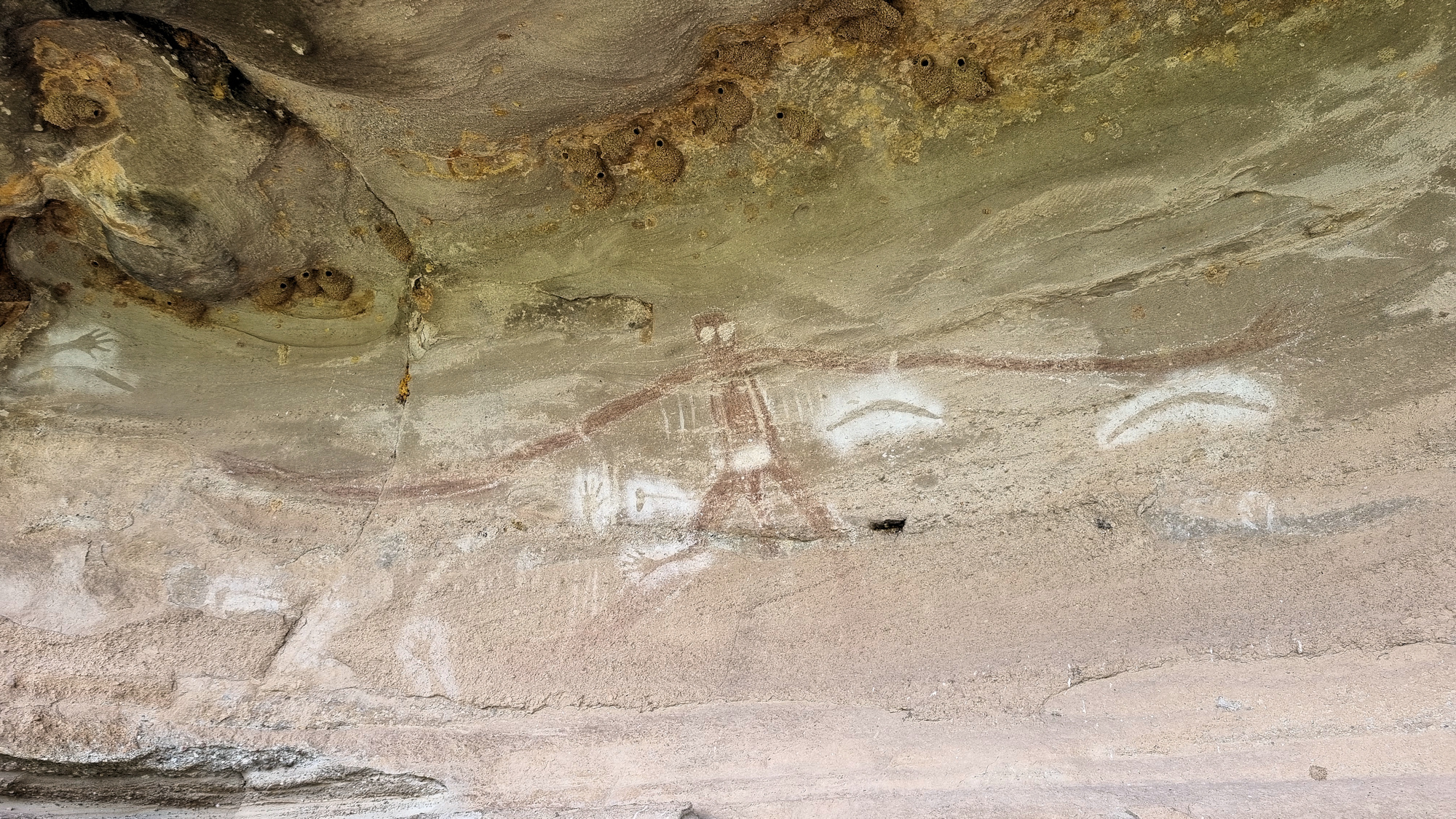
Baiame Cave Milbrodale Hunter Valley

Baiame Cave Painting

Baiame Cave Milbrodale Hunter Valley

It’s amazing what you can find close to home that you didn’t know existed! It’s even on the local council website, but we somehow failed to see it. About 25 minutes down the Putty Road from Singleton, the Baiame Cave at Milbrodale contains a significant example of Aboriginal art.

Significance

Connected to other sacred sites in the region, the cave and its artwork are culturally significant to the local Wonnarua people. Baiame is the creator and protector of the local people. In the painting he has widespread, larger than life arms. This signifies his status as protector of the local people. His eyes are also overly large, because he was all seeing and all knowing.

The choice of this particular cave is significant because it allows Baiame to look over the land of the Wonnarua. It also allows the local and visiting people to view the creator.

Getting There

Located on private property, access is via a dirt track just off Welshs Road. Although the property is privately owned, you are allowed access to the cave, but be respectful and remember no camping is allowed here. On our visit, a creek crossing just off the road, had been washed out. This meant we couldn’t drive all the way in, but it was only a short flat walk in. A sign at an intersection points in the direction to go.

The cave is located in the small escarpment to the left of the road, with a small path leading up. In the cave, a raised steel mesh platform provides a nice stable area to stand on and view the painting. Do not step off the platform, so as not to damage the cave. Remember the cave is heritage listed and protected.

The Painting

The painting depicts Baiame with arms outstretched looking over the river valley. Also visible are hand and arm stencils, representing the people who cared for and maintained the cave. There are also axe and boomerang stencil around the main figure.

What Did We Think?

This was a great place to visit, not only was it good to see, but we also learnt something else about the local Wonnarua people. The current access may be difficult for people with mobility issues, because you need to climb over the broken river crossing, but otherwise the track is flat and easy to walk.

Minnamurra Rainforest

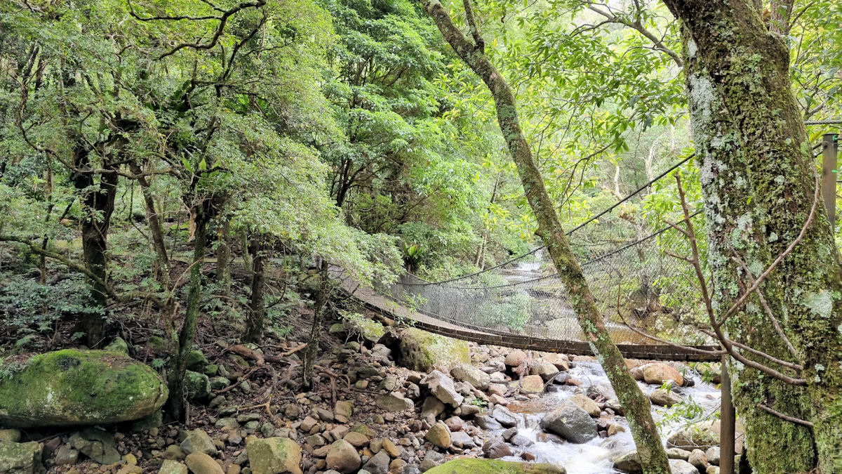
Suspension Bridge over Minnamurra River

Minnamurra Rainforest

Part of Budderoo National Park west of Kiama, Minnamurra Rainforest is a subtropical, dry, riparian and temperate rainforest. Only a 30-minute drive from Wollongong, it’s a great place to experience the Australian bush.

Parking is available near the visitor centre, for a small fee. Alternatively, if you have an annual pass for NSW National Parks and Wildlife, parking and entry are free. Advice on the walks and information on the area is available at the visitor centre.

Two walks are available, the Lyrebird and Falls walks. It is possible to do Lyrebird and extend it to the Falls. Each takes around an hour to complete, so two hours for both. Unfortunately on our visit, heavy rain had closed the Falls Walk, so we only did Lyrebird.

The track follows the Minnamurra River, crossing it four times as you walk along its valley. The majority of the track is board walk to is easy to walk, although it is steep in places. The track also has up and down grades as you move along the valley and is rarely flat. Even so, we found it an easy walk, taking us under an hour, even with constant stops to admire the scenery.

At two points suspension bridges cross the river, providing great photo opportunities and views along the river.

Don’t rush the walk, but look at the plants growing along the path. We found some amazing looking mushrooms growing there.

To see what else there is to do in New South Wales, please see some of our other stories.

Our photos are available for purchase on

Tasman Peninsula Tasmania Australia

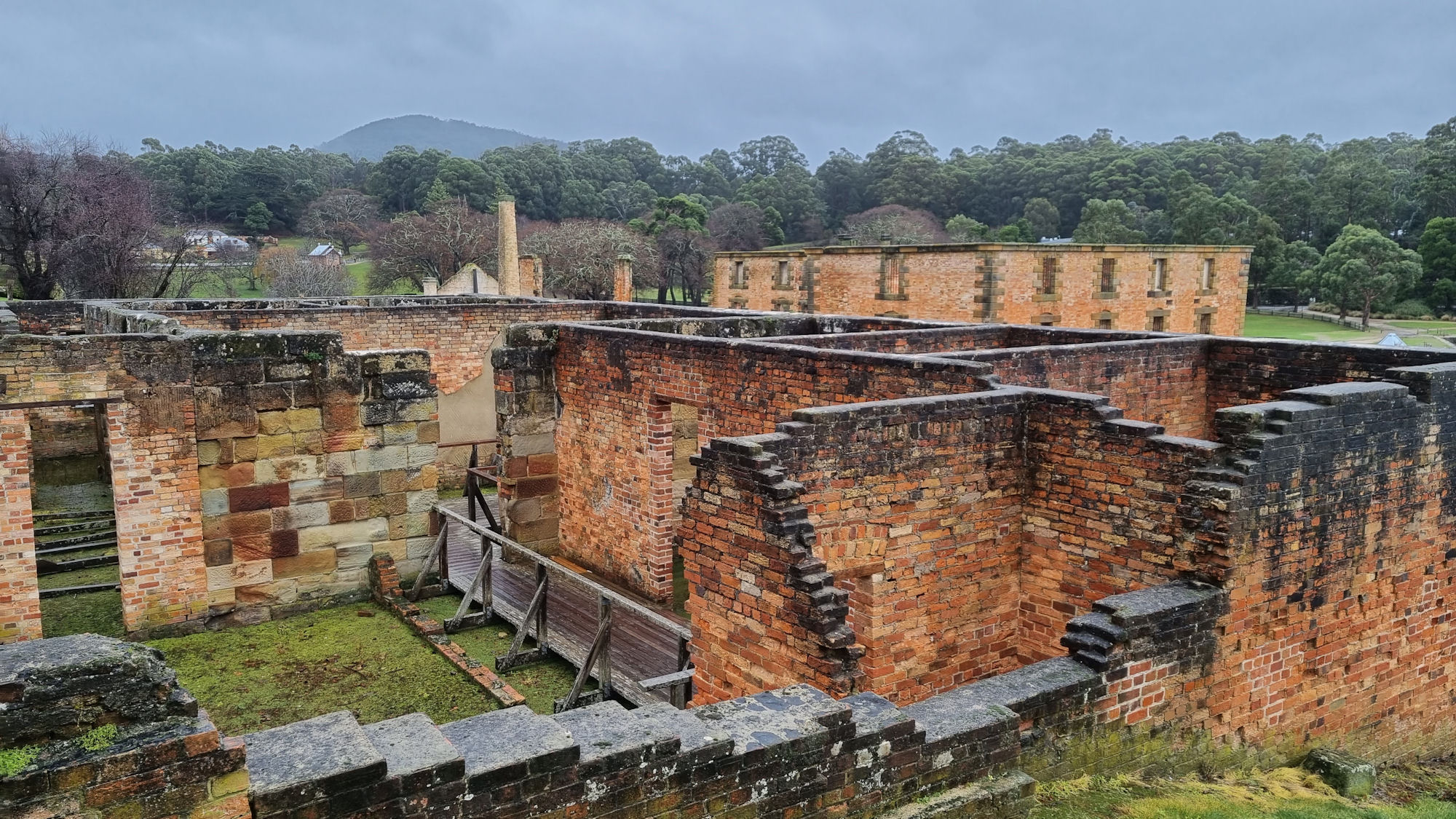
Remains of the Low Courts

Tasman Peninsula

The Tasman Peninsula has an wonderful array of historical and natural locations explore. Containing some of Australia’s oldest convict sites, it tells the story of early colonial life while being surrounded by amazing natural beauty.

During our stay here, we visited the sites below. This is by no means all there is to see and do, as there are many more bush tracks to walk, and places to visit. We spent three days here, but could easily have taken a whole week.

Port Arthur Historic Site

Tasmania’s best known historical site, Port Arthur was once a penal settlement for convicts. For the Full blog of our trip here, click this link.

Inside The Penitentiary

Geological Sites of the Tasman Peninsula

Tasmania is full of natural beauty. The wind, rain and sea have combined in places to produce wonderful geological features. For the Full blog of our trip here, click this link.

Tasman Arch

Tasman Arch
Tasman Arch

The Blow Hole

The Blowhole
The Blowhole

Remarkable Cave

Tessellated Pavement

Tessellated Pavement Eaglehawk Neck

The Dog Line

To prevent escaped convicts leaving the Tasman Peninsula, a dogs were placed at the narrowest point. These vicious dogs are commemorated with a full sized bronze sculpture. Tasmania is full of natural beauty. The wind, rain and sea have combined in places to produce wonderful geological features. For the Full blog of our trip here, click this link.

Bronze Sculpture at the Dog Line

Coal Mine Historic Site

Although not as popular as Port Arthur, the Coal Mine Historic Site is also an important relic of the convict past. The first coal mine in Tasmania and a place of punishment for repeat offending convicts, its ruins are worth a visit. Unlike Port Arthur, entry here is free. For the Full blog of our trip here, click this link.

Ruins at the Main Settlement Tasman Peninsula
Ruins at the Main Settlement

Cape Raoul Track

Bushwalking and hiking tracks range from under an hour to several days. We chose a five hour return walk to Cape Raoul because it provided temperate rainforest, coastal views and wildlife in the one walk. For the Full blog of our trip here, click this link.

Dolerite at Cape Raoul Tasman Peninsula
Dolerite at Cape Raoul

To read other posts about Tasmania, click here.

Our photos are available for purchase on