AdBlock Detected

It looks like you're using an ad-blocker!

Our team work realy hard to produce quality content on this website and we noticed you have ad-blocking enabled.

Eagle Rock Royal National Park

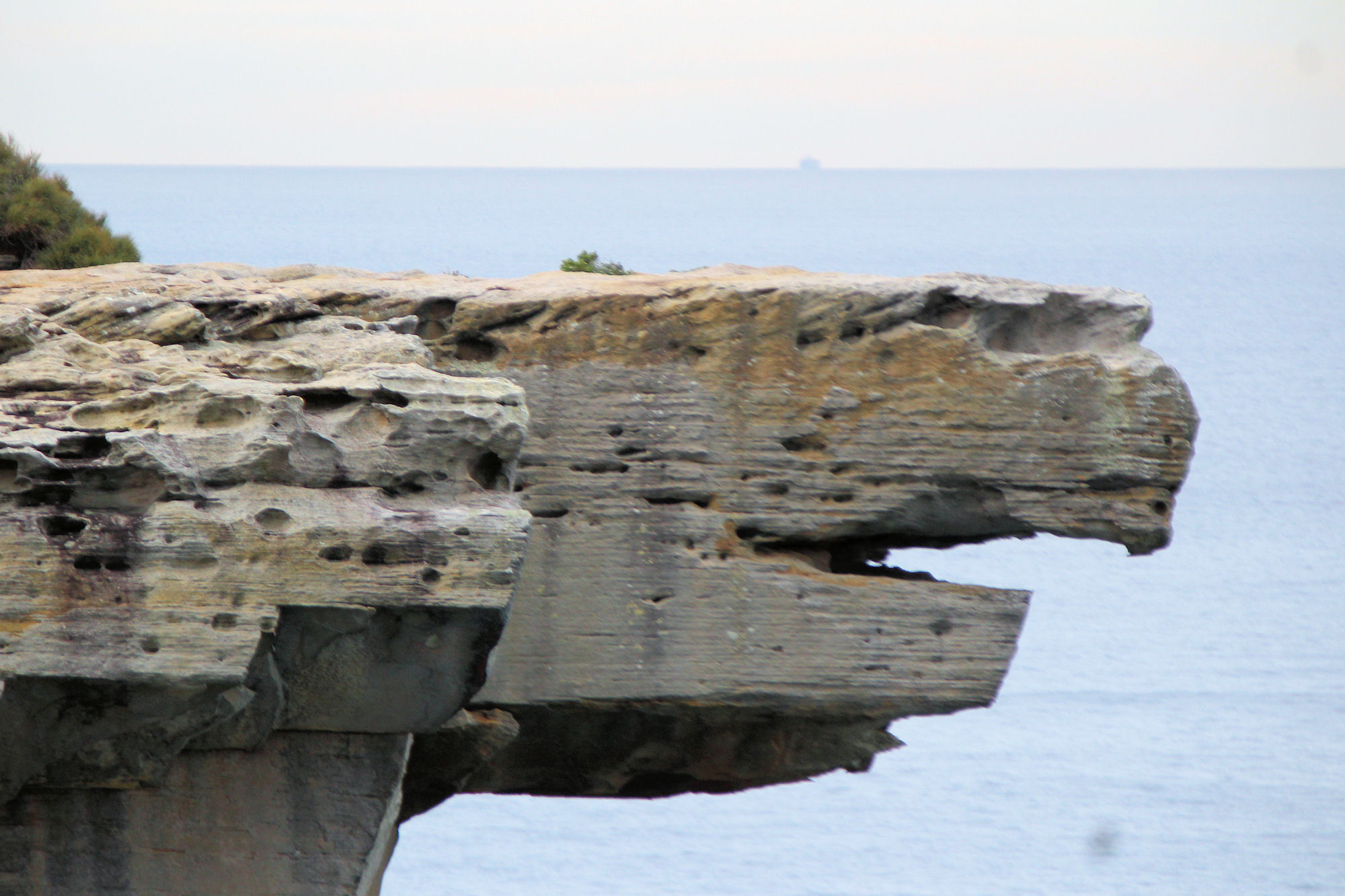
Close-up of Eagle Head

Eagle Rock in Royal National Park

Getting There

There are several ways to get to Eagle Rock, but we chose to start from Wattamolla car park. With great parking and toilet facilities, its a good place to start and finish the walk. A daily entry fee per car is payable and a ticket can be purchase in the carpark from a vending machine.

The Track

From the carpark, follow the coast track through coastal scrub and amazing ocean views. The 45 minute walk is generally flat, but there are several section with steep steps to climb. When we walked, the track was in excellent condition, with much of it on formed board walk. Steps are made of sandstone, carved into the slopes, while some areas travel over bare rocks. Where no track is obvious, like over rocks, it is well sign posted, making it easy to follow.

Several small creeks are crossed along the way, with steppingstones made from carved sandstone.

Coastal Views

The track passes coastal cliffs with magnificent ocean views, where we stopped to take photos and admire the scenery. The cliffs are high, so stay away from the edges. During the whale migration season, this is a favourite place for people to watch them going by.

Eagle Rock

One of the iconic sites in Royal National Park, Eagle Rock looks out over the ocean creating a great silhouette for photos. The path widens slightly when you are opposite, so that you can stop and take photos without blocking the path.

Water Falls

Curracurrong Creek forms a small waterfall that plunges into the ocean near Eagle Rock adding another interesting sight when it’s flowing after rain.

What did We Think of Eagle Rock?

This was a very enjoyable walk, with the track moving from coastal scrub to rugged coastal cliffs, with amazing views. With the waterfall and Eagle Rock at the end you get more interesting sights to see, making for a great day out.

To see what else there is to do in New South Wales, please see some of our other stories.

Our photos are available for purchase on

Coal Mines Historical Site Tasmania

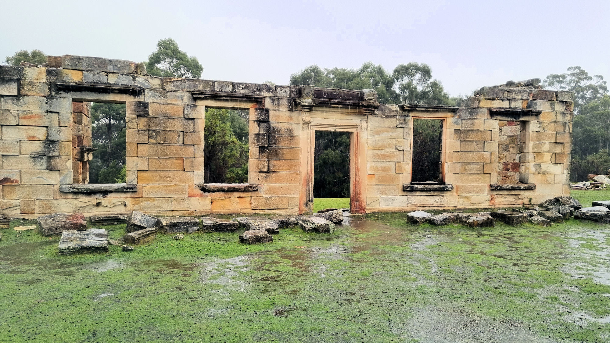
Ruins at the Main Settlement

Coal Mines Historical Site

The location of Tasmania’s first operational mine, the Coal Mines Historical Site, is now part of a World Heritage listed site where the ruins form a reminder of the past. Interpretive signs throughout the site not only describe the buildings use, but provide an insight into life there, by describing the lives of individual convicts.

With the discovery of coal in the area in 1833 mining commenced, producing coal locally, rather than import it from New South Wales. Serving as a place of punishment for repeat offending convicts from Port Arthur, the mine operated for 40 years before closing.

The Site

Two entrances to the site allow access to either the main settlement, or the old mine shaft. Walking tracks connect the two areas, so it doesn’t matter which you go to if you intend walking. Entry to the site is free. We chose the main settlement to start at, because it has excellent introductory signs and toilet facilities. The larger ruins are also located here, so if you only want to see them and not the entire site, this is the place to start.

As you can see from the photos, the majority of the buildings have been damaged by bushfires, the weather and vandals over the last 150 years. The remaining walls are still interesting to see, as they stand on a small rise overlooking bushland.

Walking from the main settlement, we passed the military barracks and commanding officer’s quarters. From here, the track steepens as you walk uphill to the signal station, where we could not see any remains.

Our last stop was the main shaft, which was surrounded by a fence. This was a large depression maybe 10m deep and 20m across, but the shaft itself it filled in, so there was nothing to see.

What Did We Think?

The sandstone ruins are imposing, standing as they do on a small hill. We enjoyed looking around and reading the interpretive sign, while taking photos. The walking track winds through bushland, which was enjoyable to walk through. Although the main shaft was a disappointment, the rest of the area was very good and worth seeing.

To read other posts about Tasmania, click here.

Our photos are available for purchase on

Mount Paris Dam Wall Tasmania

Mount Paris Dam Wall

Mount Paris Dam Wall

Mount Paris Dam Wall, on the Mt Paris Road, is the only surviving pillar and slab dam in Tasmania. Built across the Cascade River using only shovels and wheelbarrows in 1937, it was originally named the Morning Star Dam. An 11 Km water race connected it with the Mt Paris Mine. The mine closed in 1970 and the dam fell into disuse. A hole blasted into the 16 metre high wall in 1985 released the water, improving the flow of the Cascade River. In the middle of the dam, most of the vegetation has now grown back, the only indication it was ever any different is the dam wall which still rises starkly before you in the middle of the bush.

How to Get There

Driving from Launceston is a 90 minute drive, while Hobart is three and a half hour drive away. Our day started at St Helens and the Bay of Fires on the east coast and only took one hour. The final part of the drive on Mount Paris Dam Road is on dirt, so be careful and drive to the conditions. The drive takes you through logging areas which are re-growth managed forests, where you will see clear felled trees. You will also see the stages of re-growth where the forestry management have replanted trees for future use.

Dirt Road
Mount Paris Dam Road

Car Park and Bush Track

A small sign indicated the direction to a carpark along a small dirt track. From here, a short walk takes you to the dam wall and the Cascade River.

Bush Track
Track Down From the Car Park

The Dam Wall

The old dam wall stands in stark contrast to the forest growing around it. Now completely surrounded by tall trees and ferns, the concrete wall looks like something from a lost city. The breaches in the wall allow you to walk through to the other side, where the dam once flooded the forest. This area has also regrown so that it is hard to see where it was flooded.

What Did We Think?

This was an amazing stop which we were very pleased to have done. The dam area is quite surreal, because of its large concrete structure in the middle of a forest.

To read other posts about Tasmania, click here.

Our photos are available for purchase on