Tag: travel

  • Morpeth on the Hunter River

    Morpeth on the Hunter River

    Morpeth on the Hunter River

    Morpeth

    Initially created through by Edward Charles Close, who selected a property of 1,000 hectares Morpeth developed as a river port from 1831-1841.

    The river port grew steadily throughout the 1830s, but the construction of the Great Northern Railway in 1857, bypassed Morpeth. This resulted in Newcastle developing as the regional port. Morpeth became less significant commercially, but still survived as a township with its own history and heritage.

    The town is now popular with tourists because of its historic buildings and riverside setting.

    Getting There

    Sitting a 10 minute drive from Maitland, the historic town of Morpeth is one of the Hunter Valley’s major attractions. On the drive from Maitland look out for the brightly painted shed advertising “Dr Morse’s Indian Root Pills”, as it’s a well known site by the Hunter River. Originally from North America, these pills are still manufactured and sold in Australia.

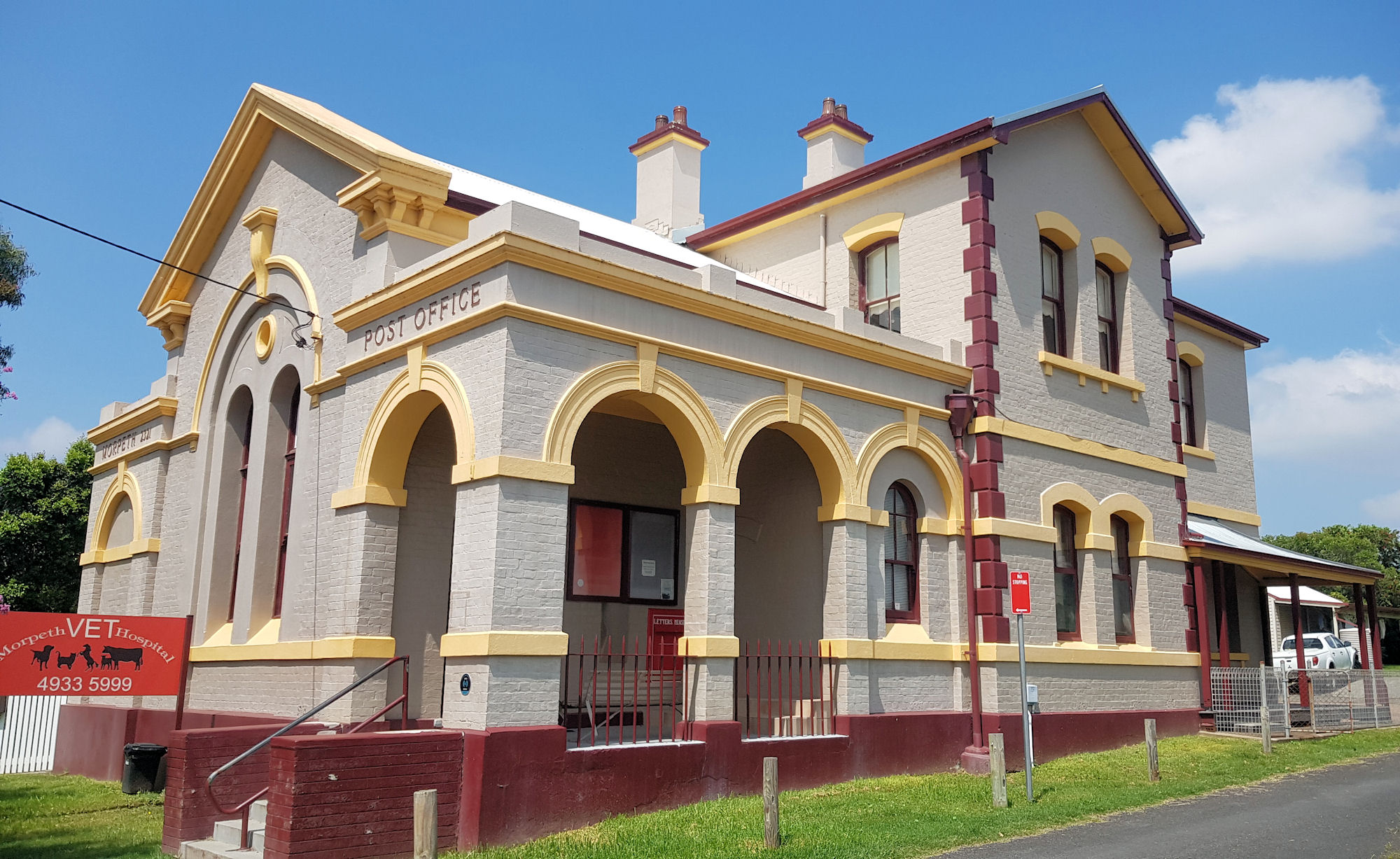
    Parking in Morpeth can be at a premium on busy days, particularly in front of shops on the main road (Swan Street). There are more spots a available further down the road opposite the museum and old Post Office (now a vets).

    Swan Street

    Most of the shops and restaurants face onto Swan Street, which makes them easy to find, because you are not wandering around back streets.

    Morpeth Bridge

    Opened on 15 June 1898, the Morpeth Bridge is a timber trestle bridge employing Allan trusses. It has two central iron cylinder span supports fabricated by Mort’s Dock. Spanning the Hunter River at Morpeth, the bridge is listed on the state heritage register because of its technical and historical characteristics. 

    Historic Buildings

    Located on Swan Street, most of the historical buildings are in excellent condition and look beautiful. Many are now used for different purposes than what they were built for, so have small plaques in the footpath showing their original use.

    Campbell’s Store

    Located on the corner of Swan and Tank Streets, Campbell’s store is a collection of small businesses in one large building. From second-hand dealers, clothes and food, there is a lot to see and explore here. At the back of the building is a café and the Morpeth art gallery, which sells art and often has exhibitions on the second floor.

    Other Interesting Things to See

    Walking around, you will find several interesting sights, including painted lane ways, sweet shops, and old telephone box, and a mannequin inviting you for free ginger beer tasting.

    What Did We Think?

    Morpeth is a great place to spend a day out exploring, because it has so much to offer. From historic buildings, antique shops, or a relaxing meal overlooking the Hunter River, it’s a great place to visit.

    To see what else there is to do in New South Wales, please see some of our other stories.

  • Burrawang Walk Kamay Bay

    Burrawang Walk Kamay Bay

    Burrawang Walk Kamay Bay

    Kamay Visitor Centre

    Before setting out on the Burrawang Walk, drop into the Visitor Centre. Not only are the toilets located here, but it is full of useful information for your visit. The staff were very friendly and helpful, which made the day start on a positive note.

    Burrawang Walk Kamay Bay

    Weaving through the history of the area, the Burrawang Walk takes you through the eyes of the original inhabitants of the area, through to Cook’s landing in 1770 and to its ongoing impact. Starting at the Visitor Centre it was originally called the Monuments Track, because of the monuments in the area. This is an easy track, because it’s only 1.2 km long, and mostly on grass or concrete pathways.

    Interpretive Signs

    Interpretive signs provide an insight into Aboriginal life in the area and the impact white settlement had on them. This is great because until recently, only European heritage was commemorated here.

    Meeting Place

    The Meeting Place Kamay Botany Bay National Park Burrawand Walk
    The Meeting Place

    Cook’s Landing Place

    A large obelisk and plaque commemorating Cook’s landing place dominate one section of the shore. In 1770, Lieutenant (later Captain) Cook landed here and claimed the continent in the name of the British Crown.

    Banks’ Memorial

    Banks inclusion in Cook’s expedition as a scientist led to many discoveries of plants and animals unknown to Europeans. A large memorial to him sits near Cook’s memorial, which recognises his contribution to science.

    Banks Memorial Burrawand Walk
    Banks Memorial

    Solander Memorial

    An interesting memorial and the first one we saw is to Daniel Solander, a Swedish scientist who accompanied Banks on the Cook expedition. He was the first Swede and university trained scientist to set foot in Australia.

    Solander’s documentation of unknown plants led to the area being named Botany Bay, although now it has a dual name, Kamay Bay in recognition of its Aboriginal heritage.

    Overshadowed by Banks while also dying at the young age of 49, he did not develop the reputation he deserved.

    Solander Memorial Kamay Botany Bay National Park Burrawand Walk
    Solander Memorial

    Bronze Sculptures

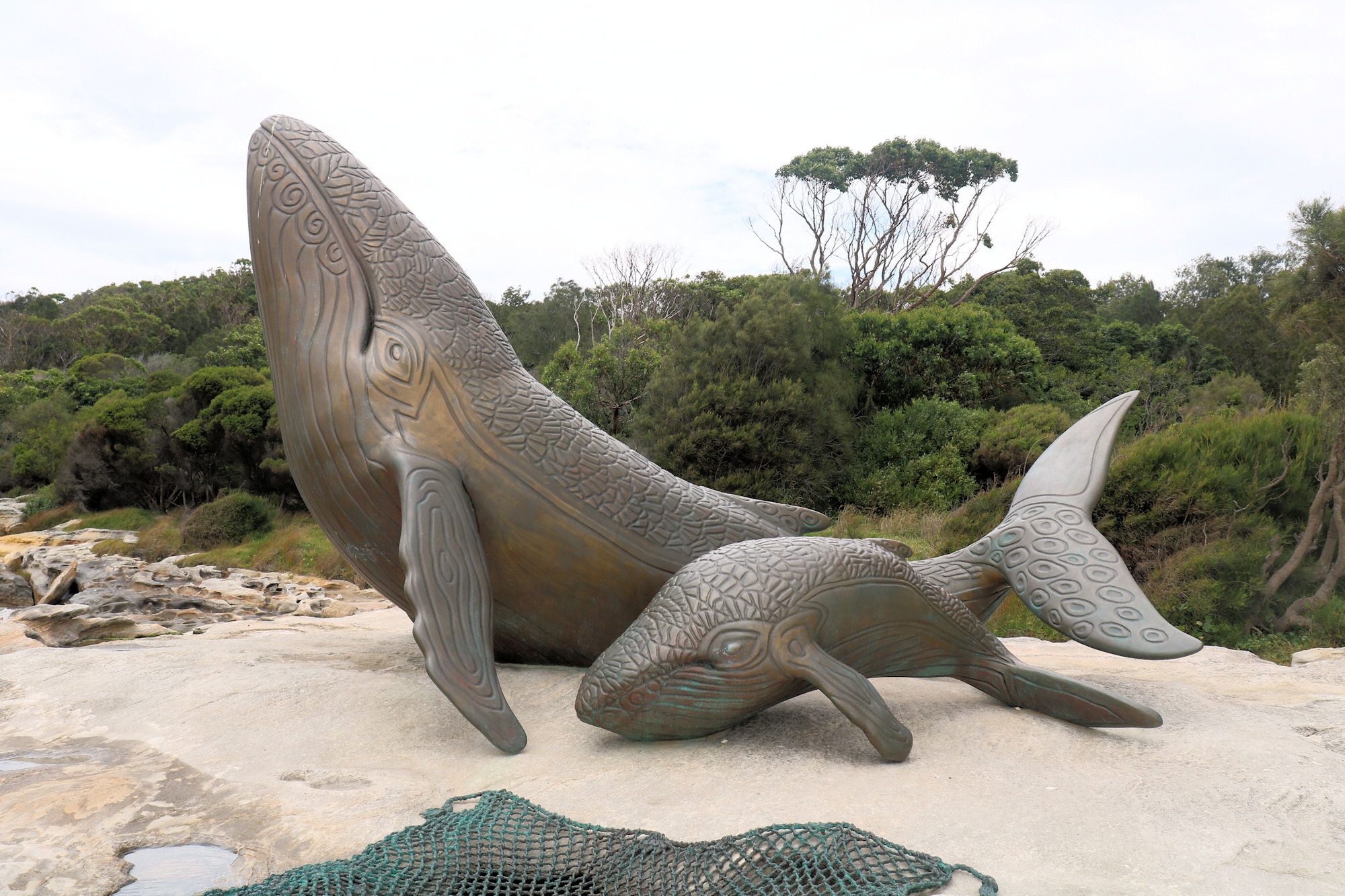
    Sitting in, or on the water’s edge are three sets of bronze sculptures. These commemorate the 250th anniversary of the meeting of Aboriginal Australians and the crew of HMB Endeavour.

    First European’s Grave

    Located on the waterfront, is a plaque marking the grave of Forby Sutherland, the first British subject buried in Australia. Forby died of tuberculosis.

    Forby Sutherland Burial
    Forby Sutherland Burial

    What Did We Think of Burrawang Walk?

    This was a nice, easy walk with lots to see. The numerous information boards were educational, which made it even more interesting. This is a must visit if you are in Sydney, because of the number of memorials and European heritage.

  • Cape Banks Botany Bay National Park

    Cape Banks Botany Bay National Park

    Cape Banks

    Getting There

    We drove to Cape Banks and parked near the pistol club and helicopter base. This large car park has plenty of space, so parking shouldn’t be a problem.

    Cape Banks Walking Track

    The Cape Banks Walking track runs past the Westpac Lifesaver Helicopter Base towards the coast. On the way you pass an old fortress before reaching the ocean. At this point you turn right, if you turn left, you will arrive back at the car park.

    The track continues along the coast to the New South Wales Golf Club, where a small bridge leads out to the cape. From here you are able to explore the rock platform and the higher ground of the cape.

    Cape Banks Fortifications

    Used to protect the approaches to Botany Bay, Fort Banks is an old World War II bunker and fortification complex. During World War Two, it was armed with two 9.2 inch guns, but these are long gone. Sand dunes and vegetation are overtaking the fortifications. Graffiti also covers most of the site, which detracts from the importance of the site.

    Despite this, it is still an interesting spot to walk around, with some of the building accessible through rusty doors.

    Several old tombstones are stored here, removed from the nearby Hospital Cemetery.

    Rock Platform

    Exposed at low tide, the rock platform provides great views over the ocean. Be careful because you need to climb over rocks to get there. Check the tides before going, to make sure the tide will be low. Rock pools and slippery surfaces on the platform mean you need to walk carefully to avoid slipping.

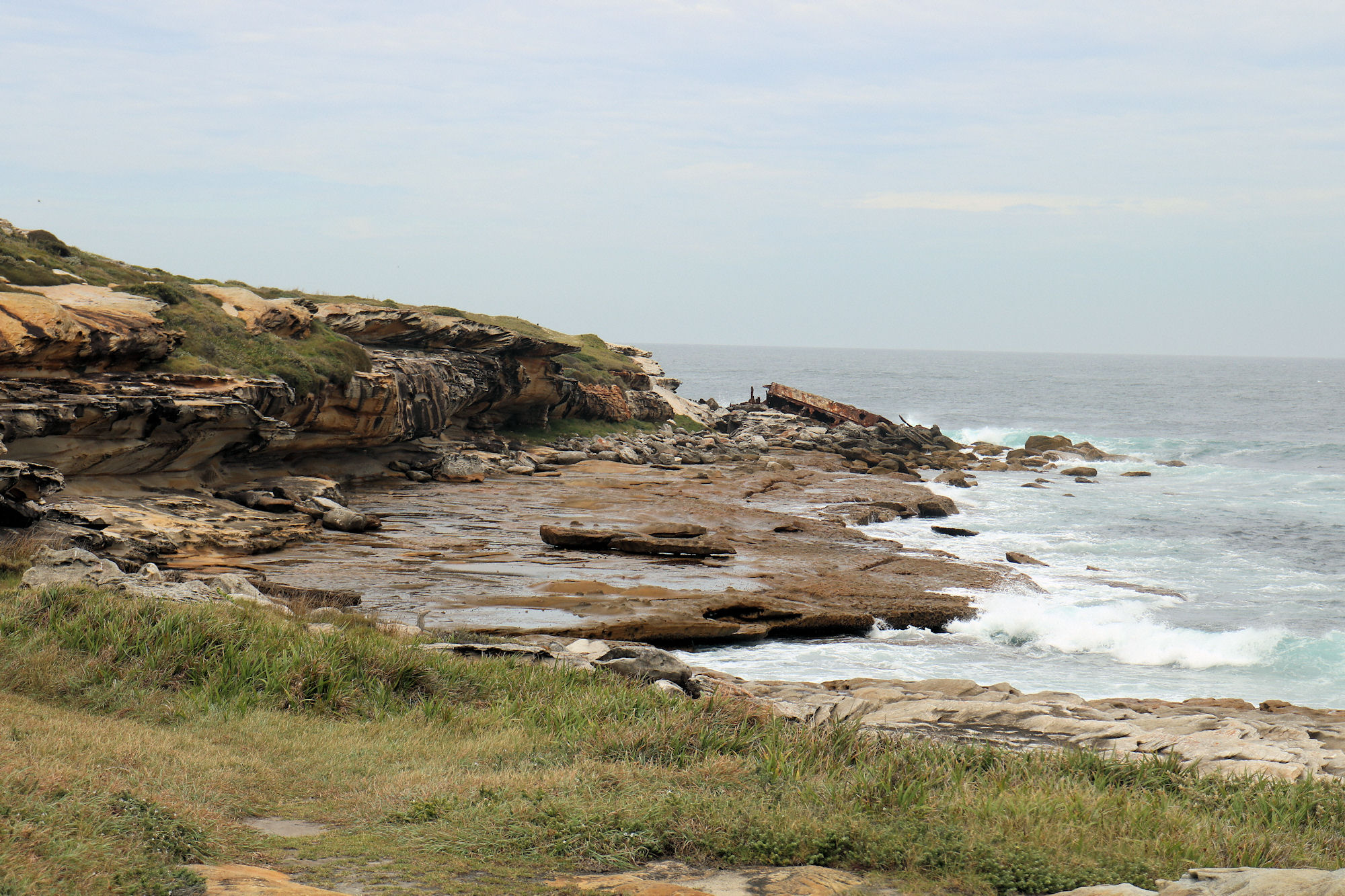
    The small cliff face displays some great erosion patterns from wind and waves. The colours of the rocks are also interesting.

    To visit the shipwreck at the end of the cape, make your way to the rocks, where the SS Minmi can be seen up close.

    Wreck of the SS Minmi

    Located at the far end of the rock platform, the remains of the wreck of the SS Minmi are easily accessible at low tide. Salvage work in the 1930s removed the forward part of the ship, so only the rear portion now remaining.

    The SS Minmi was a 75m long, 1,455 ton collier built in Glasgow, Scotland in 1927. It was named after either the lower Hunter Valley town of Minmi, or the nearby Minmi Colliery.

    The Minmi’s captain for all of her ten-year service was Captain McPhall, who had brought the ship to Australia. Captain McPhall commenced two weeks’ leave in the first week of May, leaving Chief Officer Callum to take over as Captain. On 8 May 1937 at 10 pm while returning to Newcastle after delivering coal to Melbourne, the ship struck the outside of Cape Banks. Frederick Boulton, the ship’s cook, collapsed and died of a heart attack soon after the ship struck the rocks.

    The Minmi split in two at about 12:45 am, with crew members stranded on both the front and back sections. Those at the front were rescued without incident, but it was more perilous for those in the rear. During the rescue, one life was lost because of the heavy seas.

    What Did We Think?

    This was a great little walk, because we saw an old fort, a shipwreck, and enjoyed some nice views. The walk is short, but does require some climbing over rocks and a visit at low tide is a must.