AdBlock Detected

It looks like you're using an ad-blocker!

Our team work realy hard to produce quality content on this website and we noticed you have ad-blocking enabled.

Tilligerry Habitat

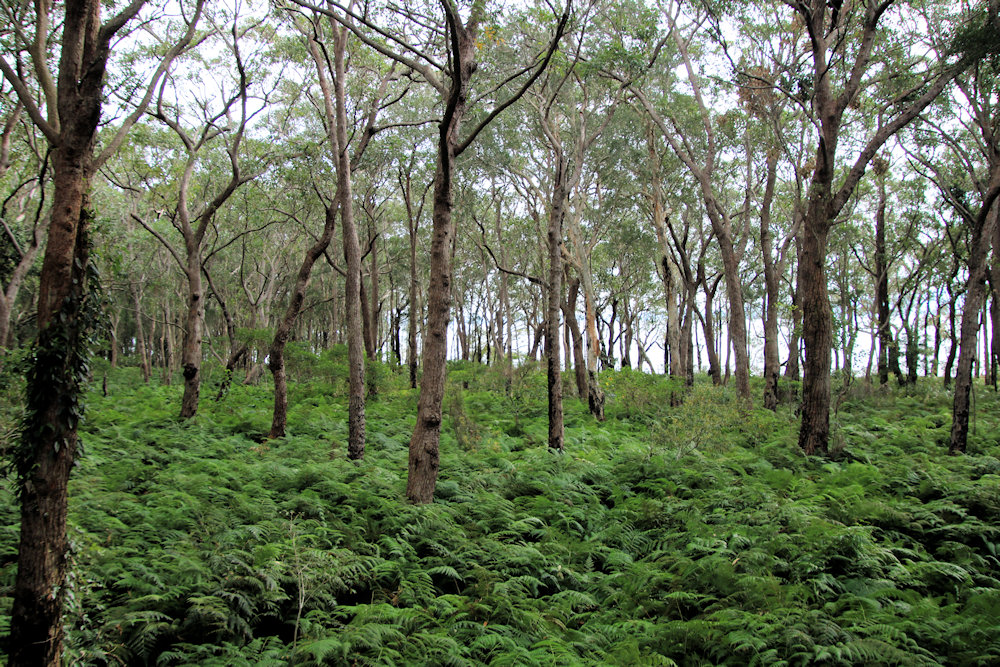
Mahogany and paperbark forest

Tilligerry Habitat Tanilba Bay NSW Australia

The original sand dunes in what is now the Tilligerry Habitat were subject to deep sand-dredge mining from the 1960s. Removal of the dunes resulted in a flat landscape with the original drainage system damaged and native vegetation cleared. A large section of the disused mine was used for housing and playing fields, but a section remained near the shore along with remnant vegetation.

This remaining section of land was proposed to be used as a caravan park which would have removed the remaining vegetation. However, lobbying by residents enabled its preservation as a reserve for public recreation and coastal environmental protection in 1996. Since then, local volunteers have spent numerous hours re-establishing drainage water flow and replanting trees and built a boardwalk. The result is an amazing area where birds and koalas thrive.

Getting There

We parked in the Peace Park carpark in Tanilba Bay which is only a 5-minute walk from the start of the boardwalk. Parking is also available along Peace Parade and at the Tilligerry Habitat Office.

Tilligerry Habitat Boardwalk

The disturbance caused by the sandmining has left the area generally flat which means that the boardwalk is also very easy to walk. Raised slightly above the forest floor so as to enable water drainage, the boardwalk is very well maintained and there are bench seats to stop at along the way. These give you a nice place to sit while enjoying views through the forest or over the bay.

Along the paths, information boards detail the vegetation growing nearby, with pictures pointing out individual species. The transformation from a sand mine to restored paperbark forest and swamp mahogany is amazing. The volunteers’ efforts have really paid off, resulting in several environmental awards.

Koalas inhabit the area, but we didn’t see any during our walk. However, we did hear the birds, which were very vocal as we walked through the trees giving us a great welcome to the area.

This was a great walk, with the boardwalk winding through the trees. Highly recommended if you are visiting the area.

Our photos are available for purchase on

To see what else there is to do in New South Wales, please see some of our other stories.

Stockton Bridge Newcastle Australia

Stockton Bridge title

Stockton Bridge Newcastle Australia

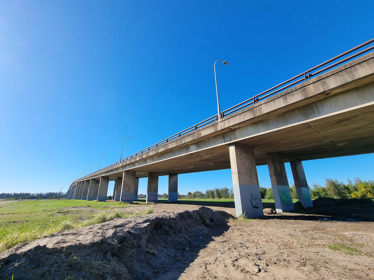
Spanning the North Channel of the Hunter River, the Stockton Bridge connects the Tomaree and Tillegerry Peninsulas with Newcastle, Australia. Replacing an earlier vehicle ferry from Stockton to Newcastle (the passenger ferry still runs), it has significantly improved vehicle flow. When opened in 1971, it was the longest bridge (at 1,024m) to have been built by the Department of Main Roads and the second longest bridge in New South Wales after the Sydney Harbour Bridge.

We have driven over the bridge many times and always assumed the central barricades were to separate traffic and prevent cars crossing into oncoming lanes. Having wondered how pedestrians crossed, because there are no footpaths on the outside edge, we did some research. It turns out that the bridge design incorporates a central footpath which you access from underneath the bridge.

Getting There

To have a look for ourselves, we parked near the boat ramp and walked across. Located where the bridge meets the ground, the stairs are easy to find. From here it’s a short climb to the bridge surface. While walking across, you are only separated from the traffic by a metal barricade. Although this is sturdy, it can feel unsafe at times as the cars and trucks drive past.

It was a cold clear morning when we walked across, so the views back over Stockton and Newcastle were beautiful. However, as you are in the centre of the bridge taking good photos is difficult because the bridge gets in the way.

Returning to our car, we found some artwork on the concrete uprights near the road. Sponsored by the NSW Government and local Rotary Club, they were a nice colourful surprise.

Our photos are available for purchase on

To see what else there is to do in New South Wales, please see some of our other stories.

Manly to North Head Walk

Manly to North Head Walk

The walk from Manly to North Head takes you past some beautiful beaches with views over the coast, through coastal scrub and passes old fortifications. Finally ending at the entrance to Sydney Harbour, it has spectacular views of the city.

Getting There

The easiest way to get to Manly is to take the Manly ferry from Circular Quay. If you’re new to Sydney, this is an attraction in itself, because the Sydney Harbour ferries form an important part of the local public transport. During the ferry ride, you get some brilliant views of the Opera House and Harbor Bridge as well as all the other boat traffic on the water.

Start of the Walk

Catching the Manly Ferry from Circular Quay, we arrived at Manly Wharf at 9:30 am. We planned our walk to take us along the shore to Shelly Beach where we would follow a track to the Barracks Precinct. Not only would this give us views over the coast but take us past some old fortifications and gun emplacements.

From the Manly wharf, we walked down The Corso, which is a pedestrian mall leading to the beach.

Manly Beach

One of the most popular Sydney beaches, Manly Beach is a great place for a swim or relaxing on the sand. We bought a coffee at a kiosk near the south end of the beach before starting the walk.

Manly Beach
Manly Beach

Manly to Shelly Beach

Starting at the south end of Manly Beach, the path follows the coastline, which is rocky until you reach Shelly Beach. There are plenty of places with places to look up and down the coast and back to Manly, giving you some amazing views.

Along the way look out for small metal sculptures of local wildlife. These have been placed on the rocks next to the path.

About halfway to Shelly Beach, Fairy Bower Pool is a protected ocean pool where you can swim. The pool is also decorated with a sculpture of two fairies.

Shelly Beach

Shelly Beach is a secluded and serene crescent-shaped beach surrounded by nice shady trees. As well as a grassed area to relax on it has a kiosk where you can buy refreshments before continuing the walk.

From Shelly Beach, the track goes uphill to head along the cliffs to the south.

Shelly Beach Manly Sydney Australia
Shelly Beach

Shelly Headland Lookout

Perched on a rocky outcrop overlooking the ocean, this Shelly Headland Lookout provides an ideal spot for photographers because of the wonderful views along the coast. During the whale migration season, it’s also an ideal point to watch them swimming past.

Coastal view looking north back to Manly Manly to North Head Walk
Coastal view looking north back to Manly

Shelly Beach to the Barracks Precinct

After the flat walk from Manly the track becomes rougher and steeper. From here the track climbs uphill to reach the cliff tops. Winding through the coastal vegetation, it is not as busy as the first section because it is a more difficult walk. We loved this section, as the walk through the bush was much more peaceful.

At the top of the cliffs, old fortifications dating from the Second World War and earlier can be seen. The track even goes through one of the old walls built to defend the area.

Barracks Precinct

The Barracks Precinct at North Head is a historically significant site that served as a military base from the mid-19th century to the mid-20th century. It played a crucial role in the defence of Sydney Harbor and housed various military units over the years.

The Barracks Precinct has well-preserved sandstone buildings, which showcase the architectural style of the time. It includes several barracks, officers’ quarters, mess halls, and maintenance buildings. These structures provide a glimpse into the daily lives of soldiers stationed at North Head.

Today, the Barracks Precinct has been repurposed as a heritage site and is open to the public for exploration. Visitors can wander through the historic buildings, learn about the site’s military history through information boards which are dotted around the area.

In this area and continuing to North Head, the walking tracks are generally well paved and often consists of boardwalks or paved roads. When we visited, the banksias were in flower adding a touch of colour to the walk.

Fortifications

Many of the original fortifications were dismantled and the guns sold for scrap when they were no longer needed. Fortunately, some are still in place so that visitors can see them. Several large gun emplacements are open to the public, but when we visited others were being repaired.

A great way to get a feel for the area’s past is to take the underground tunnels tour. We did this several years ago and highly recommend it. You walk through the tunnels and underground sections of the fortifications as well as getting into areas the general public cannot access.

Memorial Walk

Winding through the coastal vegetation, the Memorial Walk commemorates Australia’s military heritage. Not only are there great sandstone memorials but the path is inlaid with bricks commemorating individuals or military units.

Fairfax Lookout

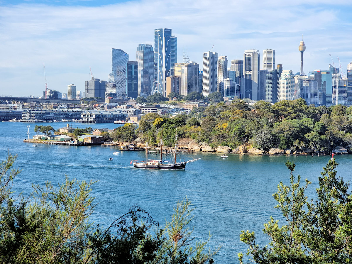
The end of our walk took us to Fairfax Lookout with its stunning views of Sydney and Sydney Harbour. The site was named after Sir James Fairfax, a prominent Australian businessman and philanthropist.

View of Sydney and the Harbour from Fairfax Lookout Manly to North Head Walk
View of Sydney and the Harbour from Fairfax Lookout

Other Places to See in North Head

If you have time, Q Station, the old Sydney Quarantine Station is worth a visit. We did a guided tour here some time ago, which took us through the history of the site and most of its buildings. The old quarantine station cemetery is also a great place to see.

Getting Back

After finishing our walk, we decided to catch the bus back to the wharf as it stops right outside. Alternatively, you could walk back via Q Station. We had an excellent tour there a few years ago and highly recommend a visit.

Our photos are available for purchase on

To see what else there is to do in New South Wales, please see some of our other stories.